
This object is in archive!
'Garmin Map' drawing problem
Closed
I see that a Garmin map I use as an overlay dosn't draw on the screen properly. The problem seems to occur in areas where there is lot of lines, but not sure of this. As it is used as an overlay, it is not a big problem for me, but wanted you to know.
The map file I use can be downloaded from here: http://www.frikart.no/garmin/velgkart.html
It is the "Trails - overlay map" ( http://www.nuug.no/pub/openstreetmap/frikart/garmin/norway/overlay_trail/gps/OSM_Overlay_Trail_Norway.img )
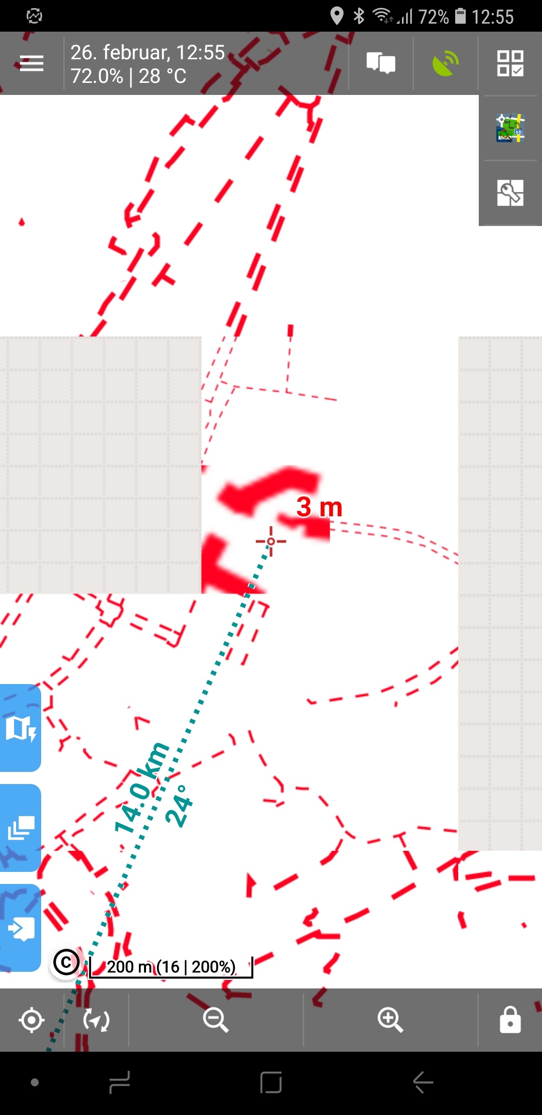
 The same problem
Good evening,
as you probably know, support for Garmin IMG maps is quite bad in Locus Map app and to be true, it is currently not on a roadplan to change it. So sorry, I cannot help here. I may only suggest to use any other source of OpenStreetMaps, like LoMaps available directly in Locus Store in app, or any other available on internet. Thank you for understanding.
Garmin maps which has trails and meant to be used as an overlay on a topo map is easy to find.
You mentions LoMaps. I had a look, but could not find any LoMaps which have trails only and usable as an overlay on top of an existing topo map. Neither can I find any OSM meant for this.
Garmin maps which has trails and meant to be used as an overlay on a topo map is easy to find.
You mentions LoMaps. I had a look, but could not find any LoMaps which have trails only and usable as an overlay on top of an existing topo map. Neither can I find any OSM meant for this.
Replies have been locked on this page!