
Locus Map - Three issues to be solved...
Dear everyone,
Firstly, I should like to share with you my opinion that the Locus Map app is excellent, with heaps of potential; a real tool for nature lovers.
I should also like to stress three issues regarding the app, hoping they can be solved in the future.
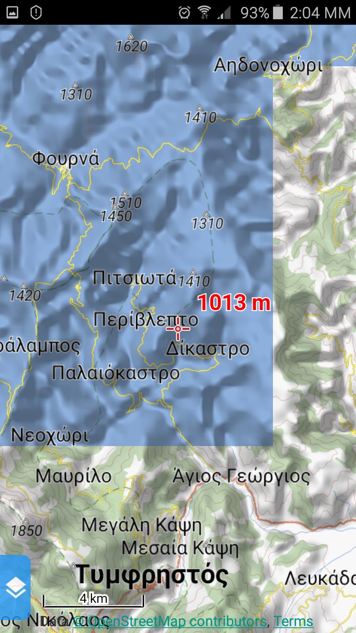
I have downloaded the map of Greece where, via “map feature” and having selected “hiking”, a large part of the country appears in blue colour, without the contour lines and with the streets and city names being the only apparent information. When one zoooms out the area appears corrected while the problem appears when one zooms in.
I have also deleted and downloaded the specific map again, but the problem remains. There is nothing like that with other map features, so I have selected the “Hiking and Cycling” option. I hereby give you an example in the screenshots attached.
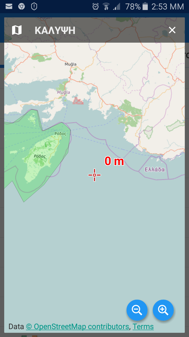
Another issue is that a Greek island is actually missing from the map of Greece. The name of the island is Kastellorizo and it is at the southeastern edge of the country, very near the border with Turkey.
Kindly see all the info you need here:https://en.wikipedia.org/wiki/Kastellorizo
Last butnot least, the official name of our neighboring country is F.Y.R.O.M. (FormerYugoslavic Republic of Macedonia) and not “Macedonia”. Macedonia is a largearea in Northern Greece, aka Greek territory and it is best not to be confusedwith our neighboring country. You might want to check with what is officiallyregistered with the United Nations.https://en.wikipedia.org/wiki/Macedonia_naming_dispute
Thanking you in advance and once more congratulating you on the Locus,
Sincerely,
Gerasimos Maris..
 The same problem
Dear Gerasimos,
thank you for comments. To you issues:
Blue rectangles on map: Do you use internal theme Hike & Bike, please? Do you use the latest version 3.18.9?
Missing Kastellorizo Island: Thank you. Greece Map really does not contains mentioned island. It'll be fixed in next version of Greece LoMaps
Macedonia - The name of the country is changed based on your suggestion.
Please let me some info about theme that you use
Thank you
Petr
Dear Petr,
Thank you so much for the prompt reply and thank you very much indeed for attending to the issues I mentioned.
Answering your first question now, yes, I am using the latest version 3.18.9 as you mention, using internal theme Hike & Bike. The problem with the blue rectangles on the map appears when I use external theme "Hiking".
Feel free to contact me should you need any other clarification or info.
Thank you once more,
Gerassimos
Hello Gerassimos,
thank you for screenshot. Honestly I don't know the source of Hiking theme. But the blue rectangles are caused wrong parameter in theme. Please use different one. Or there is quick solution if you're familiar with XML files. Please edit the hiking.xml file and on the second row is directive "rendertheme". Please add/change parameters locus-extended="1" fill-sea-areas="0" . Like:
I'd like to also inform you that missing Kastellorizo Island is solved in the last version of LoMaps 2016.08.28.
Thank you
Replies have been locked on this page!