
Thumbnail of tracks doesn't visible
Hello,
I have similiar problem as :Thumbnail doesn't visible: problem, that is solved.
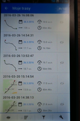
In the My track ( MOJE TRASY in slovak) I have my tracks. All older tracks are with map in thumbnail preview.
But last month, on the track map thumbnail I can see only track ( black line) and one color background - without map. Older tracks are with map in thumbnail preview.
If I long click on the thumbnail its reload, map is showing but for extra short time ( miliseconds) and again show background without map.
If I long click on the older track thumbnail with map, its reloaded, and now thumbnail show only track line without map. Map is loss.
If I want to see the map in the thumbnail the map must be : online/offline or in mobile/SD card or it does not matter?
 The same problem
Hello,
thanks for separate topic, it's usually better so I've removed your request and my answer on old place.
Background map is generated from available vector maps (LoMaps). So first important question is, if you still have some vector map available for this region (region where this track was recorded)?
Interesting is that you wrote that map appear for a while after long click. For this I do not have any explanation for now. Anyway main is here, if exists any LoMap (vector map) in track area or not.
I have this offline vector map :
sdcard/Locus/mapsVector/Slovakia - from http://www.openadromaps.org
sdcard/Locus/mapsVector/europe/Slovakia - from openstreetmap based freemap Slovakia topo
Now, I bought LoCoins, and Slovakia LoMaps.
sdcard/Locus/mapsVector/europe/Slovakia - LoMaps
And in this time in the thumbnail preview of track (after reload by long click)
I can see map for all track ( latest and older).
In my opinion, this problem is solved. So simple. Thank you.
Hello,
hmm weird. Issue is maybe solved, but purchase of LoMaps is not a correct solution, at least not wanted. Preview should be generated correctly even with vector maps from other sources (like OpenAndroMaps). I'm checking a code that generates bitmap images and it should really take closest vector map (VEC3) and use it for overview.
Hmm problem should be in rare case, like if you recorded your track close to border with other country and you have also map of this second country (like close to Hungary). Then Locus should incorrectly detect such country and use map that do not have a valid coverage. Is this possible?
Purchase of another map for Slovakia maybe only caused that Locus choose different map and in this case, correctly some Slovakia map.
If this really will be the reason, then this problem should be perfectly solved with next version of Locus and also next version of LoMaps, where will be a lot better detection of map area coverage.
Hello,
after hour test of my track and my I found easy solution of my problem.
Fox example I have maps :
SLOVAKIA (locus) - only slovak map
HUNGARY(openandromaps) - hungary map and several km of slovakia along border
I have track in the slovak city : ŠAHY.
The track is view in the map SLOVAKIA (locus) but also in the map HUNGARY (openandromaps) because it is near border.
If I place maps HUNGARY and SLOVAKIA together in the sdcard/Locus/mapsVector then
"Background of thmubnail track preview" is : HUNGARY . It is bad for my.
If I place maps separately : HUNGARY in sdcard/Locus/mapsVector and SLOVAKIA in sdcard/Locus/mapsVector/Europe then the "Background of thmubnail track preview" is : SLOVAKIA. It is right for my.
I tested this for another track - slovak city TRENCIN, and map: SLOVAK(locus) and CZECH(andromaps), the resulst
is the same. Together map in the one folder - result is CZECH, separately map - result is SLOVAK.
In my opion the map SLOVAKIA (locus) must be place in the folder sdcard/Locus/mapsVector/Europe
and other vector map in the folder sdcard/Locus/mapsVector/.
I apologize if it was my mistake.
And If I place maps HUNGARY and SLOVAKIA together in the sdcard/Locus/mapsVector/Europe then
"Background of thmubnail track preview" is : HUNGARY . It is bad for my.
Maps must be separately : HUNGARY in sdcard/Locus/mapsVector and SLOVAKIA in sdcard/Locus/mapsVector/Europe then the "Background of thmubnail track preview" is : SLOVAKIA. It is right for my.
Hello,
really nice testing :). I have to say that results are quite "random" ... to be more precise - first map that Locus find that "cover" required area, it's selected and used.
As I wrote before, this will be little bit improved in next version of Locus and new vector maps (LoMaps) from Locus Store, that will have more precise definition of coverage (current maps has only a huge rectangle).
Thank you and I look forward to the new version.
Thank you and I look forward to the new version.
Replies have been locked on this page!