
Suggestions for vector maps readability improvements
Hi, I'd like to suggest next vector maps readability improvements (style):
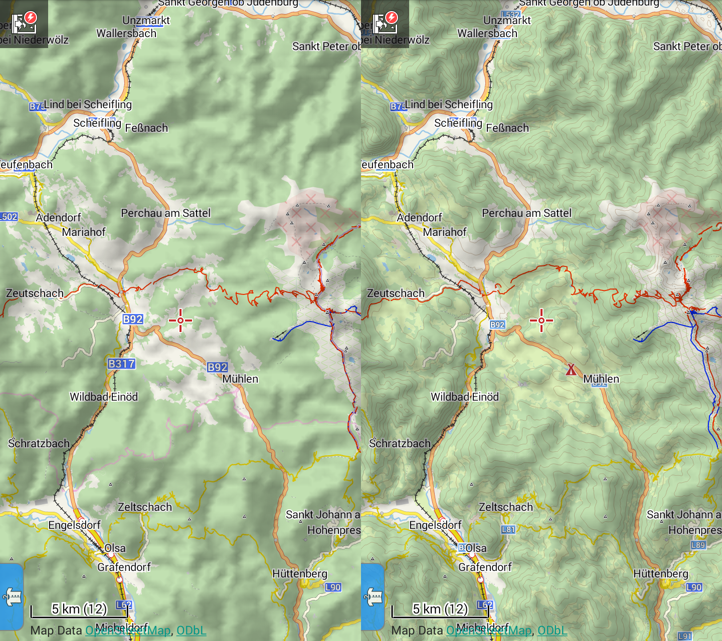
– Distinction of grass (pleasant, we like it) and fields (to avoid them)
– More clear tracks (a bit wider and smaller spaces to make them readable)
– paths smaller to have a clear difference between track and path (alternating white/gray improves readability even if the commas are shorter)
– I personally added a dashed lines for unclassified tracks which is handy if you track for OSM but might be redundant for others
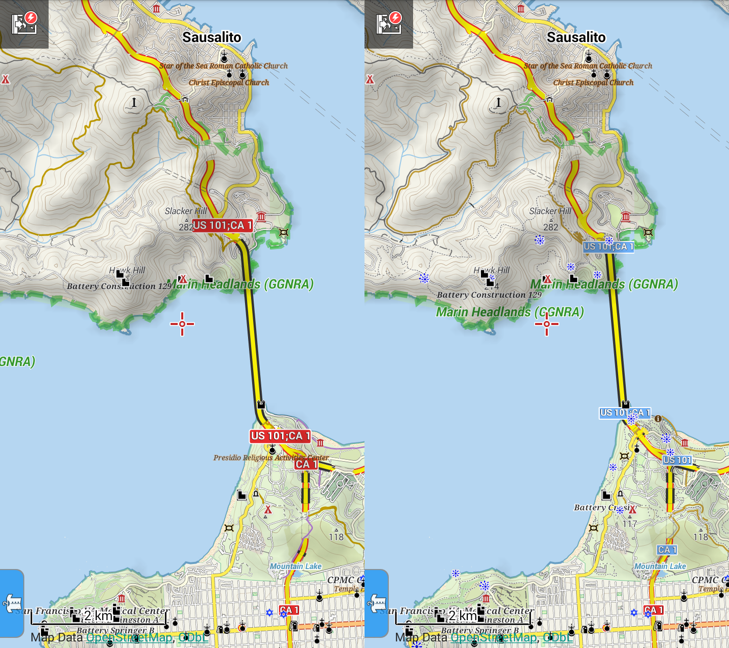
– administrative borders only on smaller scales (who cares about local borders, state borders not affected)
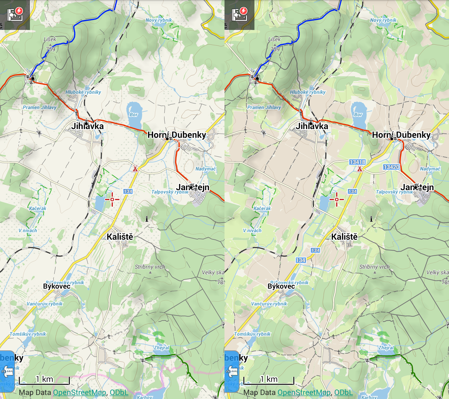
– footways not hidden in contours or trees (there was a bad readability on phone in sunlight), now they are similar to paths
– offsetted international marked trails (those without osmc_symbol)
– tourist POIs in smaller scales (viewpoints, shelters, alpine huts, info points, camps) because you want to see them if they are around even if you don't know you should search for them
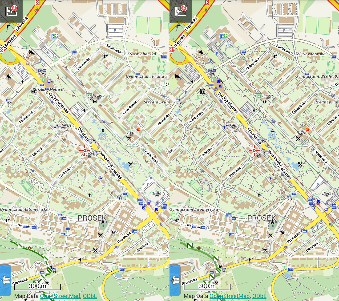
– works in cities as well:
– + gray service tracks to dim them a bit relatively to more important roads
– removed pointless unmarked international routes when they run in parallel with marked ones (kept when they run alone)
– cycle theme shows tourist trails as well because even cyclists use tourist trails for orientation
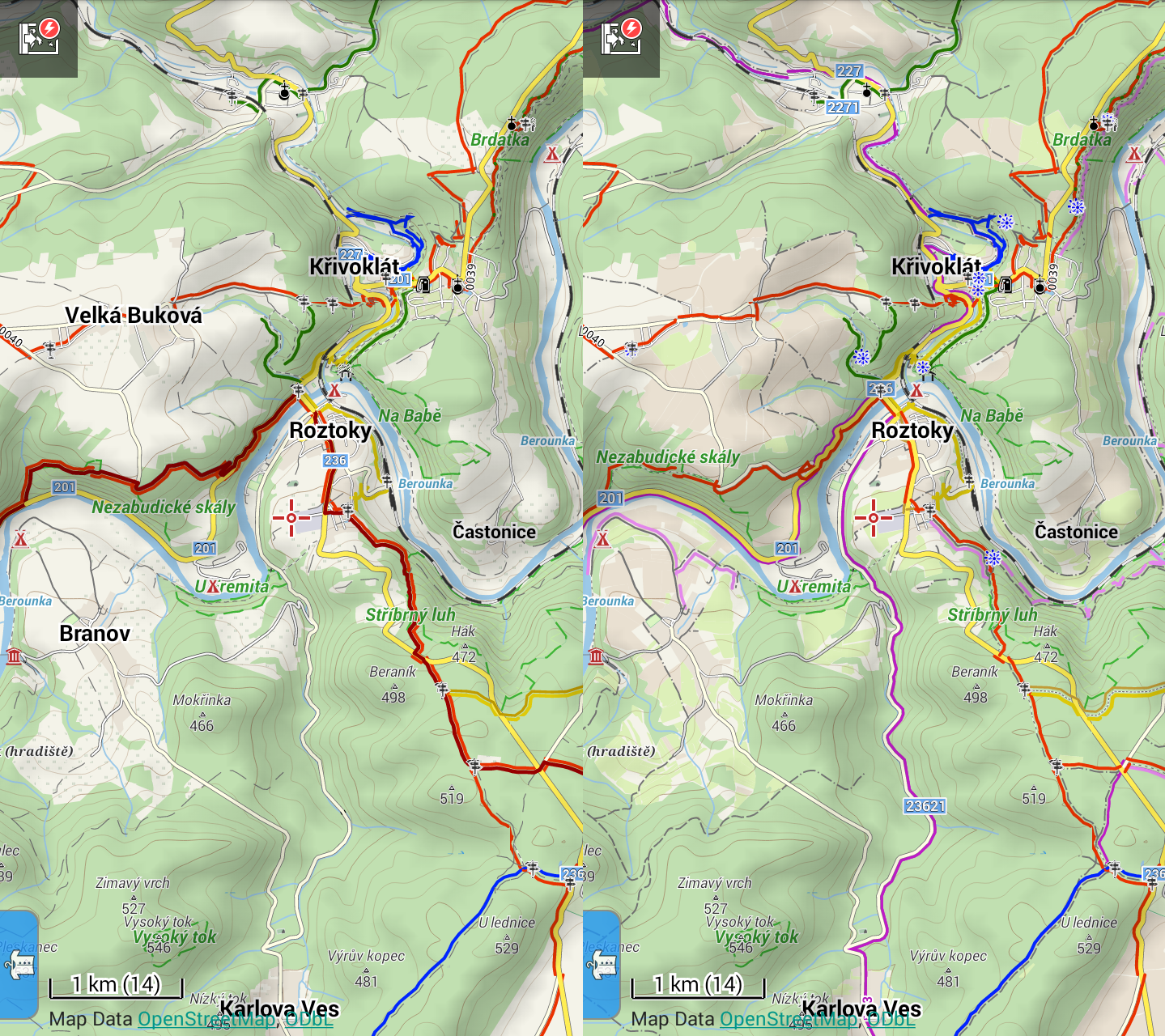
– contours and POIs (as above, here just camp) in smaller scales
Hope it will help improving vector maps (see styles making those updates).
m
 I like this idea
Replies have been locked on this page!