
Allow display of full elevation profile chart from Route Planner
Gathering feedback
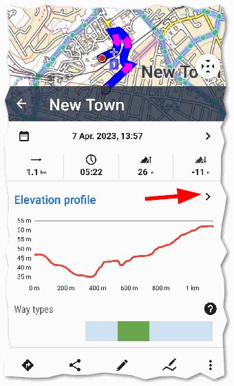
The Route Planner at present allows the following info to be dragged up from the bottom:
- Elevation profile,
- Way types,
- Surface:
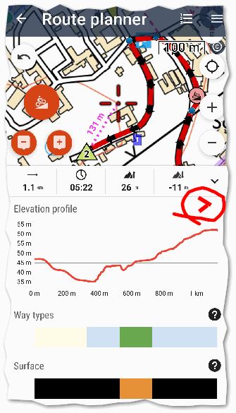
But the track manager allows even more info to be displayed by tapping the ">" below:
the most important info for me being Slope (%):
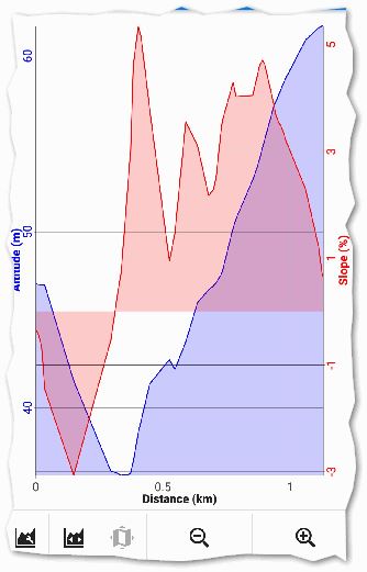
Can I suggest the Route Planner bottom info panel has the same ">" button next to the Elevation profile chart (as annotated in the first screen capture), and consistent with the Track manager, which links to the users already configured chart with X axis (Distance/ Time) , left Y &/or Y axis (Altitude/ Slope/ Speed/ etc.).
 I like this idea
Replies have been locked on this page!