
This object is in archive!
Display Korean National Point Number as coordinate
Completed
Hi, Menion!
South KOREA government install and use National Point Number (converted from UTM-K(GRS80))
for emergency rescue purpose.
and we need that displayed at LOCUS MAP title bar as a coordinate instead of UTM-K.
Can you make this function to locus map next update?
Our 10000 GPS club member need it desperately.
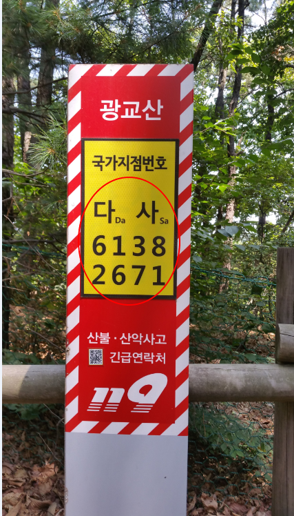
figure 1) KOREAN national point number
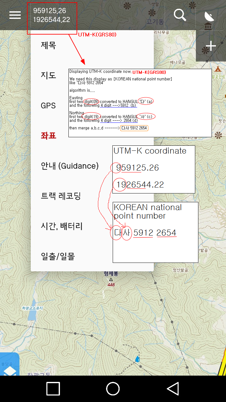
figure2) Display on locus map
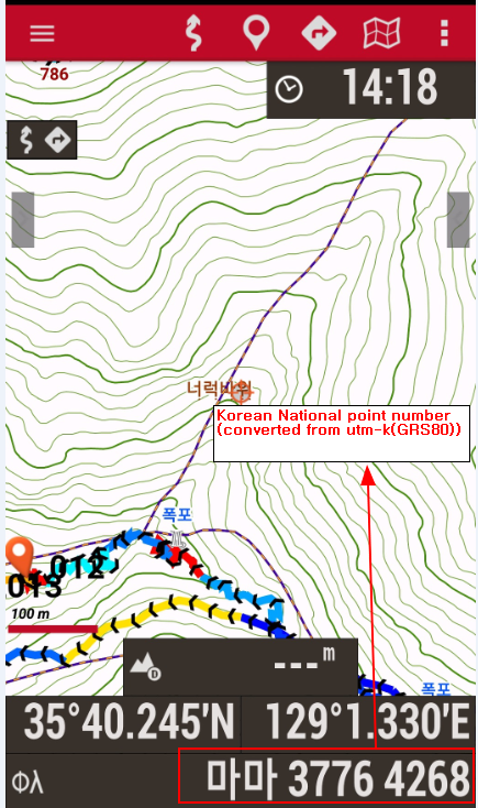
figure3 ) Oruxmaps support this function
I attached file (Convert UTM-K to korean national point number)
It explains converting algorithm.
Additionally, If you can, We need this function too.
search as coordinate (korean national point number) ---> to map position.
Thanks a lot .
Skully Fox.
Files:
utm-k.txt
 I like this idea
Hello Skully,
thanks, "5179" was information I was missing.
So in the next version 3.39, the required feature will be implemented.
Hello Skully,
thanks, "5179" was information I was missing.
So in the next version 3.39, the required feature will be implemented.
Good day Skully,
thanks for a precise description and source code that may help here. We are currently preparing the bigger change in the inner system of application, so such a task has lower priority. Remind me this in half of next year if you will be still interested. Till then, we will see if there will be more users interested in these coordinates. Thanks
EDIT: thanks all for the feedback. +1 vote is enough to give us know that there is interest in this feature. Useless comments will be removed. Thanks for understanding.
It's very important thing.
Korean National Point Number is the coordinate system for National Grid that have been used in the United States(USNG:United States National Grid) and the UK(NGRS:National Grid Reference System) for many years already.
This is the basic coordinate system for clarifying unspecified locations where there is no nearby building or far from the road.
Therefore, it is the coordinate system that must be applied to inform a precise point using it for rapidly action when an event occurs in mountainous region or sea, etc.,
This is a feature already applied to other companies' Apps, but I hope that I will soon be able to use it in your App as a favorite enthusiast of your App.
Thanks.
Good day Skully,
what exactly is "UTM-K"? In the mentioned area is UTM at zone 52S, so should I use standard UTM at this zone?
Menion
Good day Skully,
what exactly is "UTM-K"? In the mentioned area is UTM at zone 52S, so should I use standard UTM at this zone?
Menion
Replies have been locked on this page!