
This object is in archive!
Strange altitude difference data
Not a Problem
Hi,
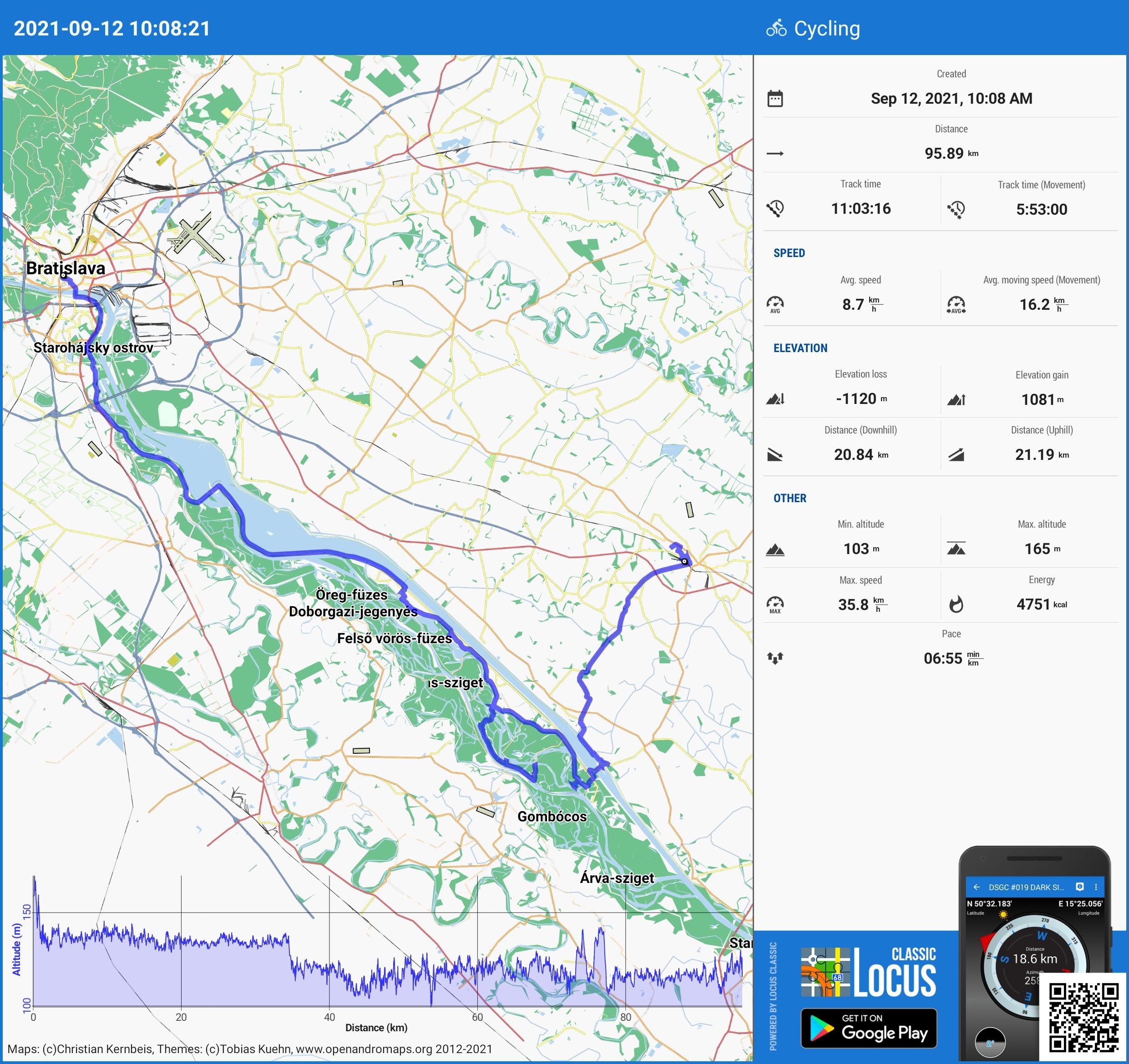
for some time I have seen that Locus computes the overall gain/loss in altitude of a track very strangely.
Yesterday, I cycled 95km over a very, very flat country, yet Locus says I did an elevation gain of 1081m and an elevation loss of 1120m (picture attached).
My hypothesis is that Locus is not doing enough "smoothing" in recorded altitude data, but I might be wrong.
Any ideas? :)
Files:
2021-09-12_10-0...
 The same problem
Hi Juraj,
Locus Map processes elevation gain from the data it receives from your phone GPS. If the data are incorrect or contain huge deviations, then the resulting elevation gain is also incorrect. Locus Map, however, offers a few methods on how to limit these deviations. Open Locus settings > GPS&sensors:
- Location filter > select medium or heavier filter
- Google Services assisted location > turn it ON
- Altitude manager > settings tab > SRTM data - select "Optimize GPS values" or "Replace GPS values"
- Altitude manager > settings tab > Pressure sensor > turn ON (if available)
- Altitude manager > settings tab > Altitude filter - select medium or heavier filter
Replies have been locked on this page!