
This object is in archive!
RTK / NTRIP Logging
Completed
Hello
I'm currently testing an RTK / NTRIP system together with logging in Locus Map, which allows a much more precise localisation of the logging phone down to 1-2 cm!!
Up to now it is a bit difficult to combine both systems because there is no hiking app on the market, which provides the relevant features.
Do you want to be the first?
I'm sure that this technic will be relevant for all track logging apps in the future.
Just to make sure: I don' want to sell something, I' an interested user an engineer.
If you are interested in more information, please contact me
Thanks
Olaf
 I like this idea
To make it a bit more clear:
You can now already connect Locus with external sensors but for the optimization of the GPS signal, the NTRIP correction data have to be loaded. Not a big thing, just a feature but the difference of the position quality is amazing.
In the attached picture you can see a tracking in forest area with typical mobile phone GPS quality problems. The green line is logged with RTK data.
Questions?
Hello Olaf
do you know
menu/all features/Set up/NTRIP client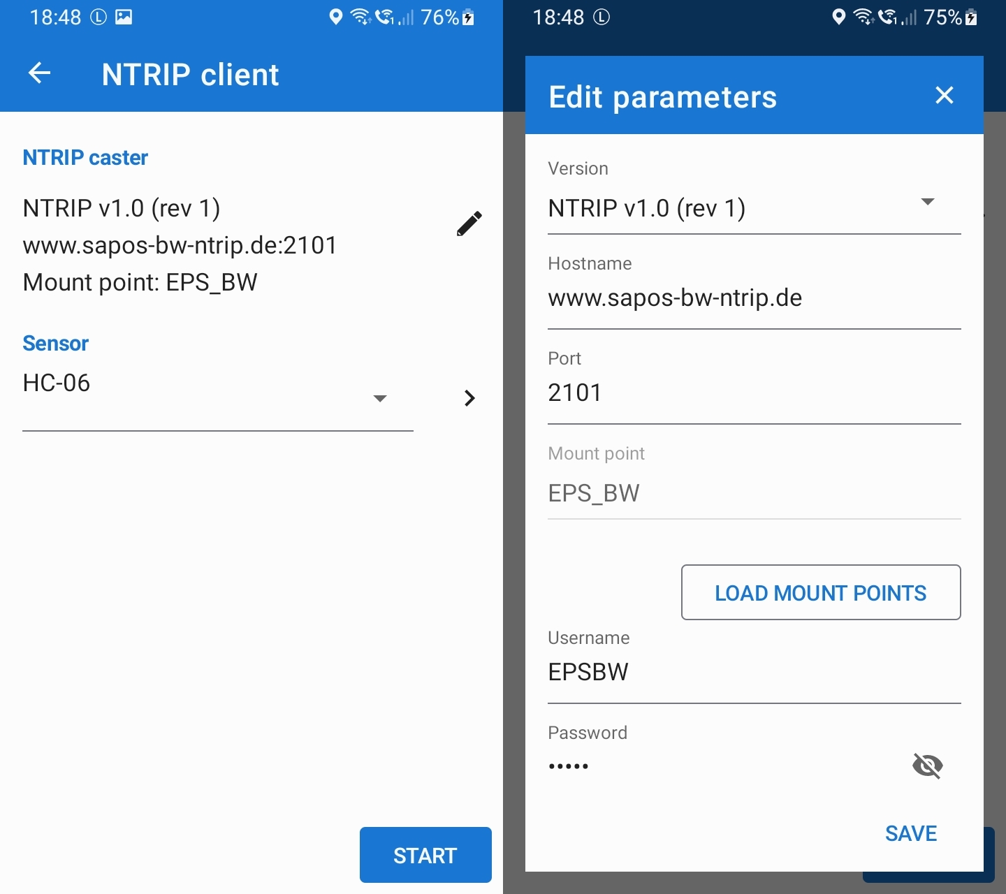
Hello Olaf
do you know
menu/all features/Set up/NTRIP client
Thanks very much for your help! You're my hero of the day ;-)
Maybe some optimisations are possible
- Storing different connections with naming
- Making download value visible (see other NTRIP client apps)
- Some connections/ Mountpoints are not working but they do in other apps
Nevertheless I'm once more really happy that I made the decision to use Locus as my hiking app!
Replies have been locked on this page!