
This object is in archive!
One more wrong dynamic altitude
Solved
Hello,
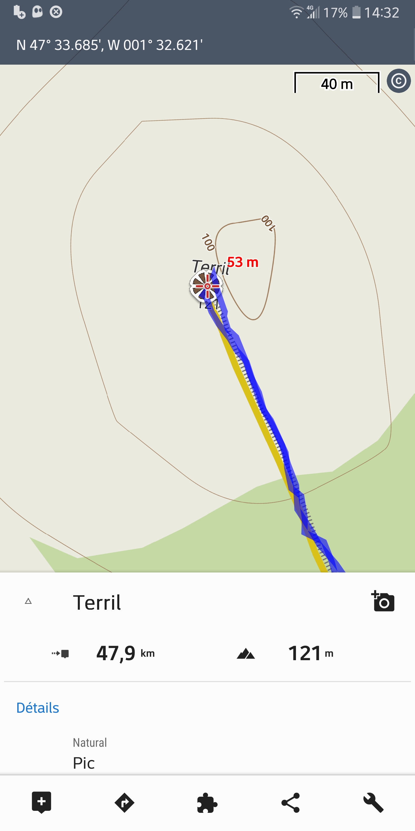
I'm French user of LocusMap 4.15 on Android Smartphone
I found a wrong (dynamic) altitude on a French Offline LoMap as you can see with the Screenshot : N 47° 33.685', W 001° 32.621' => the real altitude is 121m but the LoMap show 53m. Of course, the elevation profile of my route is wrong too :-(
Could you correct this anomaly ?
Thanks for your answer
Stéphane
Files:
13-mars-2023-14...
 The same problem
Hello,
is it possible that you have old elevation data?
You can try deleting this file: Locus/data/srtm/N47W002.hgt
When you go back to Locus, it offers you to download elevation data again and the latest version will be downloaded. Then it should be better.
But there will still be some imperfections because elevation data are created in the grid and many peaks are underestimated. But this is a question about what current technology could (or couldn't) do.
Regards,
Zdenek, Locus team
Please have a look at https://forum.locusmap.eu/index.php?topic=5363.0
You can download DTM 1" France and will get an elevation of about 112m at the peak
Please have a look at https://forum.locusmap.eu/index.php?topic=5363.0
You can download DTM 1" France and will get an elevation of about 112m at the peak
Question @Sonny: as the 1" are 8 times bigger in size, a general switch in Locus to 1" has a number of consequences for both, the company and the user.
Would 3" LIDAR data also solve above (and the parallel thread issue) to a reasonable extent?
Question @Sonny: as the 1" are 8 times bigger in size, a general switch in Locus to 1" has a number of consequences for both, the company and the user.
Would 3" LIDAR data also solve above (and the parallel thread issue) to a reasonable extent?
The elevation difference based on a 3" compared to a 1" depends on the contour of the terrain. In case of the 1"-file each ca. 25 m an elevation point is listed, in the case of a 3" just each ca. 75 m. So in quite flat regions the difference will be insignificant, but in hilly, mountaineous regions on where narrow glens the difference is significant. And if we calculate the total Elevation gain a hiking track these differences will sum up.
Yes, the 1"-files are of course bigger. But an average 1"-zip file is 5 MB in download size and 26 MB unpacked one the phone. I think both numbers are exeptable regarding todays donwload speeds and phone memories since people wont necessary dowload the files of a whole country but just the areas they are interested in.
Of course it would be clever to offer both versions, 1" and 3", so the user could decide what precision and what download/memory size he wants to deal with regarding elevation files.
Replies have been locked on this page!