
Show Delta height meters instead of azimuth
Hey there (again),
I've got another idea (again compared to Oruxmaps where I came from) 😉 just give it a read 📖 🤗
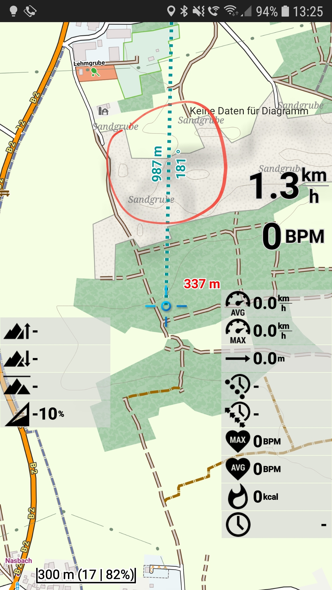
When scrolling in Locus Maps from my actual location to another location I can configure that the distance and the azimuth is shown. For me, it would be much more useful (than the azimuth) how many height meters lie between my actual location an the targeted (scrolled to) location.
Especially when hiking and biking, it is very helpful to know quickly how many height meters lie between two points.
I know, such a feature could be be very complicated if you would start to calculate every height meters following only marked ways and so. But for me, it would be enough just to see the "naive" difference between my actual location an the target location (scrolled to). I personally have a look if I am crossing any further contour lines, that would be (manually) added to the "naive" difference 🙂
 I like this idea
Hello,
just for your info, this feature is already (for some time) implemented over expert settings.
Enjoy it!
Hello,
just for your info, this feature is already (for some time) implemented over expert settings.
Enjoy it!
Awesome, a thousand thanks Menion 👌❤
Awesome, a thousand thanks Menion 👌❤
Replies have been locked on this page!