
Transformation of image (raster layer) during calibration
Image map calibration has been incredibly useful for me - I hope so it is so for other users too.
I find image map calibration in Locus app very comfortable and easy to use for various purposes - as an archaeologist, calibration of old maps and aerial photographs helps a lot during researches.
Though sometimes image calibration might be difficult, especially using aerial imagery - sometimes they were taken at specific angle and doesn't cover the area at 90°. While trying to calibrate such image in Locus, few points might be off by few meters only, but other end of the aerial photo might have 100 m or more of offset.
Bringing Transformation function to Locus would solve this problem.
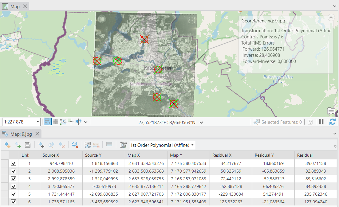
For example: Image "1" shows an aerial image calibration on ArcGIS Pro with marked 6 control points - they were placed correctly and all of them brings terrible offset (one of the points - more than 200m). This is due to specific angle, from which the aerial was taken.
Same would happen on Locus.
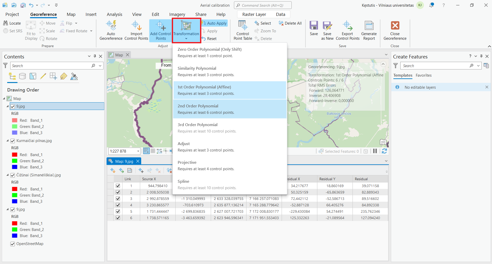
ArcGIS Pro offers a "Transformation" tool, which is highlighted in red on attached "2" image. Using the tool functions as "2nd Order Polynomial" or "3rd Order Polynomial" solves this problem. This is nicely described on their official website:
https://pro.arcgis.com/en/pro-app/latest/help/data/imagery/overview-of-georeferencing.htm
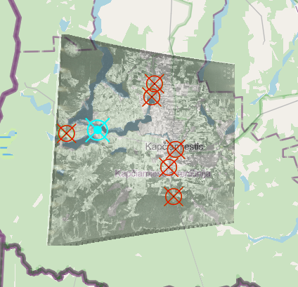
Attached image "3" shows the results - the aerial image was shaped in specific angle, which brought results of offset no more than 10 meters (because the aerial photograph was taken at such specific angle). Few control points were added or edited for better results.
Bringing such function to Locus would be a great additional tool. The examples were taken from ArcGIS Pro desktop app, but it is complicated for beginners, doesn't keep original quality of the photo and is not accessible for ordinary user.
 I like this idea
Hello Kęstutis,
I'm glad you find this a little complicated function useful.
What you ask makes sense and I agree it may be useful. On the second side, Locus Map does not try to be a professional georeferencing tool. Currently, the app uses the so-called Helmert transform that only does a basic move/rotate/scale transformation.
Our TODO list is neverending and this feature is not, and never will be, a top-wanted feature, More complex transformations are really out of the scope of Locus Map, so sorry, I have to decline this idea.
Kęstutis Jankus, Try converting the image before calibrating it. I can eliminate the distortions in this quite acceptable way. I do this right on my phone using the Snapseed app (https://play.google.com/store/apps/details?id=com.niksoftware.snapseed). Perhaps this information will be useful to you.
Kęstutis Jankus, Try converting the image before calibrating it. I can eliminate the distortions in this quite acceptable way. I do this right on my phone using the Snapseed app (https://play.google.com/store/apps/details?id=com.niksoftware.snapseed). Perhaps this information will be useful to you.
Hello!
Thank you for the answer, I really appreciate it.
Of course I agree with the answer as such function would never be "top-wanted feature". Though I wonder if I am alone who would find such feature useful, or how popular in general "Image map calibration" feature is.
If anytime in the future such function as Transformation would end up on the app - I wouldn't hesitate to pay for it even as a function (like purchasable maps).
Replies have been locked on this page!