
Trekking bike
Good morning gentlemen, I occasionally use your program to go cycling, even though I have had it for many years.
My desire has always been to have off-line maps with street/road names and countries using all the available profiles.
Unfortunately I can only see the street names if I use GRAPHOPPER and I only see some profiles.
In the past I used "elements/elevate" now I saw that there is also V5LE.
Since a lot of time has passed, you have certainly made important updates.
If I take out a paid subscription will my problems be solved? Or what else should I do?
Thanks for the always kind replies
Armando
Signori buongiorno, per andare in bici impiego saltuariamente il vostro programma, anche se lo possiedo da molti anni.
Da sempre il mio desiderio è quello di disporre di mappe off-line con nomi vie/strade e paesi impiegando tutti i profili disponibili.
Purtroppo i nomi delle vie posso vederli solo se uso GRAPHOPPER e vedo solo alcuni profili.
In passato impiegavo “elements/elevate” ora ho visto che c'è anche V5LE.
Visto che è passato molto tempo, sicuramente avete fatto aggiornamenti importanti.
Se faccio un abbonamento a pagamento risolvo i miei problemi? O cosa altro devo fare?
Grazie per le sempre cortesi risposte
Armando
 The same question
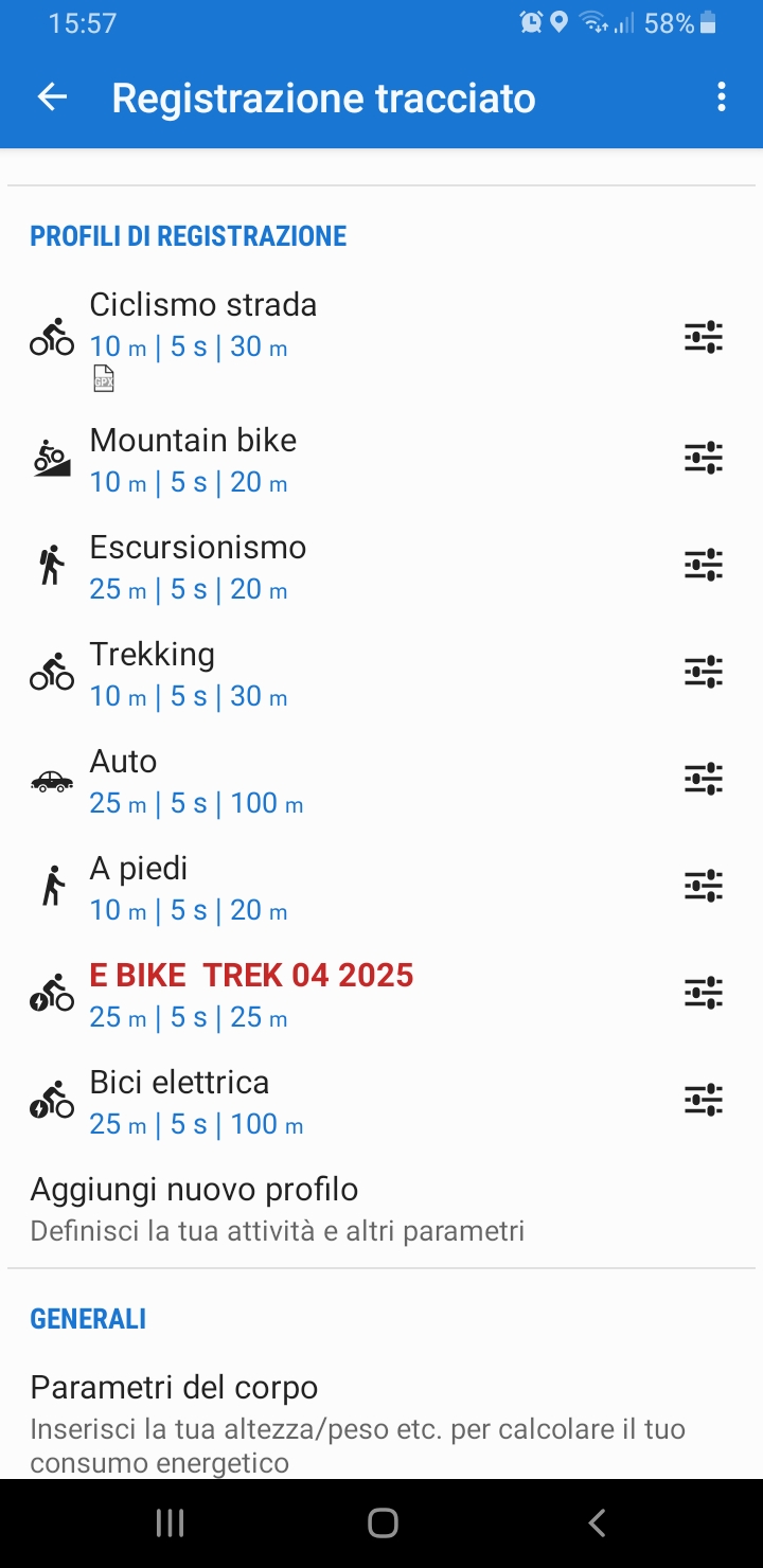
Hi Armando.
as you might have noticed, Locus Map 3 Classic has been in maintenance-only mode for a few years and it has recently entered the last year of its support. It means that the app will not be improved anymore.
If you want to see the street names during navigation and use multiple routing profiles with custom parameters, please install Locus Map 4. Its built-in LoRouter online offers both. And if you decide to support Locus Map's further development and subcribe to Premium Gold, you will be able to use the LoRouter in full offline mode.
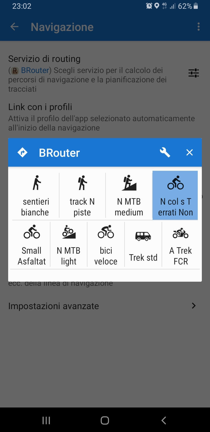
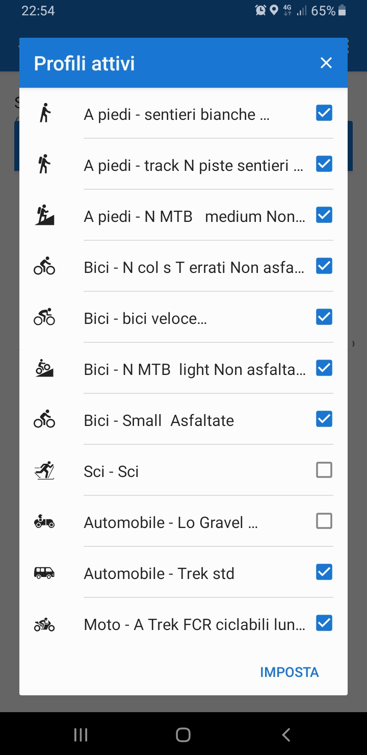
Also BRouter is supported by LM4, with its multiple options for customization:
Hi Armando.
as you might have noticed, Locus Map 3 Classic has been in maintenance-only mode for a few years and it has recently entered the last year of its support. It means that the app will not be improved anymore.
If you want to see the street names during navigation and use multiple routing profiles with custom parameters, please install Locus Map 4. Its built-in LoRouter online offers both. And if you decide to support Locus Map's further development and subcribe to Premium Gold, you will be able to use the LoRouter in full offline mode.
Also BRouter is supported by LM4, with its multiple options for customization:
Signor Michal buona sera,
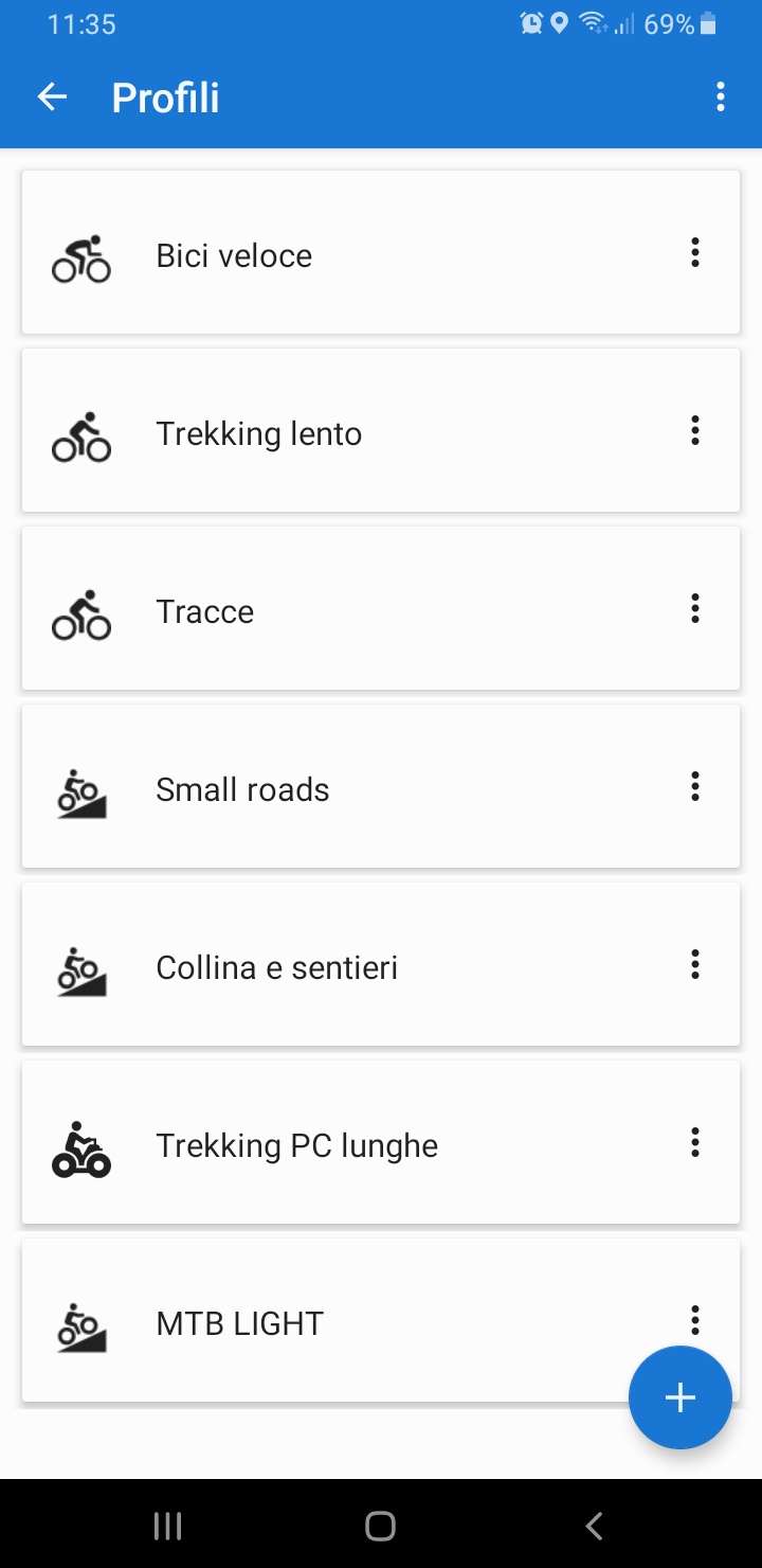
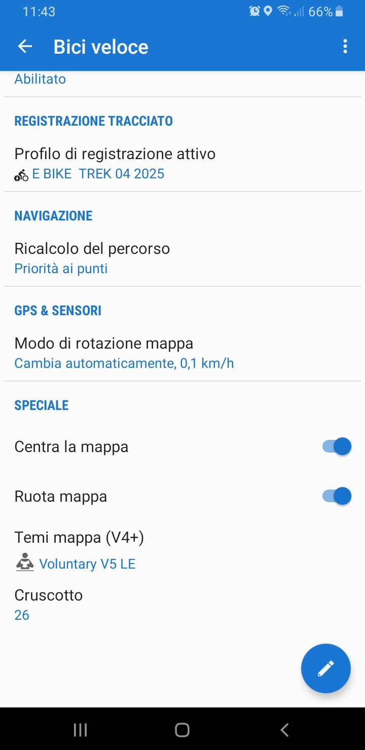
posso anche abbonarmi, ma prima vorrei sapere cosa devo fare per aggiornarmi a Locus Map 4 mantenendo (senza perdere nulla) tutte le personalizzazioni che ho fatto negli anni? (cruscotto, Profili, ecc)
Grazie
Mr. Michal good evening,
I can also subscribe, but first I would like to know what I have to do to update to Locus Map 4 while maintaining (without losing anything) all the customizations I have made over the years? (dashboard, Profiles, etc.)
Thanks
Signor Michal buona sera,
posso anche abbonarmi, ma prima vorrei sapere cosa devo fare per aggiornarmi a Locus Map 4 mantenendo (senza perdere nulla) tutte le personalizzazioni che ho fatto negli anni? (cruscotto, Profili, ecc)
Grazie
Mr. Michal good evening,
I can also subscribe, but first I would like to know what I have to do to update to Locus Map 4 while maintaining (without losing anything) all the customizations I have made over the years? (dashboard, Profiles, etc.)
Thanks
Here are the instructins on how to transfer your data and settings from Locus Map Classic to Locus Map 4: https://docs.locusmap.app/doku.php?id=manual:faq:pro_to_lm4
Here are the instructins on how to transfer your data and settings from Locus Map Classic to Locus Map 4: https://docs.locusmap.app/doku.php?id=manual:faq:pro_to_lm4
Michal Buona sera,
sicuramente per voi è facile, ma io non riesco a ripristinare il file di backup.
allego alcuni screenshot.
Spero di ricevere istruzioni dettagliate, altrimenti sono disposto ad un vostro intervento da concordare con TeamViewer
Grazie per l'interessamento
Michal Buona sera,
sicuramente per voi è facile, ma io non riesco a ripristinare il file di backup.
allego alcuni screenshot.
Spero di ricevere istruzioni dettagliate, altrimenti sono disposto ad un vostro intervento da concordare con TeamViewer
Grazie per l'interessamento
Armando, what version of OS Android do you use? Could you please send a screenshot of the "About app" section in the main menu of Locus Map Classic? Thanks
Armando, what version of OS Android do you use? Could you please send a screenshot of the "About app" section in the main menu of Locus Map Classic? Thanks
Spero sia sufficiente ...A presto
Spero sia sufficiente ...A presto
1) please move the main app directory to the default location in the internal storage
2) follow the instructions for the data move specified for Android 9: https://docs.locusmap.app/doku.php?id=manual:faq:pro_to_lm4#android_6_-_10
1) please move the main app directory to the default location in the internal storage
2) follow the instructions for the data move specified for Android 9: https://docs.locusmap.app/doku.php?id=manual:faq:pro_to_lm4#android_6_-_10
Good afternoon Michal,
I think I finally managed to enable LOCUS 4, but I only saw limitations (silver and gold)
Can you tell me the improvements you have made for cyclists?
To convince me, can you give me a free subscription for a few months?
Thanks again for the time you dedicated to me
Good afternoon Michal,
I think I finally managed to enable LOCUS 4, but I only saw limitations (silver and gold)
Can you tell me the improvements you have made for cyclists?
To convince me, can you give me a free subscription for a few months?
Thanks again for the time you dedicated to me
As a LM Classic user, you automatically get 100% discount on Premium Silver subscription for one year and 50% for one year of Premium Gold.
Go to menu > log in with the same account you used in LM Classic > enter Go Premium > choose the Premium plan you want.
Improvements for cyclists:
- support of Garmin Varia radar
- customizable routing profile "gravel" - parameters for wet conditions, steps, ferries, adjustment of personal speed for exact ETA calculation
- customizable routing profile "road" - ferries, tunnels, steps, preference of cycleways, adjustment of cyclist's power for exact ETA calculation
- route warnings (demanding terrain, barriers, dense traffic...)
- route planning with way types and surfaces graphs
- etc. etc...
Replies have been locked on this page!