
This object is in archive!
LoPoints rendering
Answered
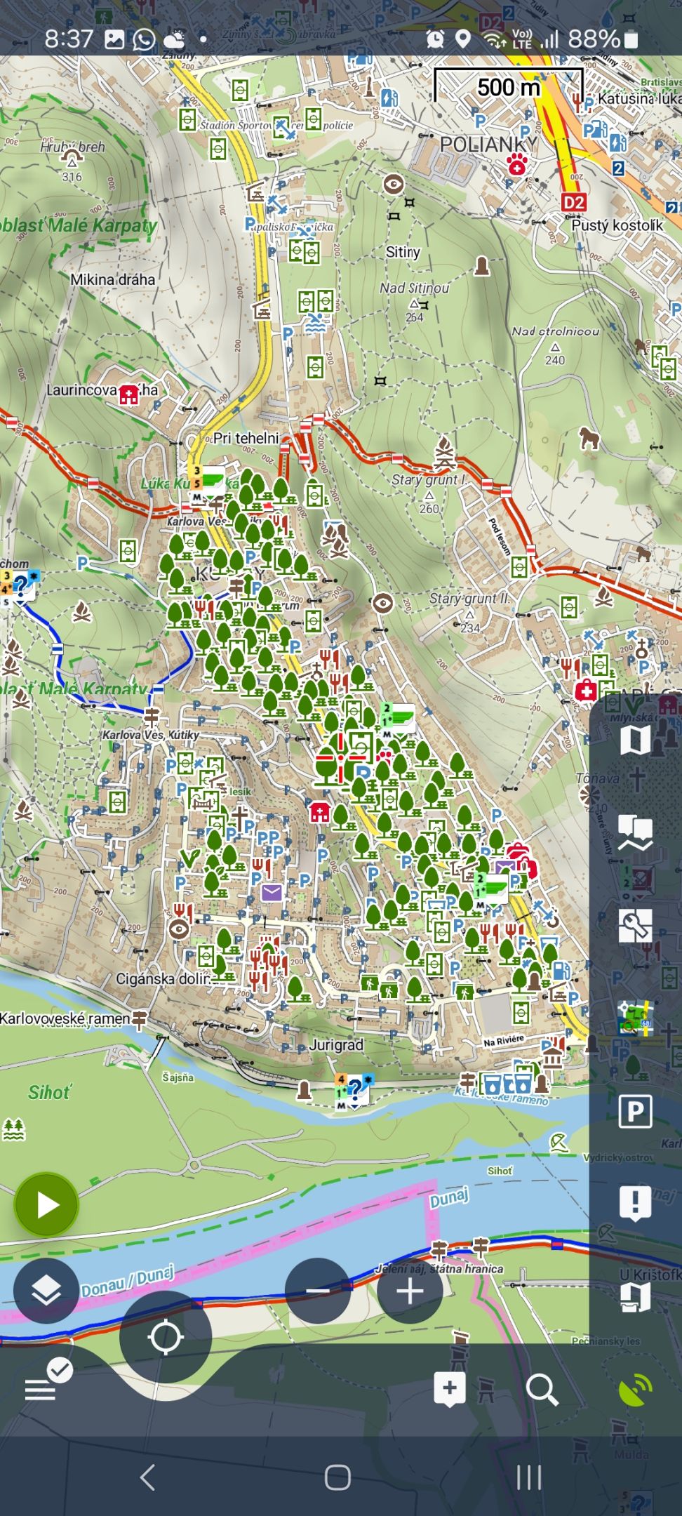
After update (22.6.), when I move the map too quick, Lo Points are shown on map as info icons and then they change the appearance to normal icons (screenshot). Also on map there are too many trees (parks). I attached the screenshots comparing LoPoints (trees) with Locus 3 with OpenAndroMaps map+points.
 The same question
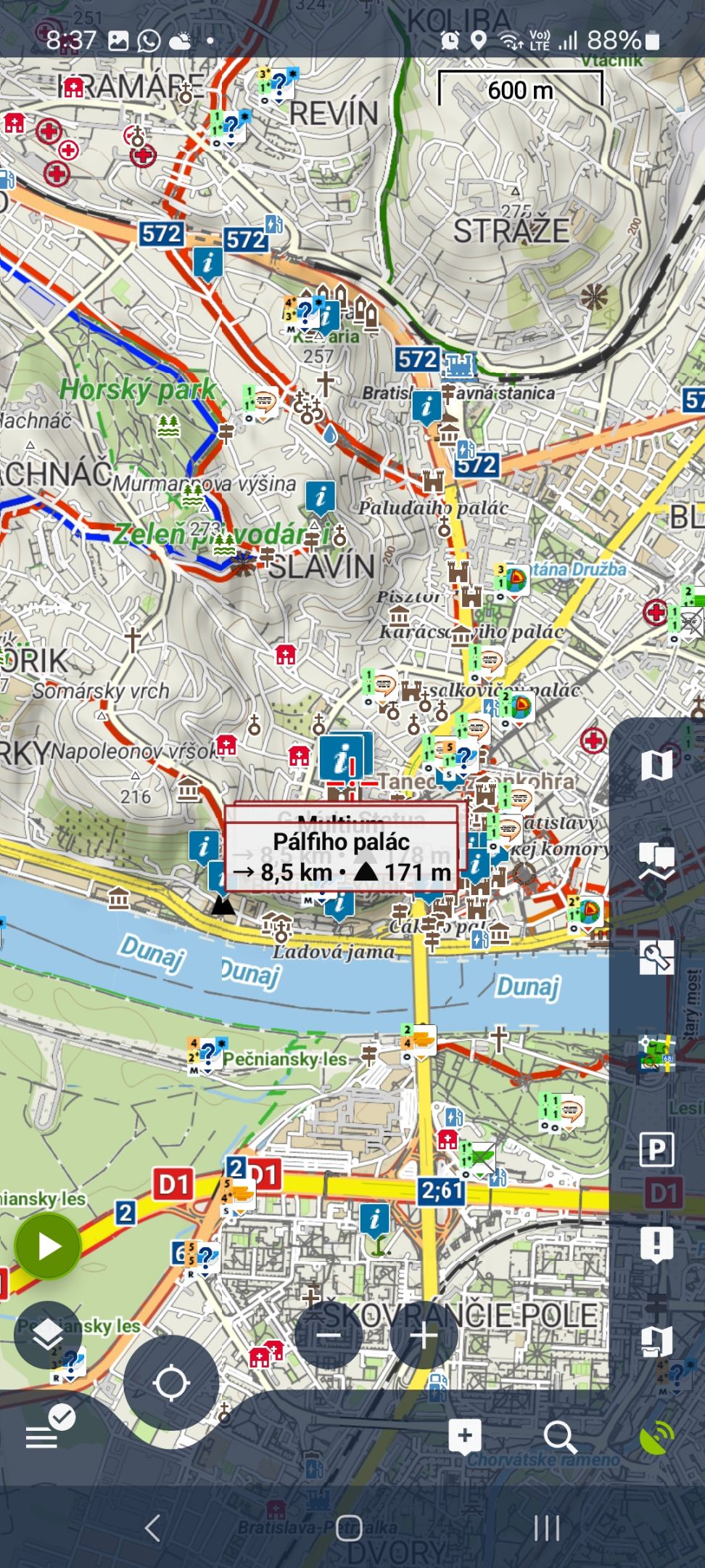
Hi,
"info icons"
- standard behavior when the app has performance issues e.g. when too much content is active on the map screen
"too many trees"
- I'm not able to simulate the issue. Parks icons are displayed in zoom 16 when there is enough space. In zoom 15 the parks are hidden:
Hi,
"info icons"
- standard behavior when the app has performance issues e.g. when too much content is active on the map screen
"too many trees"
- I'm not able to simulate the issue. Parks icons are displayed in zoom 16 when there is enough space. In zoom 15 the parks are hidden:
I use PAWS map (slovakia gccz) from https://osm.paws.cz/
Testing scenario:
- turn off LoPoints
- zoom is 16
- go to Karloveska Bratislava
- turn on LoPoints
First the info icons are displayed which changed to many trees after 5 seconds, I attached screenshots.
I also tested it with LoMaps version 2025.04.10. There are literally icon for every tree here next to road.
Also on your screenshots there are not so many parks (not on streets), also there is a policlinic here which is not so visible because of trees.
I use Locus daily for geocaching, that rendering issues were not in Locus Classic so I comparing and testing the app versions next each other because when I will be in foreign countries/mountains I need the bombproof app.
I found a temporary workaround using OpenAndroMaps with other POIs from menu but LoPoints will be very useful in combination with Compass mountains maps.
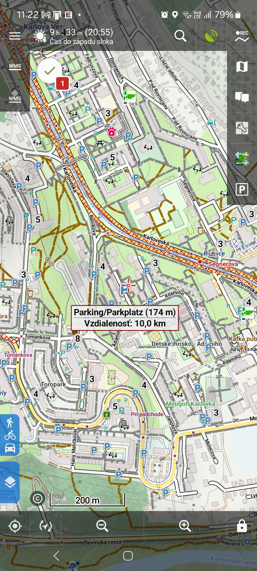
Also I found another problem, I check offline lo points (not online), I was driving to woods 50km away, turn on Locus and LoPoints were not on the map because they were not cached/downloaded before for whole country. They were on the part of the map - on this part which I was browsing when I was online.
I use PAWS map (slovakia gccz) from https://osm.paws.cz/
Testing scenario:
- turn off LoPoints
- zoom is 16
- go to Karloveska Bratislava
- turn on LoPoints
First the info icons are displayed which changed to many trees after 5 seconds, I attached screenshots.
I also tested it with LoMaps version 2025.04.10. There are literally icon for every tree here next to road.
Also on your screenshots there are not so many parks (not on streets), also there is a policlinic here which is not so visible because of trees.
I use Locus daily for geocaching, that rendering issues were not in Locus Classic so I comparing and testing the app versions next each other because when I will be in foreign countries/mountains I need the bombproof app.
I found a temporary workaround using OpenAndroMaps with other POIs from menu but LoPoints will be very useful in combination with Compass mountains maps.
Also I found another problem, I check offline lo points (not online), I was driving to woods 50km away, turn on Locus and LoPoints were not on the map because they were not cached/downloaded before for whole country. They were on the part of the map - on this part which I was browsing when I was online.
We optimize Locus Map 4 to work best with our content - LoMaps (with LoMap internal themes) and LoPoints. We can't secure the app's behavior with custom content or services even though it is possible to use such content. The anomalies you've described are probably caused by the combination of custom content with internal content.
We optimize Locus Map 4 to work best with our content - LoMaps (with LoMap internal themes) and LoPoints. We can't secure the app's behavior with custom content or services even though it is possible to use such content. The anomalies you've described are probably caused by the combination of custom content with internal content.
The same behaviour is with LoMaps Slovakia. When I work with custom content (OpenAndroMaps with their POIs), everything is OK.
Also on your pictures, trees are directly in the tram path: https://help.locusmap.eu/public/attachments/a0953fd3bfa290d57b12b22d52aba0f19a9623a545b56fa375bdee28b65f4c1f.png
This is screenshot with LoMaps using only LoPoints:
1) your LoMap and LoPoint database are obsolete - you are using V3 maps that we abandoned in May 2023. Now the map data generalization works in a different way.
2) the parks in Karlova ves are incorrectly mapped by some local OSM contributor - every pieace of lawn is mapped individually and not in a single relation.
Replies have been locked on this page!