
Color-coded trails on the map
Answered
Hi.
Is it possible to turn off the colored hiking and biking trails on the map?
When I try to concentrate on the terrain and other details, such a view is very distracting. This is particularly annoying when I want to see e.g. my last three tracks on the map. They get mixed up with the colored hiking trails and bike routes.
I looked for how to turn it off in the menu but couldn't find it. I am attaching a file with a screenshot where all these colored paths are visible.
Thank you for your help and best regards. :)
Files:
LM-screen-01.JPG
 The same question
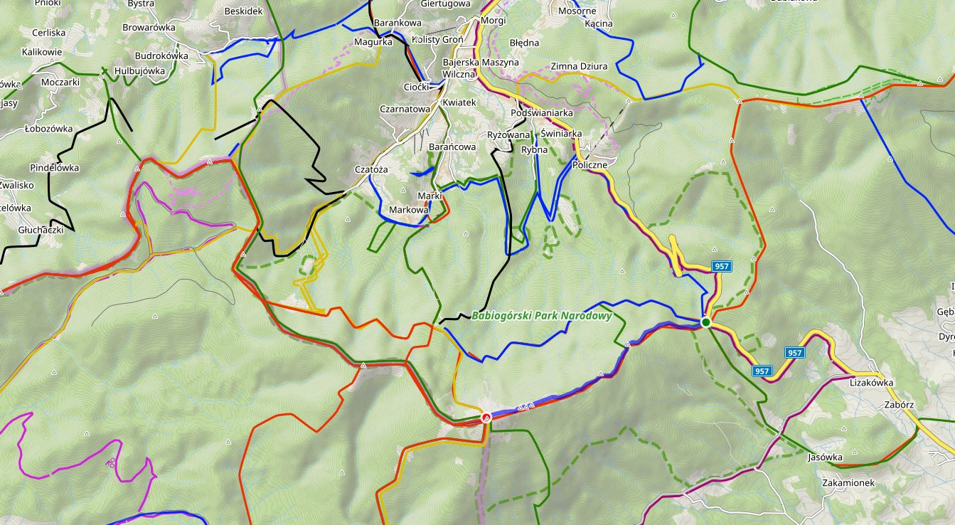
Yes, in the theme menu. With OAM Maps and the Elevate theme, you can hide even more.
Yes, in the theme menu. With OAM Maps and the Elevate theme, you can hide even more.
Elevate Theme
Elevate Theme
I meant the browser version on my PC. Planning a more complex route on a smartphone is extremely difficult.
But of course, it's better to turn everything off on a smartphone too.
Thanks for your help.
I meant the browser version on my PC. Planning a more complex route on a smartphone is extremely difficult.
But of course, it's better to turn everything off on a smartphone too.
Thanks for your help.
Hi Marek,
on the Locus Map web, it is not possible to turn marked hiking and biking routes from the map yet (will be added in the future).
In the app, you can turn them off even when you use the internal map theme of LoMaps:
Hi Marek,
on the Locus Map web, it is not possible to turn marked hiking and biking routes from the map yet (will be added in the future).
In the app, you can turn them off even when you use the internal map theme of LoMaps:
Thank you.
Unfortunately, I don't have the “Hike & Bike Map Themes” feature in my version at all.
I uninstalled Locus and installed the latest version today, searched for 90 minutes in all 10,000 possible menu items, but couldn't find anything related to Themes :(
After the first menu item, “Czech Republic Base Map,” I immediately have “Map shading,” “Map overlays,” etc. I don't have the “Hike & Bike Map Themes” item.
It's normally included with the LoMap offline. Download it from the store and then select the map.
It's normally included with the LoMap offline. Download it from the store and then select the map.
OK. Now I understand. Thank you.
I always have the map downloaded, but I only turn it on when I don't have internet access. :)
You know, I use LM in a rather unusual way. I don't ride a bike and rarely walk along trails. :)
I tend to explore large forest complexes. I visit such large areas many times, taking different forest paths. When planning my next trip, it is good to see on the map the paths I have not yet taken. Seeing all these colorful trails, it is difficult for me to recognize where I have not yet been. For example, as on the attached map.
And it's best to make such plans in front of a large monitor. I hope this feature will soon be available in the PC version of LM.
Competitive LM maps do not show these colorful trails, but they lack an important feature that LM has. I am referring to map planning with the “draw manually” option. I like this feature! :)
Best, m.
Replies have been locked on this page!