
Elevation change calculation: locusmap-brouter vs mapout
Answered
I use LocusMap Classic (full licence) with Brouter and my partner uses mapout for Apple. I also have a non paid version for LocusMaps 4.
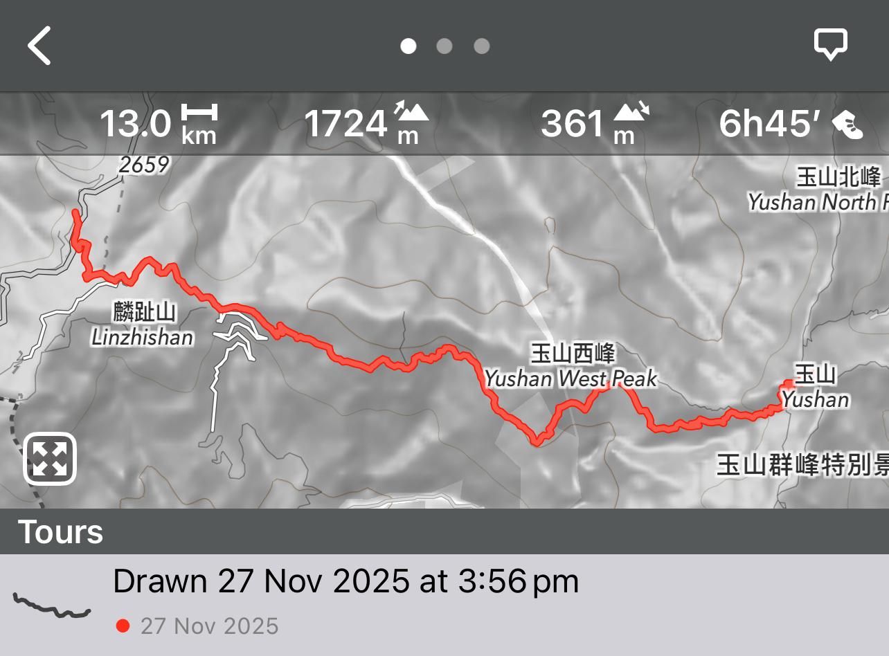
We calculated a route from Dongpu Lodge to Yushan peak in Taiwan and found a substantial difference in elevation gain between the two apps: LocusMaps calculates 2300 m up and 1000 m down; Mapout Calculates 1700 m up and 400 down.
(Figures rounded)
That's a substantial difference, more than the 10% estimated by other online blogs.
Which would be more accurate? How could such large differences in calculation come to be?
 The same question
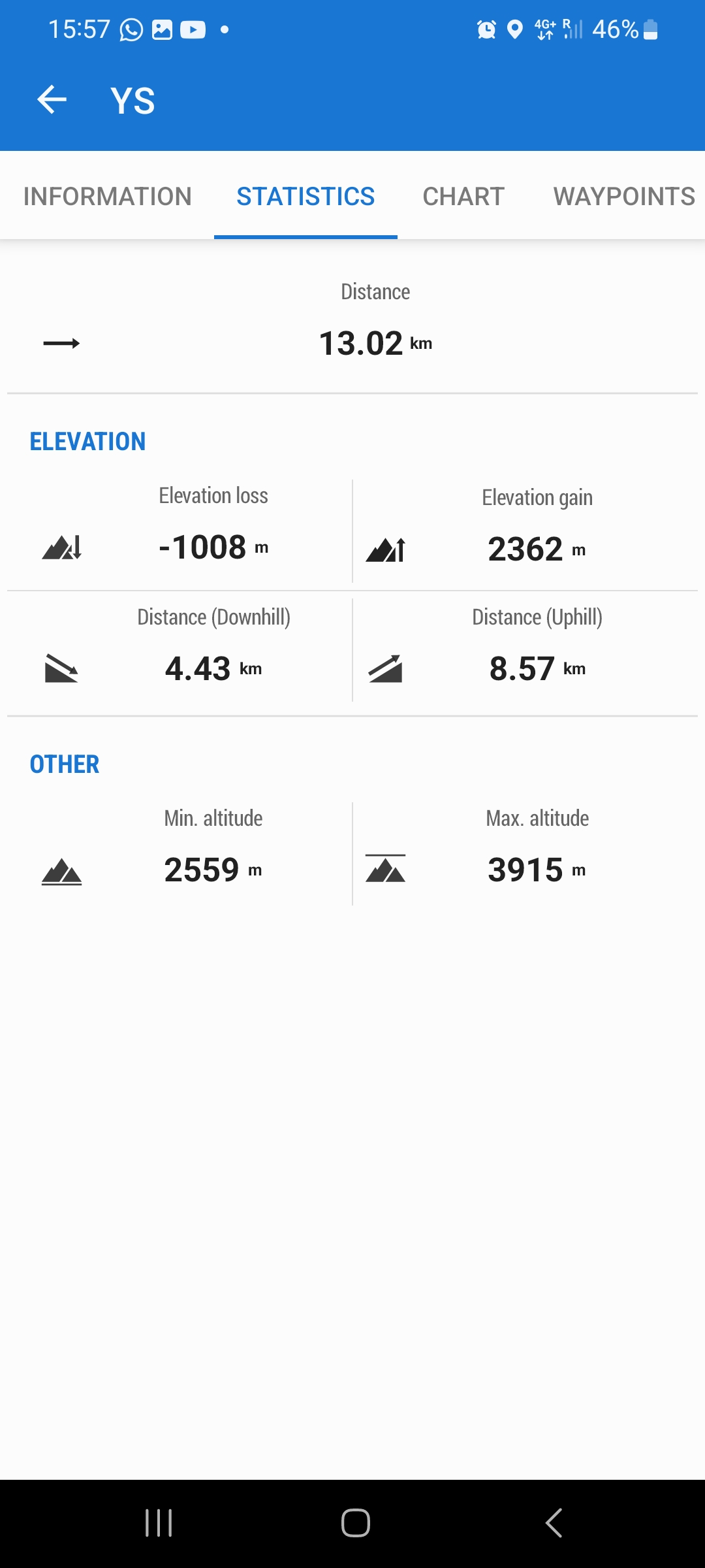
Hi Aleks,
every app, router or service has its own algorithm and routing data for calculating elevation gain. Which values are correct in this case, I don't know. It can be compared to the values measured when recording a track along this route. And even in that case, there are many factors influencing the result - weather, terrain, GNSS unit accuracy, altitude threshold etc. In Locus Map 4, there is an option to set a custom altitude threshold, eliminating bigger deviations.
Replies have been locked on this page!