
This object is in archive!
PO visibility in track chart and exported track.
Answered
Hi,
Is it possible to include POI in small icons in the track chart (altitude and distance profile)?
Also, can the POI with the track be exported to a cloud database like gpsies.com?
 The same question
Good day Rogemar,
if point is stored directly in a track (for example during track recording or as imported) it should already be visible in a track chart. You have a track with points and you do not see them in chart?
And export - nope it is not possible as GPSies supports only a track, not it's waypoints.
I added waypoints while live recording. But the POI icons are not visible in the track chart. Is that how to directly store the point to a track? For example in the images below: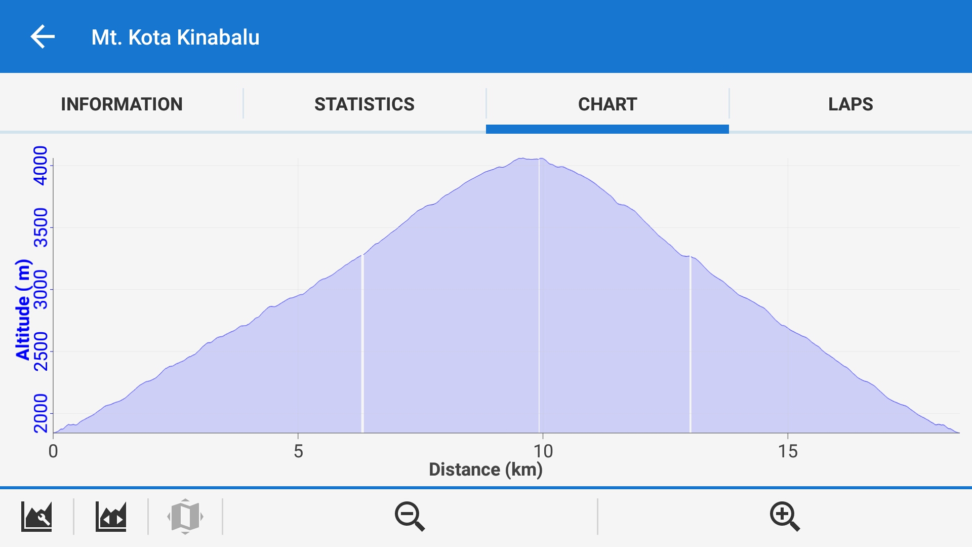
Thank you for the immediate response.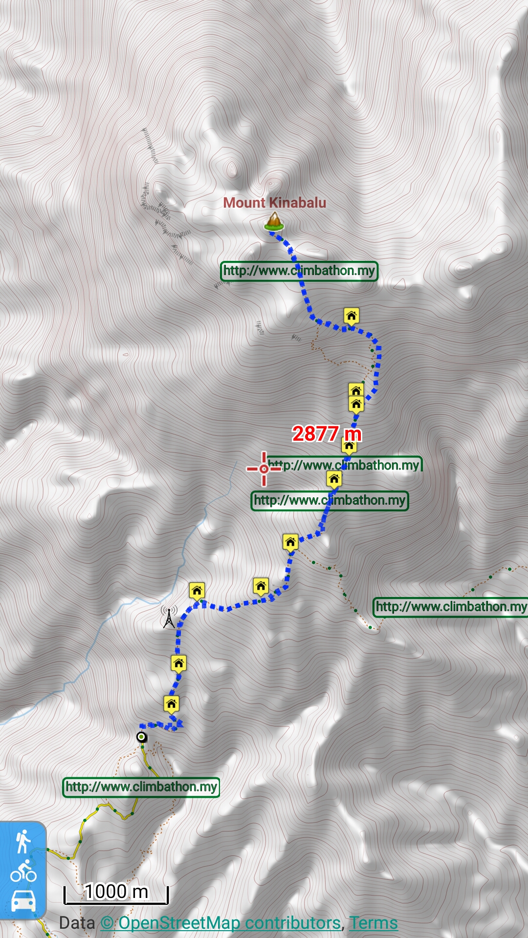
I added waypoints while live recording. But the POI icons are not visible in the track chart. Is that how to directly store the point to a track? For example in the images below:
Thank you for the immediate response.
Hello, you probably add points manually and store them in separate folder with other points right? I'm rather talking about this option: http://docs.locusmap.eu/doku.php?id=manual:user_guide:tracks:recording:panel#options ( third blue icon at bottom of this panel ), which attach new point directly to track.
There are request for some alternative methods, like add points manually later etc, but it's not yet implemented. Hope this helps.
Replies have been locked on this page!