
This object is in archive!
Incorrect slope gradient shading colors
Closed
the shading Colors do not correspond to the slope:
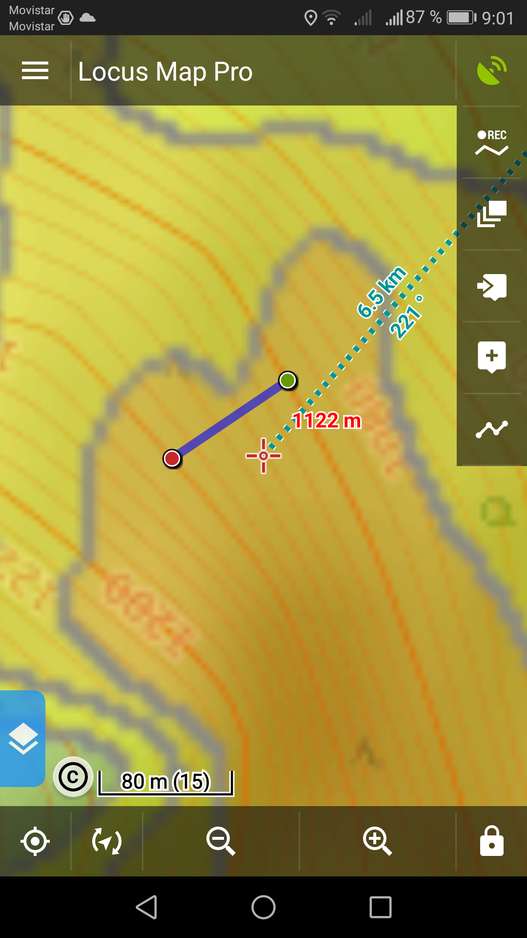
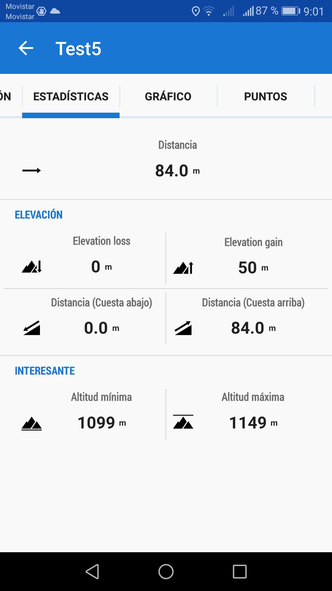
to show this a created a track: altitude difference of 50m and distance 84m this corresponds to slope angel 30,8°
the Color is red which corresponds to >40°
 The same problem
Hi Stefan,
algorithm of calculation of slope shading in Locus is set in order to reflect just overall view of the slope angles in the area - it is because of saving general app (phone) performance. More detailed shading calculation would consume too much battery and time. Shading in Outdooractive maps is created as another layer of the map and needs no calculation, therefore it's more accurate and detailed (and paid).
hi Michael,
ok, i understand.
But if accuracy of slope shading is less than 5° it is misleading that the documentation states steps of 5°, e.g. 30° -35°.
For activities in winter with snow/avalaches it is important if the inclination is mor or less than 30°.
The description in the app should reflect the accuracy and state e.g. inclination low/medium/high instead of values to correspond the accuracy of the calculation.
Hi Stefan,
the way of describing the slope angles in >30°, >35°, >40 corresponds with a general use and doesn't have to reflect real terrain on a distance of 84 meters - Locus Map is not a professional angle measurement tool and the slope coloring brigs just generalised information rendered from digital 3D terrain model data. Moreover, the calculation is optimized for decent ratio of accuracy and app/phone performance.
hi Michael,
These 84 meters are just a example to show the mismatch. if in this part has the Color red which means more than 40° and the Elevation data which are used by locus map Show 31°, in my opinion this is an error.
It makes no sense to use a fast calculation which produces wrong results.
If the Color red does not correspond to >40° the description should be adapted.
For me, this feature was the main argument to buy the pro Version :(
Hi Stefan,
we made a more thorough analysis of the depicted data and it seems you are right - there's probably a bug. However, it's not so easy to solve so it may take a few days or weeks until it is done. Thanks for reporting.
Hi Stefan,
we made a more thorough analysis of the depicted data and it seems you are right - there's probably a bug. However, it's not so easy to solve so it may take a few days or weeks until it is done. Thanks for reporting.
Replies have been locked on this page!