
Point export is buggy
Hello Locus team,
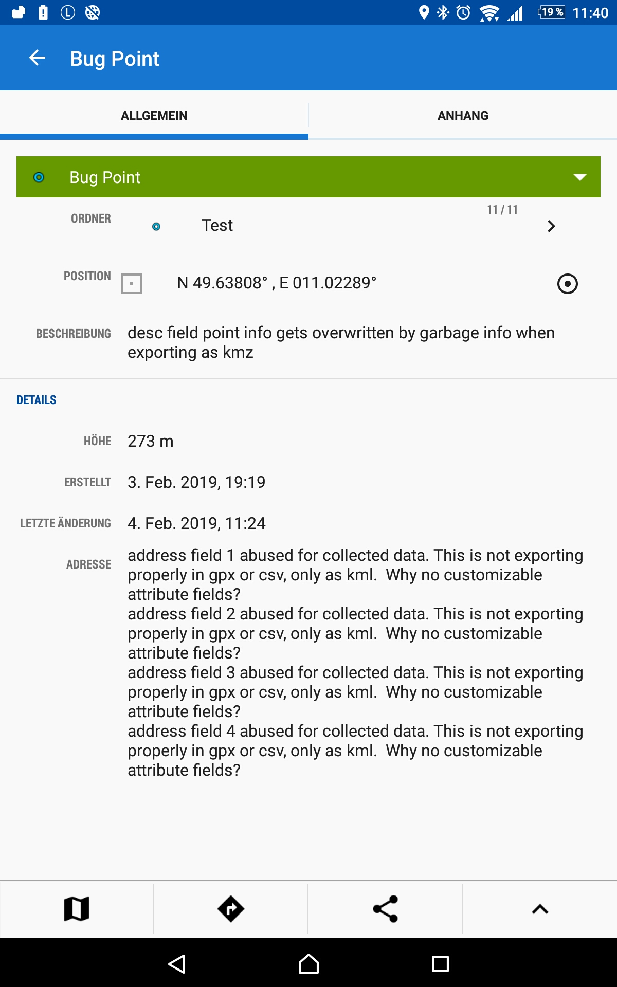
I (and quite a few other people I know) use Locus to collect data in the field, point data. It is very unfortunate that we can not have customizable attribute fields to go with points. I 'abuse' the adress fields for collected data that goes with my points.
Two things:
1) Bug: the adress fields do not export in gpx or csv format. Only export as kml will retain the collected information in the adress fields. Sometimes even that does not seem to work properly, but mostly it does.
2) Bug: The 'desc' field gets overwritten with other info when exporting as kmz.
3) it would be crazy good to improve Locus to become a more efficient outdoor data collection tool. Customizable fields with drop-down selections, numbers, free text, mandatory fields, default entries, automatically generated entries (date, temp, gps status, compass direction, whatever), foto or audio fields, etc. Is there any chance we can get any improvements in this direction in the future? I would support development (crowdfunding).
 The same problem
Hi,
Locus Map is developed primarily for leisure time activities likie hiking, geocaching or mountain biking. Not for collecting GIS data. For professional purposes we develop Locus GIS. You can test it, I think it will be more conveient for you. See https://play.google.com/store/apps/details?id=menion.android.locus.gis
Thanks for a quick reply. I tried almost every (gis) app for outdoor data collection. They are all missing a few features that Locus has, and which are extremely useful for me: vector maps, compass bearing line, distance and angle.
Locus Gis, in particular, is very inefficient in the field, because adding points simply requires too many clicks, too complicated. Best are mapit and mappt, but these lack critical features mentioned above.
It would be great if at least the export functions couldbe fixed.
Thanks, Michael
Hi,
thanks for the feedback. Nevertheless, I think Locus GIS should be the tool you need - describe in detail all your objections at discuss.locusgis.com or start a new thread there.
As for the export bugs, I'll discuss it with the main developer.
Hi,
thanks for the feedback. Nevertheless, I think Locus GIS should be the tool you need - describe in detail all your objections at discuss.locusgis.com or start a new thread there.
As for the export bugs, I'll discuss it with the main developer.
Update:
1) export of addresses is supported in GPX 1.1 format, not in GPX 1.0 (can be changed in the export settings)
2) description is exported as HTML if you check "Incl. description&attachments". Anyhow, we'll think about this if it is right solution.
Update:
1) export of addresses is supported in GPX 1.1 format, not in GPX 1.0 (can be changed in the export settings)
2) description is exported as HTML if you check "Incl. description&attachments". Anyhow, we'll think about this if it is right solution.
1) That export as gpx 1.1 mangles the 4 address fields into a single field called "gpxx_WaypointExtension". Within this field the 4 address fields are encoded with html code. Yes, it is there, but it is basically useless. Because dividing this info back into 4 separate fields is impossible with any GIS application that I know of. Really, the easiest would be to include the 4 address fields in the export as separate fields (just as with the .kml). I'd be happy with .csv if the .gpx standard does not allow this.
2) Same with the overwriting of the description field when exporting as .kmz. I know that the original text information of the description field is still present somewhere in the exported .kmz file. But it is basically inaccessible and mangled up in cryptic html together with a lot of other stuff. Just put the html in a separate field and leave the description field as it was?
Thanks! Michael
Good day Hans,
I'll enter the discussion as the app developer.
1) Export as is now made, is perfectly valid by GPXX extension: https://www8.garmin.com/xmlschemas/GpxExtensionsv3.xsd . There is no other globally used method how to insert the address into GPX files.
2) Major usage of exported fields of our users was in Google Earth. Here exported KMZ files looks well with this generated description. As Michal wrote, try to uncheck "Incl. description&attachments", it may helps.
Please keep in mind, Locus Map is made for hike & bike, not primarily for data collecting. Both these points are not bugs. It's just app works and fact that it does not fit your needs does not mean, it also does not fit to needs of other users.
Point no 3. is completely out of Locus Map usage. Give a try to Locus GIS, post idea on Locus GIS help desk if you are interested in its usage, or simply use different application that may work as you wants.
Thanks for understanding.
Hi Menion,
Thanks for your feedback here. Locus has an incredible amount of functionality for displaying various maps and offers some options that no other android app offers (and that includes everything from the 30Euro / month mappt to the free Locus GIS and SWmaps - I tried them all). That is why I will continue to use Locus and still prefer it over other apps, you did an incredible job here.
It's just that In light of the incredible functionality it somehow seems a glaring omission (in my one-sided view) that we can not define custom fields for points and not even export the few fields that are offered in a simple .csv. However, from your and Michals answer I get the impression that you don't see any lack of functionality and that there is no chance of future development in this regard at all. Which is too bad... But I thank you for your time and the wonderful app anyway!
Michael
Replies have been locked on this page!