
This object is in archive!
Measuring your fingers - the difference in altitude
Completed
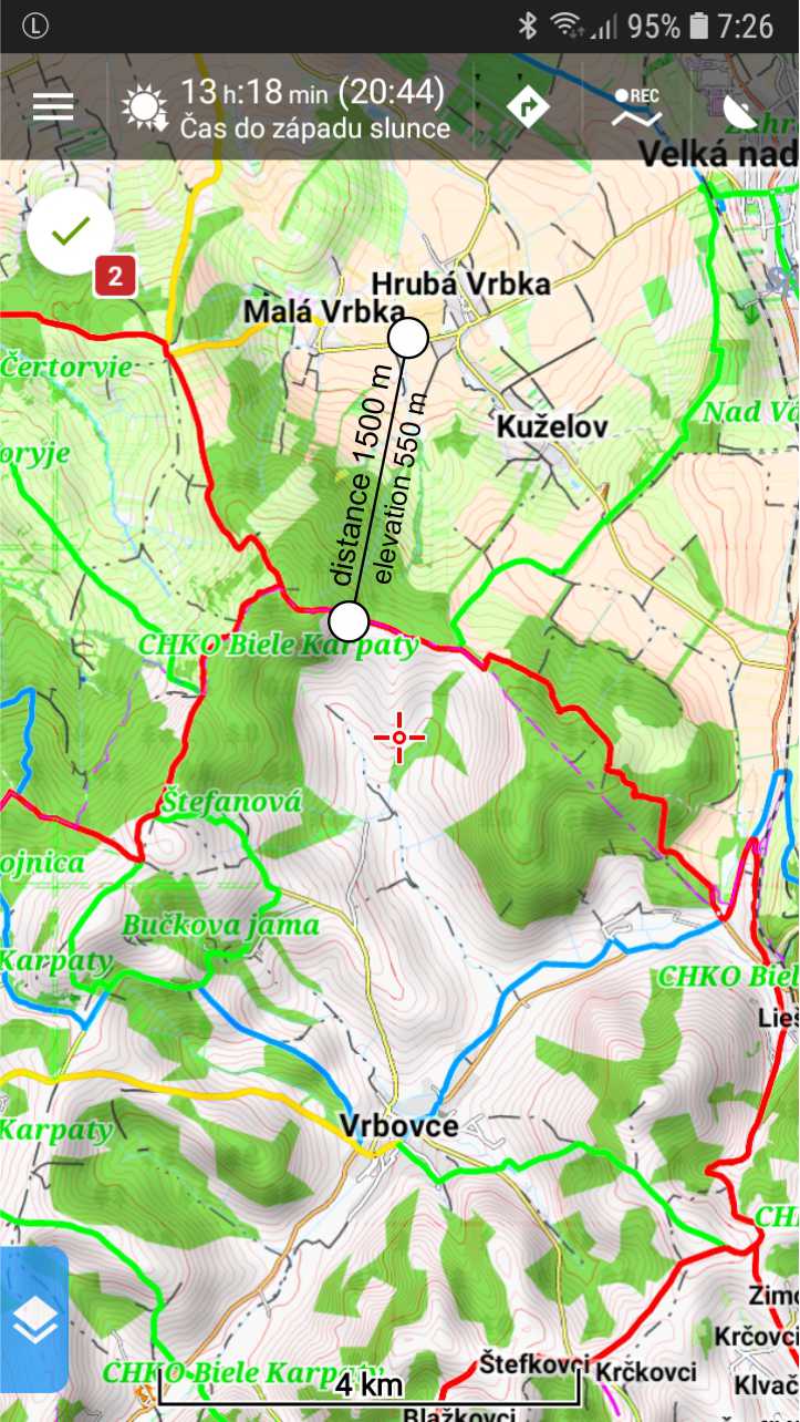
When planning a route, it would be a good idea to have an altitude difference for distance measurements. See picture.
Files:
Bez názv...
 I like this idea
Hello Josef,
do you know feature "Two finger measurement"? What about extending this to display not just distance (as now), but also elevation?
EDIT:
Ah, it is already possible with "map_items_selection_line_value_above" and "map_items_selection_line_value_below" values over config.cfg file.
Hello Josef,
do you know feature "Two finger measurement"? What about extending this to display not just distance (as now), but also elevation?
EDIT:
Ah, it is already possible with "map_items_selection_line_value_above" and "map_items_selection_line_value_below" values over config.cfg file.
I set both items to 1, but I see the distance above and below the line and not the altitude difference. See scr.
I set both items to 1, but I see the distance above and below the line and not the altitude difference. See scr.
Hi Josef
change value in line below to 4, save change of config and restart locus
Wolfgang
PS: description of needed values are at top of config
Hi Josef
change value in line below to 4, save change of config and restart locus
Wolfgang
PS: description of needed values are at top of config
Excellent, thank you
Excellent, thank you
But for 4 , only elevation of selected point is shown below line..
It would make sense to put another number in config. Number 7 ,which would be the difference in altitude (differential elevation) between gps location and the point select line
But for 4 , only elevation of selected point is shown below line..
It would make sense to put another number in config. Number 7 ,which would be the difference in altitude (differential elevation) between gps location and the point select line
I've just moved settings from config.cfg to internal "expert settings" directly in the application, so it will be easier to change this.
A new result on the screen. Believe it will be more useful now.
@Marius Moldovan
I think no such value is needed. For this you may use Settings > Maps > Auxiliary graphics > Cursor to position line option.
Replies have been locked on this page!