
HDPI (512px) Map is too magnified with 'Optimize raster map resolution' option
Old Locus versions had the problem that different map rendering size each Display resolution setting even the setting was same
but this problem solved after adding 'Optimize raster map resolution' option on Locus 3.38
It makes the map rendering size is always same
So, Display resolution setting does not effect the map size of locus anymore
However, I think It need to be fixed or added an option for 512px tile maps
Because It only perfect for 256px map still uncomfortable for 512px tiles map
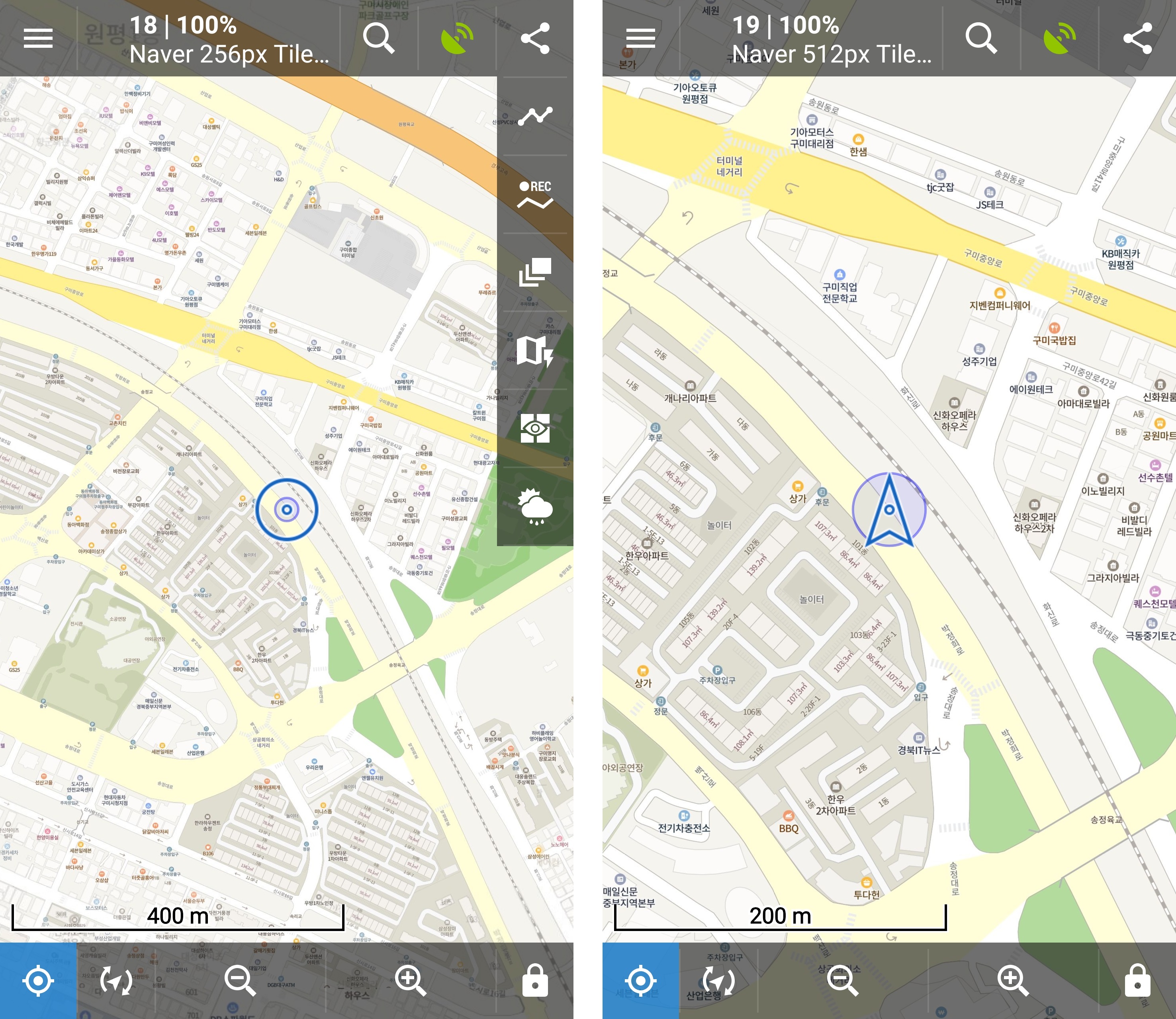
Look at the below photos
The first photo is same zoom level of 256px and 512px map without any option
as you know, It is too small to read both maps so, need to use magnify option
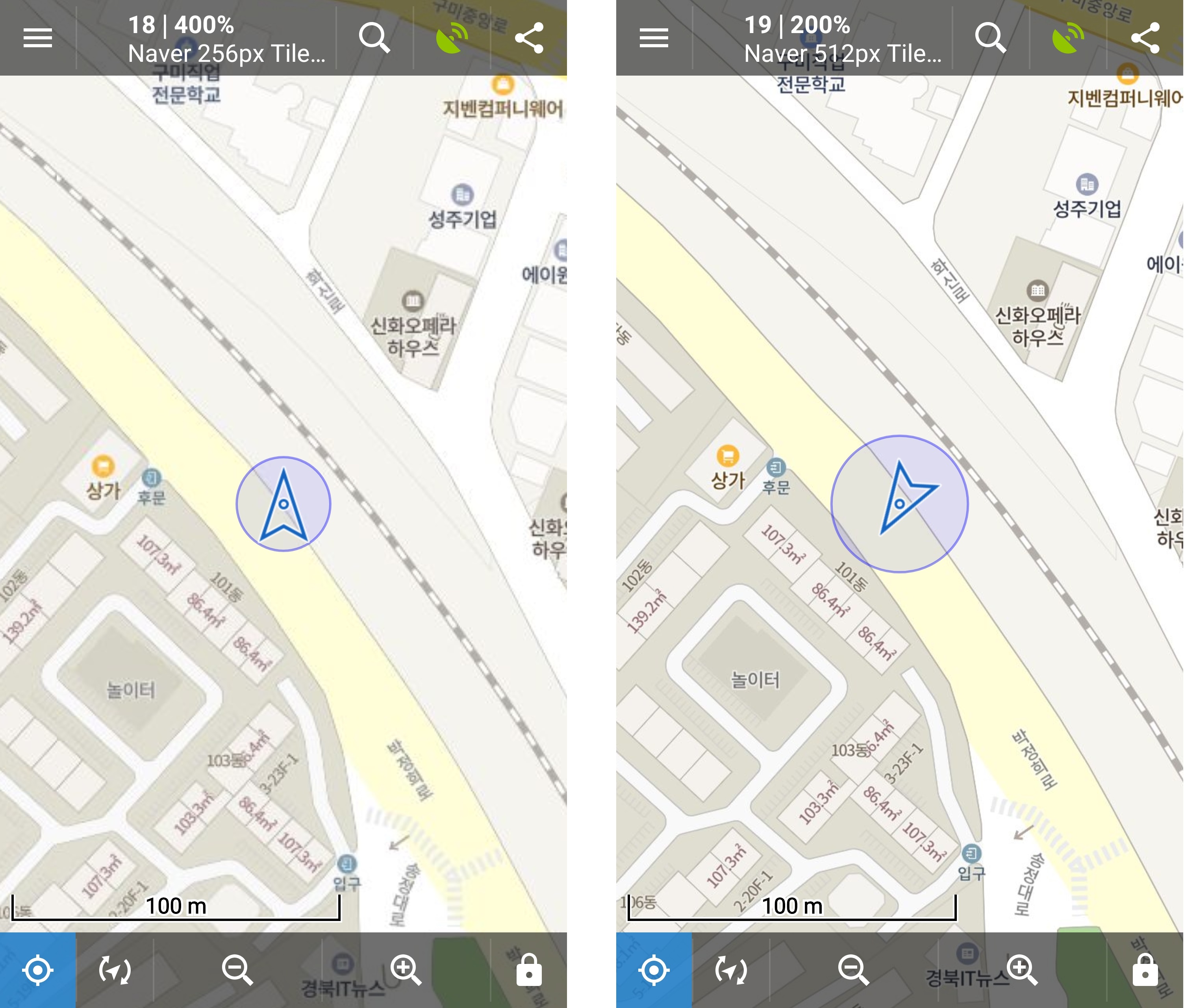
The second photo is same zoom level of 256px and 512px map with 'Magnify all maps' option to set propper rendering size
It is the best setting to see the maps
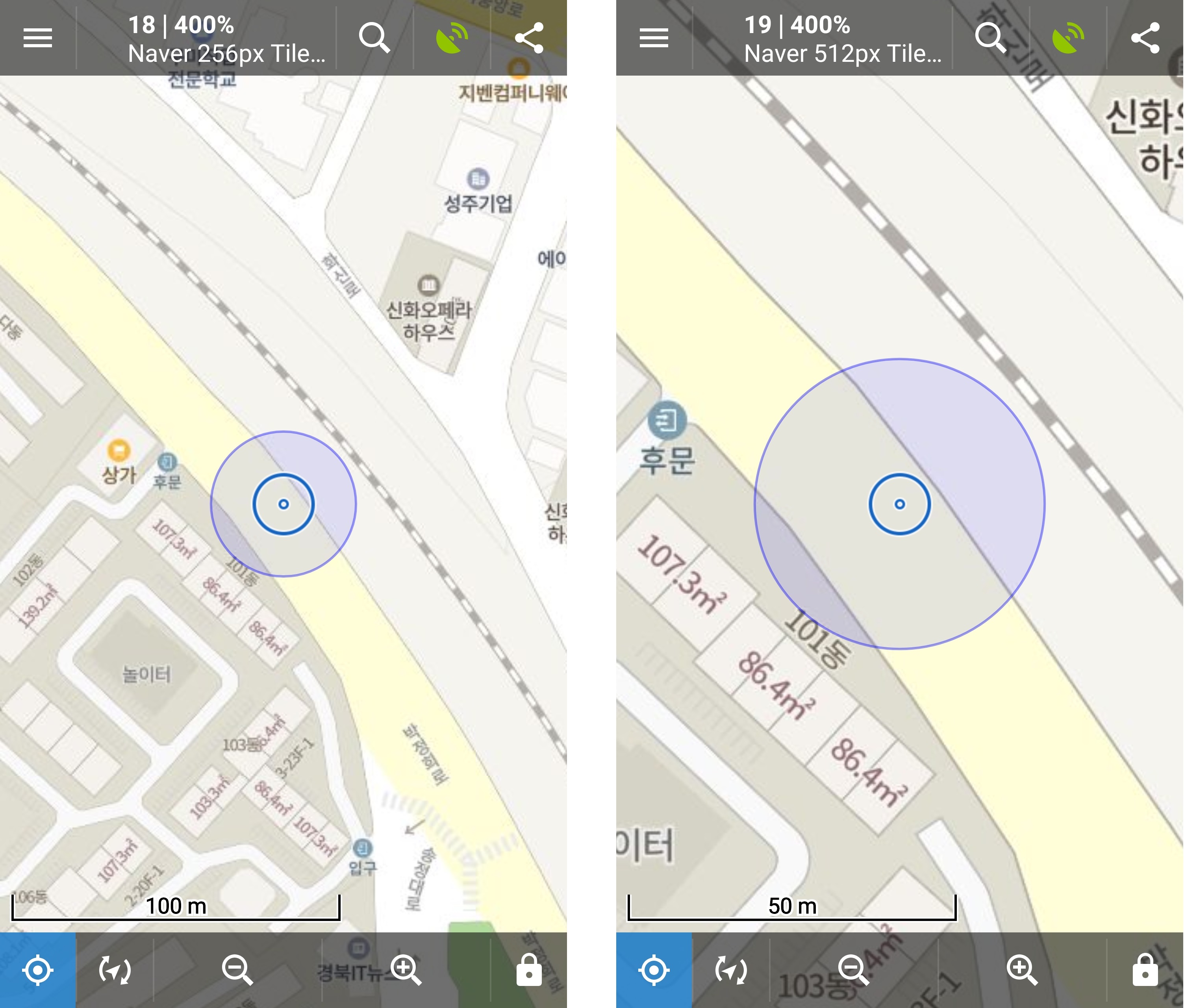
The third photo is same zoom level of 256px and 512px maps with 'Optimize raster map resolution' option
As you can see, 256px maps is perfectly, comfortably works but 512px map is too magnified to see
It need to reduce about half of its magnify but there is not any demagnify option
Because of my bad English, I am not sure I perfectly explain what I want to explain
But I hope you understand it.
Have a nice day!
 The same problem
Hello JaeGwang,
I can't help myself, but I still believe that all is correct in Locus Map. Your 1024px base map just took map tiles from zoom X, requested 4x bigger map tile then usuall and put it into zoom X+2. Locus Map then computes tile coordinates correctly because of this shift, but the map is logically 4x bigger in the same zoom.
Please check my post here. It may give a better explanation of what is going on in Locus Map and how to handle bigger map tiles correctly.
Menion
Good day JaeGwang,
unfortunately, I do not exactly understand what is the problem.
On all your photos, you compare different zoom levels, this is correct? You also mix "Optimize raster map resolution" and "Magnify all maps".
"Optimize raster map resolution" is settings enabled by default for all users, that should improve the readability of all raster maps to an acceptable value. Using "Magnify all maps" is optional settings usually useful for people who have some problems with eyes or just wants to have everything bigger.
So generally, keep "Optimize" enabled and "Magnify" disabled and all should be ok.
Menion
Replies have been locked on this page!