
This object is in archive!
Check altitude graph when navigating
Answered
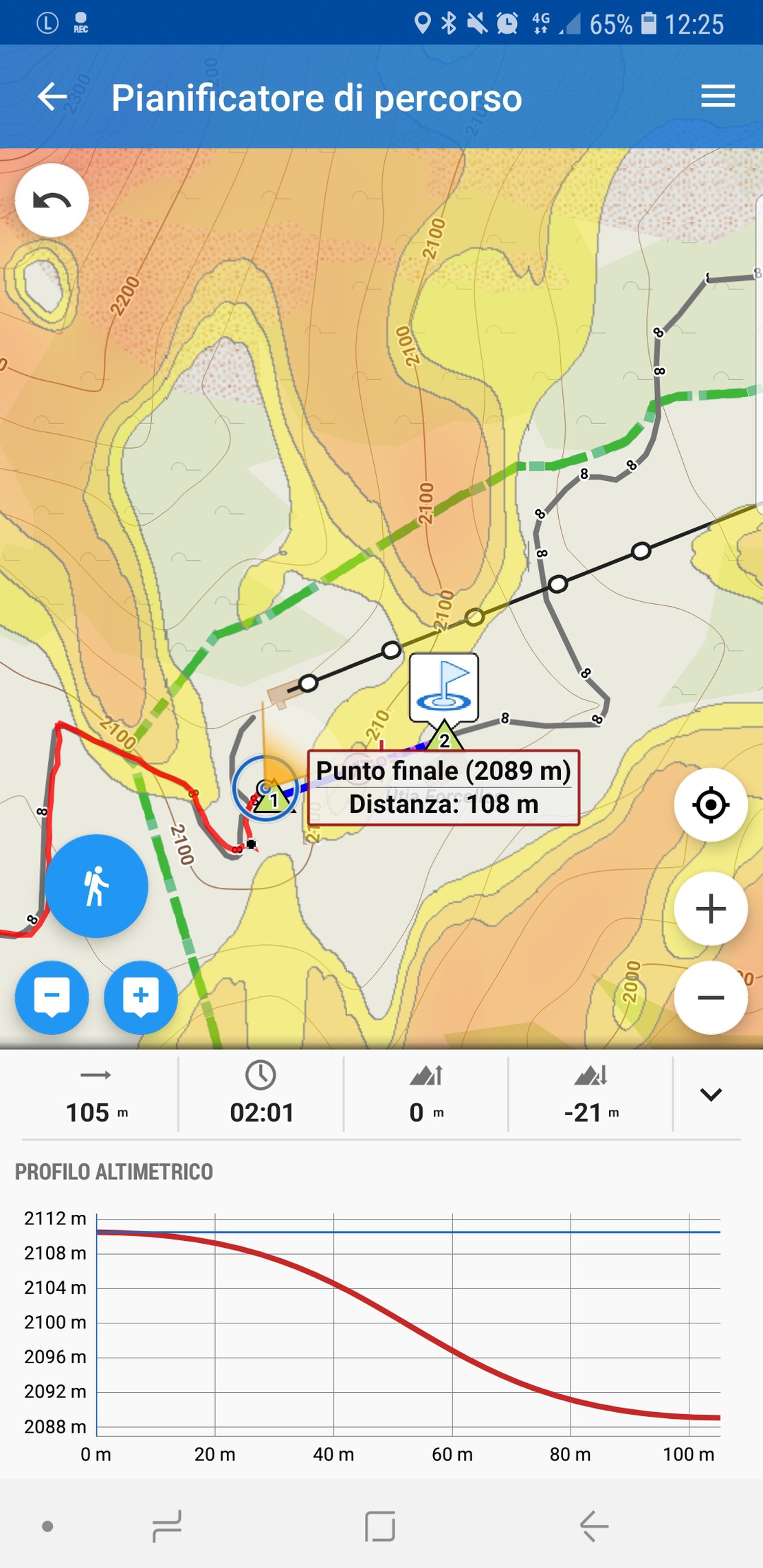
I've set this as a question, but if not implemented it can be an idea. The altitude graph that appears when creating a route with the planner is great; I mean the graph on the bottom of the screen below:
But when navigating, i.e. after navigation has started, how can I access that graph? I would like to know where I am and what kind of altitude profile I will encounter while hiking. A point "you're here" on the graph would be great for example.
Is something already possible? Because I wasn't able to find how.
 The same question
It's possible, you need to create custom dashboard:
https://docs.locusmap.eu/doku.php?id=manual:user_guide:tools:dashboards
For the item in cell you choose navigation chart and put altitude on axis.
It's possible, you need to create custom dashboard:
https://docs.locusmap.eu/doku.php?id=manual:user_guide:tools:dashboards
For the item in cell you choose navigation chart and put altitude on axis.
It's possible, you need to create custom dashboard:
https://docs.locusmap.eu/doku.php?id=manual:user_guide:tools:dashboards
For the item in cell you choose navigation chart and put altitude on axis.
It's possible, you need to create custom dashboard:
https://docs.locusmap.eu/doku.php?id=manual:user_guide:tools:dashboards
For the item in cell you choose navigation chart and put altitude on axis.
Replies have been locked on this page!