
Colored elevation overlay, improvements
Gathering feedback
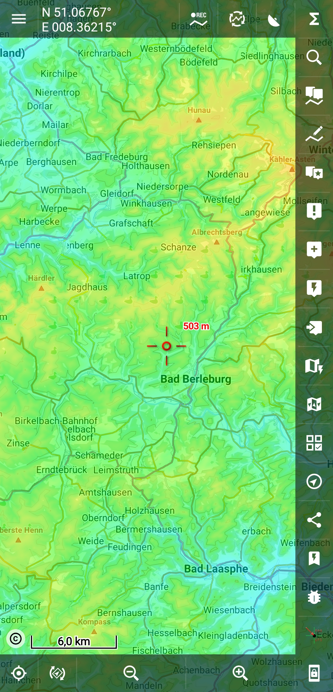
The colored elevation overlay does also overlay all darker areas and text, can you use a more sophisticated algorithm? Let darker areas peek through? Black text stay black?
Also: you could let the user define low/high areas. Eg, low=100m,high=500 and coloring will be accordingly. System just like in track coloring.
Files:
Screenshot_2019...
 I like this idea
Hello Tapio,
can't imagine how to include coloring between background map and texts in case of raster maps. Also in the case of MapsForge maps, it may be a problem, but most probably solvable.
About the colors of this coloring: check this, it may help.
Menion
Hello Tapio,
can't imagine how to include coloring between background map and texts in case of raster maps. Also in the case of MapsForge maps, it may be a problem, but most probably solvable.
About the colors of this coloring: check this, it may help.
Menion
Great, thx. I wasn't thinking about putting it "in between", but you could just overlay it on top, but use a different algorithm to combine the overlay with the underlying parts. Like in "lighten", "darken", "multiply", that kind if stuff.
Great, thx. I wasn't thinking about putting it "in between", but you could just overlay it on top, but use a different algorithm to combine the overlay with the underlying parts. Like in "lighten", "darken", "multiply", that kind if stuff.
These modes have one big dis-advantage = they downgrade performance ... a lot. Also, with the latest version(s), it seems not to work correctly in all cases. Generally, I would rather avoid them as much as possible.
The solution here really should be, intercept rendering system for vector maps and insert these shadings in the middle, between background and overlay (text, points) ... probably not so easy, but believe that doable.
On my Mate 20 X only light stuttering, but I recognise the performance impact.
The massive pro's of such overlays are, as you can see in the screenshot, you can see elevation much better than just with hill shading.
But you can also see, it looks a bit... foggy 😁
On my Mate 20 X only light stuttering, but I recognise the performance impact.
The massive pro's of such overlays are, as you can see in the screenshot, you can see elevation much better than just with hill shading.
But you can also see, it looks a bit... foggy 😁
I was just playing with it now and I'm unable to find PorterDuff mode that will improve readability as we want.
So I really see as the best solution improve shading by including it into the middle of rendering cycle for vector maps. This should be really nice ...
I was just playing with it now and I'm unable to find PorterDuff mode that will improve readability as we want.
So I really see as the best solution improve shading by including it into the middle of rendering cycle for vector maps. This should be really nice ...
In the context of this topic it would also be good if hill shading on/off was added to the preset system.
In the context of this topic it would also be good if hill shading on/off was added to the preset system.
Replies have been locked on this page!