
This object is in archive!
Strange bug in Locus? ..or in OSM? Explanation appreciated
Answered
Hi,
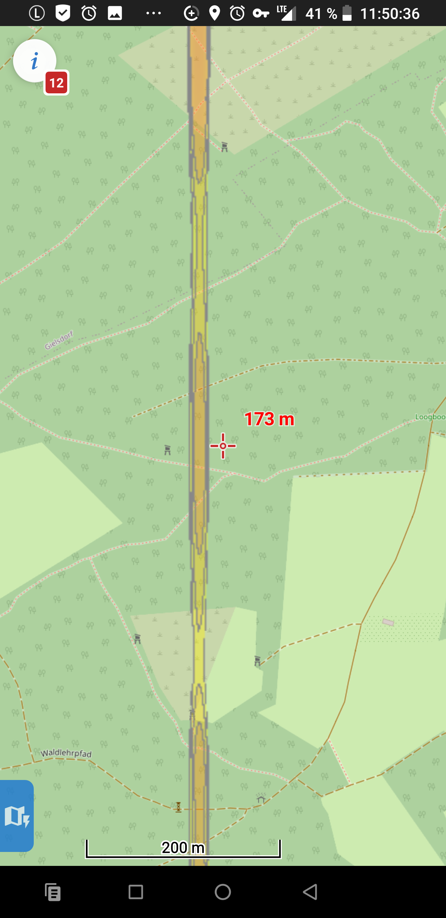
there's a strange object (like a transparent major road) that's perfectly straight, running North/South for several kilometres, but which is visible only after zooming in and vanishes again when zooming out.
Searching for "Um die Sang" and "Heppertsweg" (both in Alfter, Germany) puts two markers onto the (OSM classic) map on either side of the region where "it" appears when zooming in.
I can't find any explanation either in Vespucci or in OSM's iD.
What IS it?
Kind Regards,
Jochen
 The same question
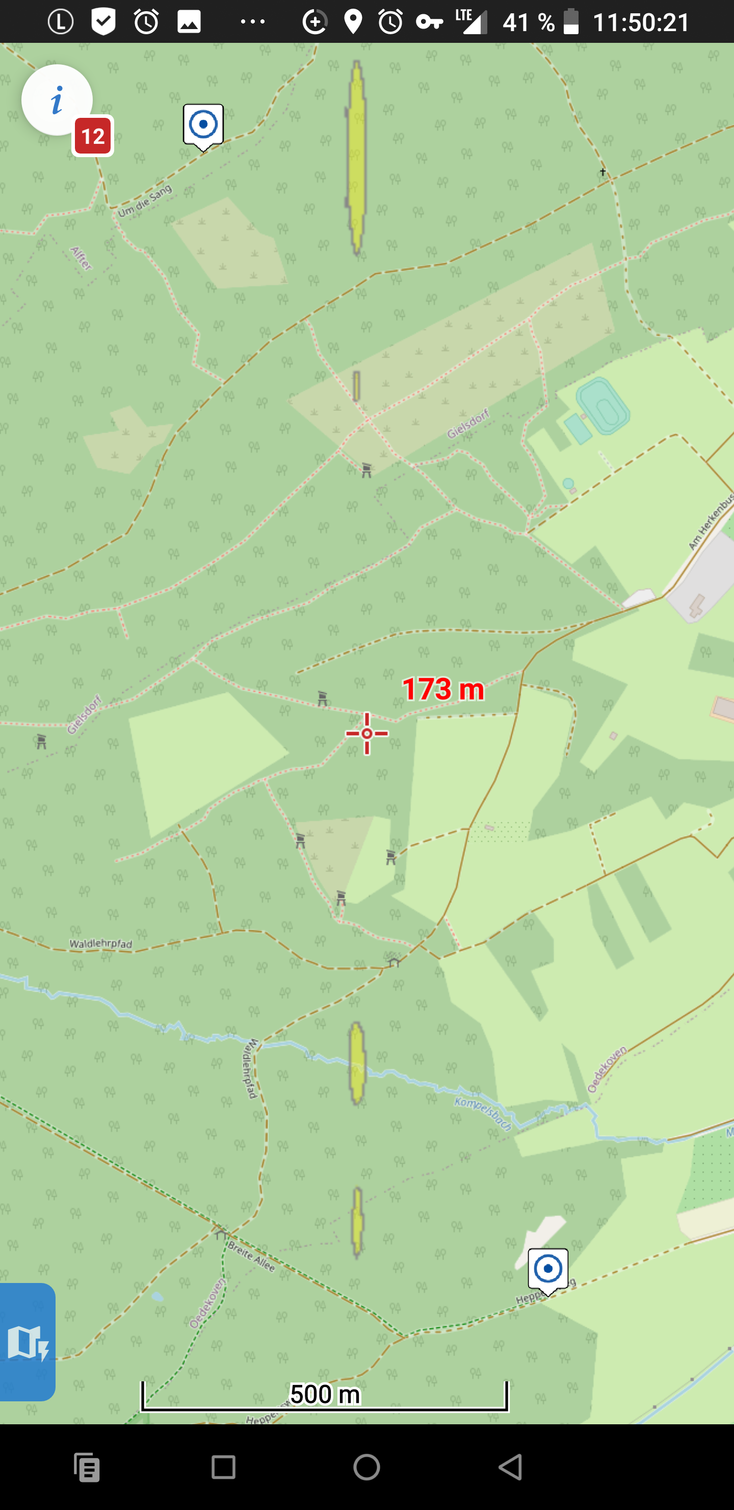
Dear Jochen,
the colors you see are created by 'Map shading' - specifically by colored slopes. Please see https://docs.locusmap.eu/doku.php?id=manual:user_guide:maps_settings#map_shading
Anyway, it seems that there is some inaccuracy on the edge of the altitude data used for shading. We'll check it
Thanks, Petr
Hi, Petr,
thanks for your quick response.
The „transparent road” has indeed vanished.
Unfortunately, however, all is not well: in my favourite hiking region (the Siegerland/Sauerland area), the shading now looks EXTREMELY odd (see attached screenshots).
Kind Regards,
Jochen
P.S. just for information's sake: there were 235 of the files in question on my device.
19 of them had the size "0".
Is this expected behaviour, or was there a minor glitch when I downloaded them? J.
Dear Jochen,
do you want to use the hill shading or rendering of the slope areas? Please check settings Menu > Settings > Maps > Advanced features > Map shading > select 'Hill shading' https://docs.locusmap.eu/doku.php?id=manual:user_guide:maps_settings#map_shading
Regarding the 0 size file - it's expected behavior. Empty files are used only for areas with no elevation data (eq. sea)
Petr
Ooops - sorry about that!
I occasionally fiddle with the settings; I must have changed that one unintentionally and not noticed because my home region at the souteastern end of "Cologne Bight" is too flat to show this effect.
Ooops - sorry about that!
I occasionally fiddle with the settings; I must have changed that one unintentionally and not noticed because my home region at the souteastern end of "Cologne Bight" is too flat to show this effect.
Dear Jochen,
no problem :) I'm glad that's 'solved'.
BR Petr
Dear Jochen,
no problem :) I'm glad that's 'solved'.
BR Petr
Replies have been locked on this page!