
PKWDWPL points not merged after update
Hi Menion,
I have been playing with the PKWDWPL feature in the last few days, as I a want to use two SoftRF dongles to track our hot air and gas balloons from the chase vehicles. On the receiving end I implemented the Kenwood protocol with $PKWDWPL because it also includes the altitude.
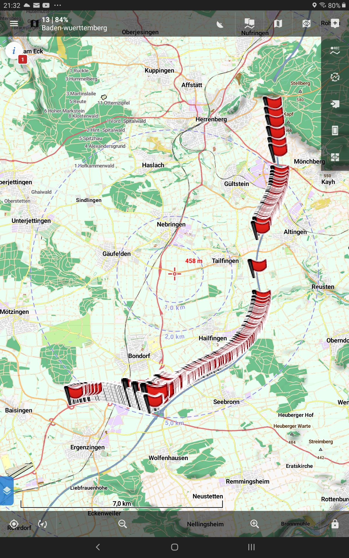
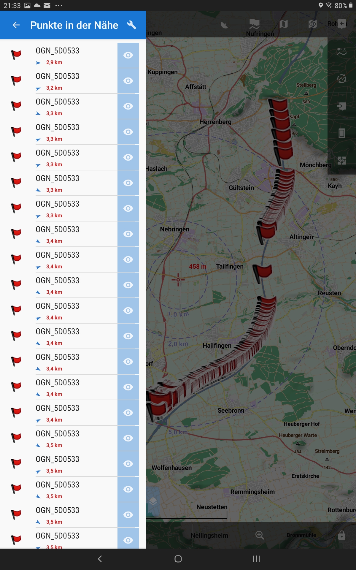
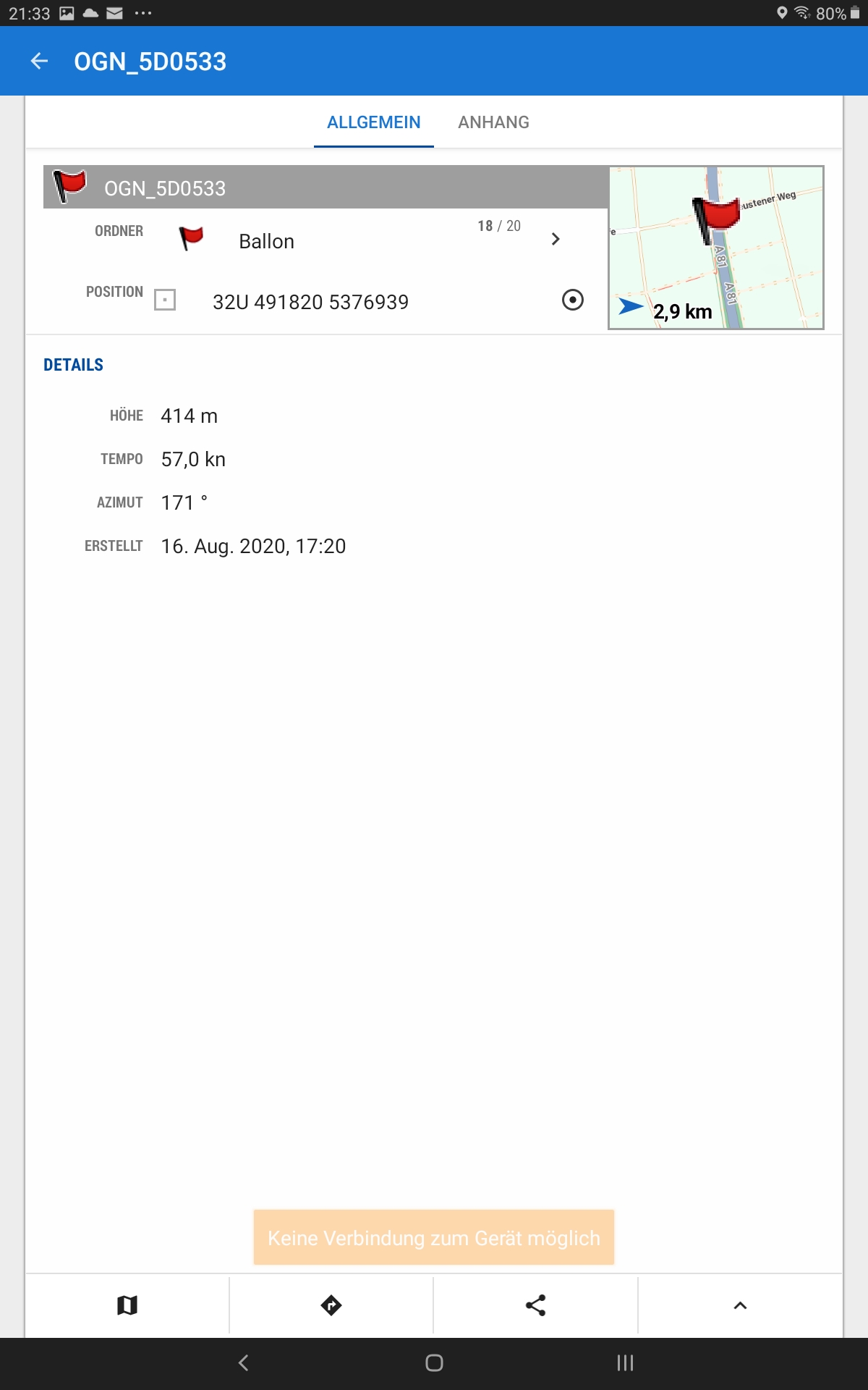
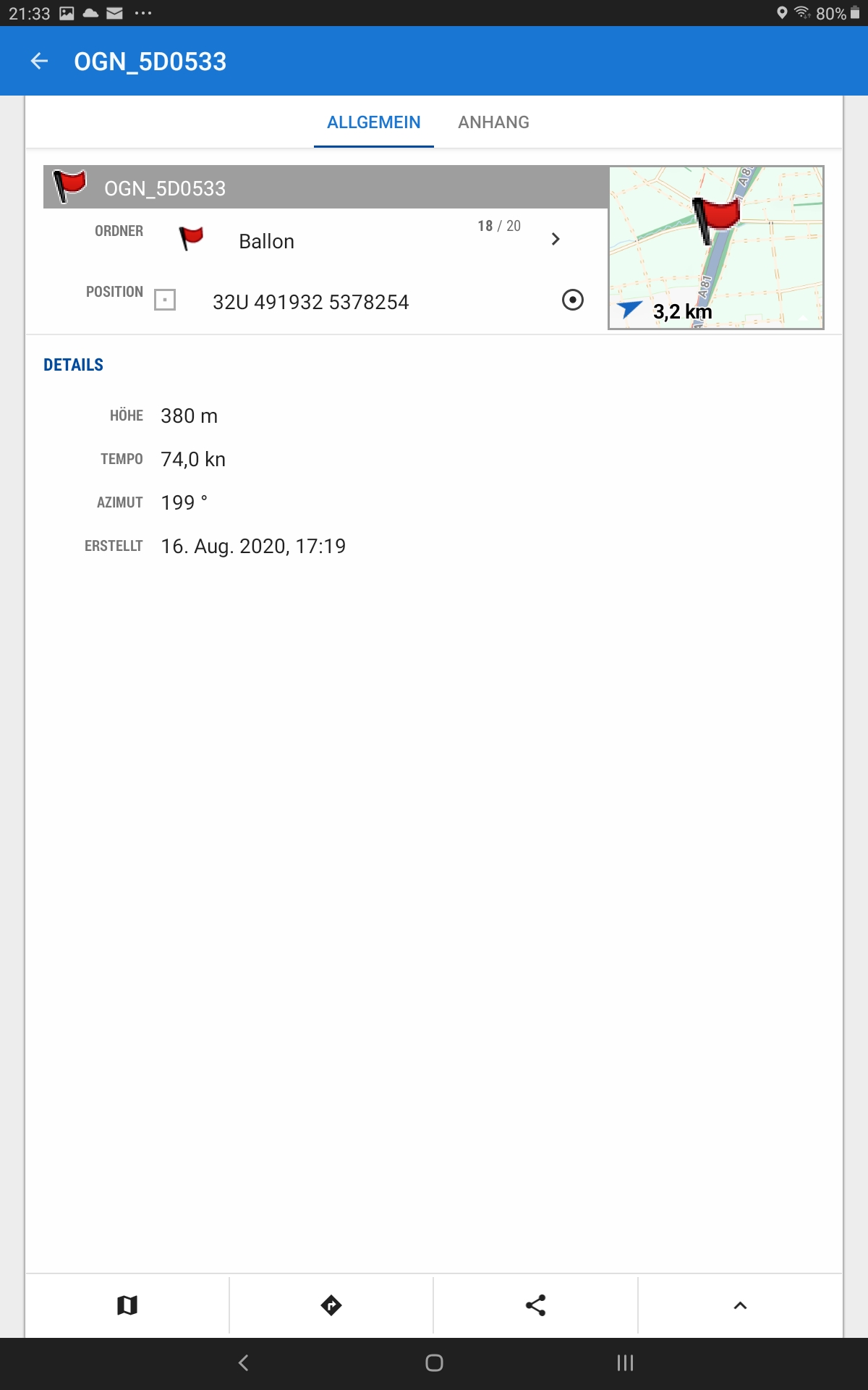
Today I made my first test drive (with the car), and it looks like point 2 from the list above does not work correctly. I got hundreds of points created with the same name. I assume that they were recognized as different points because the altitude/speed/course values were different.
It would be great, if you could check out if there are additional criteria to match the waypoint to overwrite it. While I do like the trace of the previous points, I am worried that the performance may suffer, if it's going to be a few thousand points.
I have attached a few screenshots to illustrate what I mean.
If needed I can switch to the $GPWPL protocol to only transmit positions and see if that will update the existing waypoint.
Thanks a lot for a faboulous software!
Christian
 The same problem
Hello Christian,
I've moved your post to a separate topic to prevent discussion in already completed task.
As I see in the code, points should really be correctly merged, so duplicates, as you see, should not happen. All received points has generated unique ID based on its name (column 5) and if the point with the same ID exists, should be overwritten.
May be possible to get a short recorded NMEA file for test & simulation?
Hi Menion,
is it possible to record (and play back) NMEA data for the NMEA reader function (vie Bluetooth) as well? I will then record data later today from within LocusMap. Otherwise I will record a track by connecting a Bluetooth Terminal to my receiver.
Thanks,
Christian
PS: My original post was referring to https://help.locusmap.eu/topic/enhanced-gps-nmea-reader-functions
Hi Menion,
I recorded the NMEA file while walking around the block. Before that I cleared all map items. After the short round I had 8 waypoints displayed, as you can see from the nearest waypoint list.
I played around with the PKWDWPL reports and it seems that there are 8 different longitude values, maybe there is a correlation.
Two remarks: my PKWDWPL statements do not contain valid date and time because my receiver doesn't have a real time clock and the coordinate packages sent don't contain that information. But since there are many more waypoint messages than waypoints, I don't believe that those incorrect date/time values are relevant.
Let me know if there is anything else I can do to help narrow down the problem.
Thanks,
Christian
Hello Christian,
thanks, NMEA message helped. Issue should be fixed in next Locus Map version 3.48.
Menion
Hello Christian,
thanks, NMEA message helped. Issue should be fixed in next Locus Map version 3.48.
Menion
Hi Menion,
wow, thanks for the quick turn-around. I'll give it a try after the next update.
Christian
Hi Menion,
wow, thanks for the quick turn-around. I'll give it a try after the next update.
Christian
Hi Menion, I verified the correct function today. Thanks for the support!
Hi Menion, I verified the correct function today. Thanks for the support!
Replies have been locked on this page!