
This object is in archive!
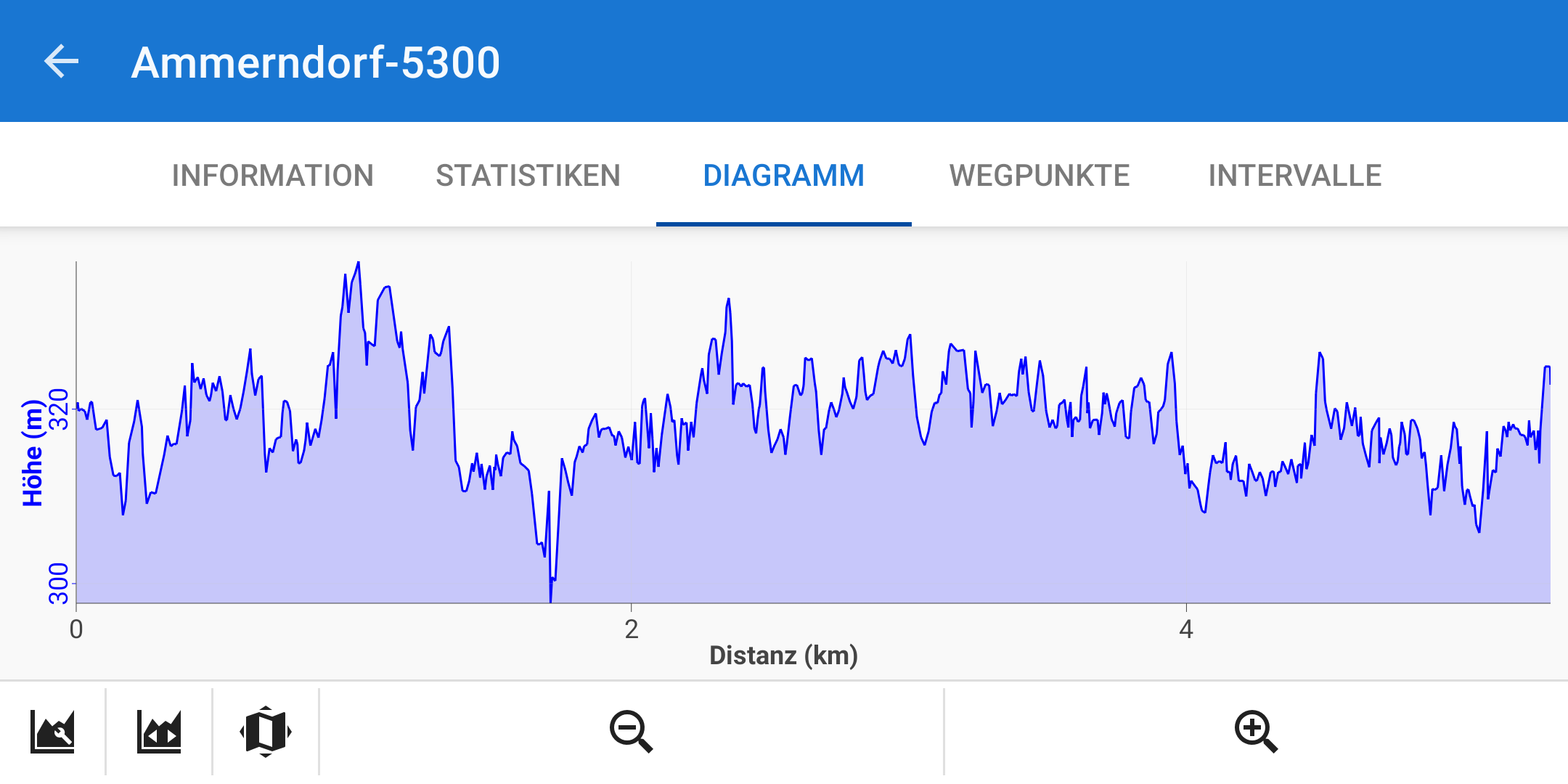
Diagram shows big jumps, although the path is flat
Answered
Hello,
when recording a track, although there are only very moderate ups and downs in the path, a very large number of altitude changes are displayed. Is there a way at Locus to level this recording? Or are these simply inaccurate results of the GPS signal? The attached trail is almost level, only slight even gradients, but according to the recording the altitude jumps up to 15 meters.
Many greetings
Günter
 The same question
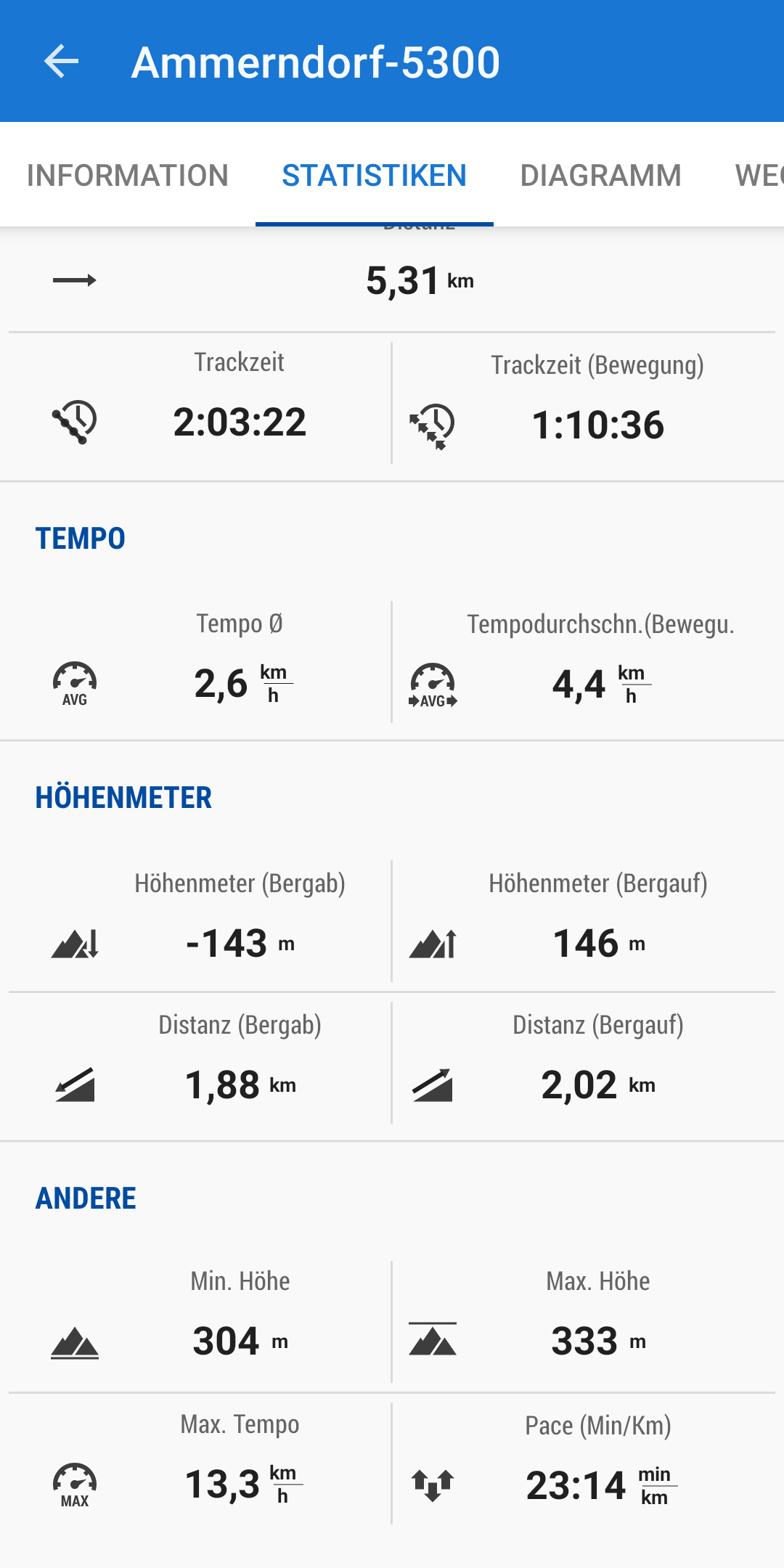
Hello Günter,
Locus Map processes elevation gain from the data it receives from your phone GPS. If the data are incorrect or contain huge deviations, then the resulting elevation gain is also incorrect. Locus Map, however, offers a few methods on how to limit these deviations. Open Locus settings > GPS&sensors:
- Location filter > select medium or heavier filter
- Google Services assisted location > turn it ON
- Altitude manager > settings tab > SRTM data - select "Optimize GPS values" or "Replace GPS values"
- Altitude manager > settings tab > Pressure sensor > turn ON (if available)
- Altitude manager > settings tab > Altitude filter - select medium or heavier filter.
You can also check the link on this blog for GPS troubleshooting
I hope this procedure helps you and your issue is resolved
Have a nice weekend
Andrea
HelloAndrea,
i have tried some of your tips, the result is much better now.
Thanks a lot
Günter
HelloAndrea,
i have tried some of your tips, the result is much better now.
Thanks a lot
Günter
Hello Günter,
I'm glad the information helped you.
Have a nice day
Hello Günter,
I'm glad the information helped you.
Have a nice day
Replies have been locked on this page!