
CalTopo smokes all in map data
devs please look at the new caltopo android. The maps are amazing and it makes it really hard to continue to use your product when you can't see remote roads and trails they can.
MVUM layers???....can you pull this in like they do at least
NPS Visitor?
USFS Visitor?
BLM public lands?
This stuff is stunning and I guess some of it comes from geo referenced pdfs which apparently are verboten??? you are slipping away as the others gain...even gaia (not a fan) will have the pdfs soon. Functionality you still win by far but my ability to see way more details might make me switch...and I'v spent years trying to learn you program and it works well for me so I do not want to switch. I will pay for better layers...any chance in V4 you will tackle this?
 The same question
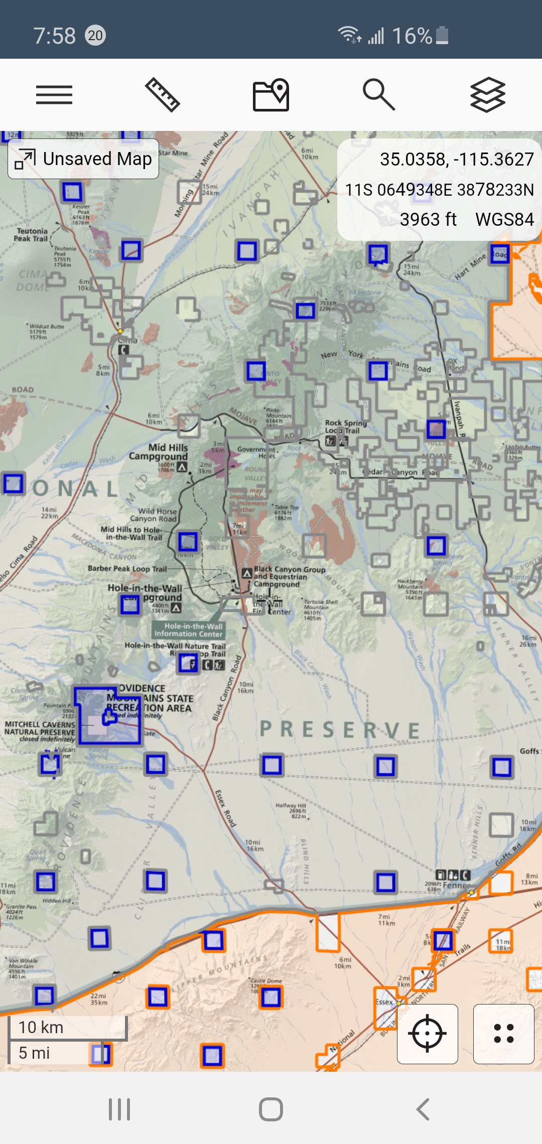
Hi,
thank you for the post. GeoPDF isn't really supported and I promise any date when (If even ) will be implemented.
Maybe that we can't see the issue from our European perspective. So could I kindly ask you for help, please? There are about 4 different maps in Locus that can be used in US: USGS Map, Neotreks maps, USGS By JohnThorn (contains USFS data), LoMaps (based on OSM)
Please download/purchase any following map and compare it with any mentioned Calltopo layer. Please describe and highlight what elements are missing and especially explain why are important. I'll definitely refund LoCoins and outcomes for the mentioned maps. I suppose it's presumptuous of me, but we needed to find out how inaccurate are our maps were, what's missing and why it's important for users in US.
Thank you for your help
Best regards
Petr
See these comparisons of maps within locus and compared to caltrops.
I now understand why John Thorne maps cost so much…they seem to be the best…at least in Utah.
After doing these comparisons I will say it appears more about what you see at a wider zoom level which makes caltopo easier but the actual map data between the products is very close.
If there was a way to pull the mvum layer that caltopo uses can in to locus would be great.
See this video: https://youtu.be/nSQnUnpKoMQ
***I downloaded neotreks Bryce Canyon and John Thorne Utah for this test…please remove them and refund the locoins. Thanks
Replies have been locked on this page!