
This object is in archive!
Incorrectly recorded altitude
Answered
J'ai un pb avec les graphiques d'altitude , plein de petits pics apparaissent, ça fausse complètement les stat' de dénivelé
Files:
Screenshot_2021...
 The same question
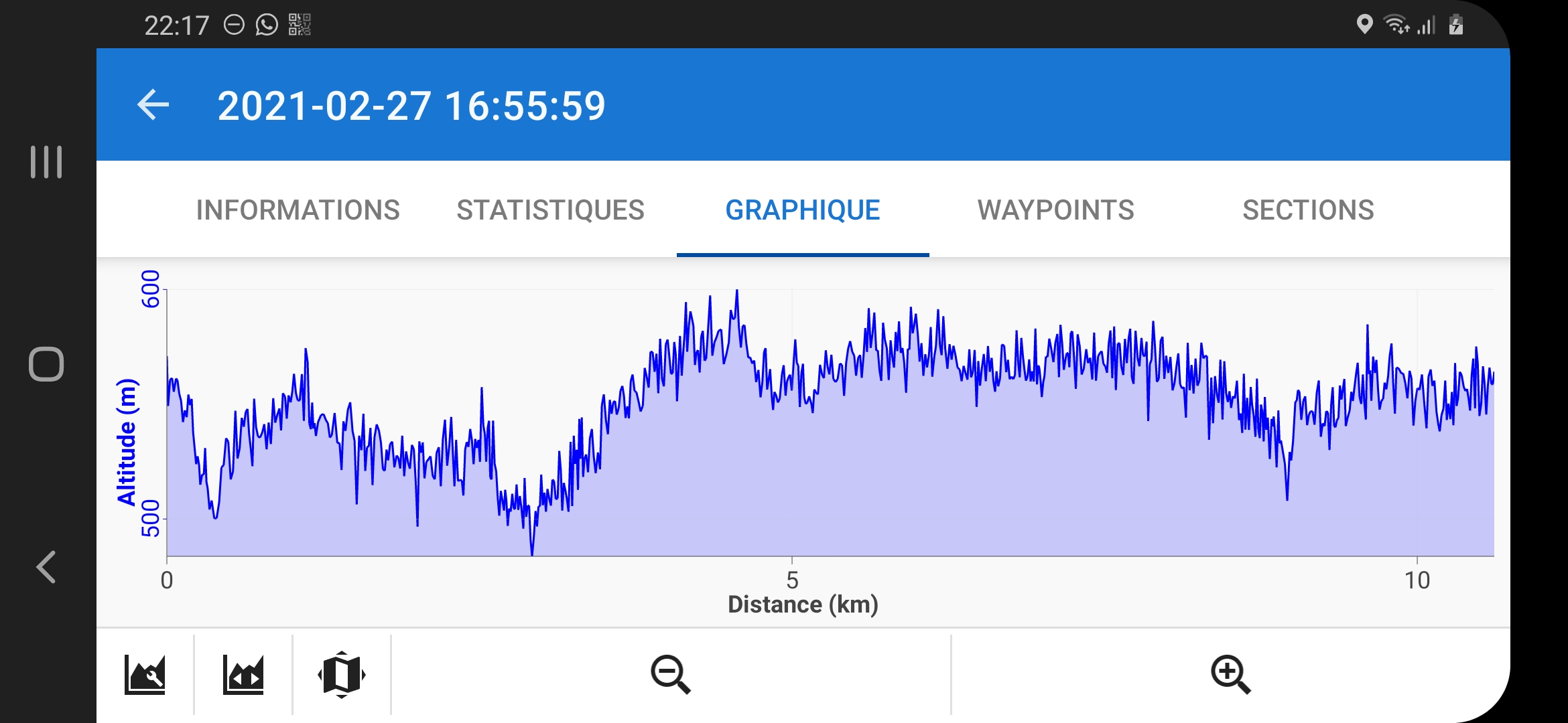
Hello,
Locus Map processes the altitude gain from the data it receives from your phone's GPS. If the data is incorrect or contains large deviations, the resulting altitude gain is also incorrect. However, Locus Map offers several methods to reduce these variations. Open Locus settings> GPS and sensors:
- Position filter> select medium or heavier filter
- Location supported by Google> turn it on
- Altitude Manager> Settings tab> SRTM Data - select "Optimize GPS Values" or "Replace GPS Values"
- Altitude Manager> Settings tab> Pressure Sensor> On (if available)
- Altitude Manager> Settings tab> Altitude Filter - select a medium or heavier filter bad altitude gain
Have a nice day
Andrea
Pressure Sensor> On - may cause elevation "spikes" in my experience: when the GPS first starts, or has been re-enabled after disable during track recording pause to save battery power, the first few elevation measurements can be wildly in error, 10's or 100's metres wrong. If possible do not enable track recording for a few minute to allow the GPS to stabilize. Why this is related to the "independent" pressure sensor, I don't know, but certainly with my 2017 Samsung A520 phone, this is my workaround.
Pressure Sensor> On - may cause elevation "spikes" in my experience: when the GPS first starts, or has been re-enabled after disable during track recording pause to save battery power, the first few elevation measurements can be wildly in error, 10's or 100's metres wrong. If possible do not enable track recording for a few minute to allow the GPS to stabilize. Why this is related to the "independent" pressure sensor, I don't know, but certainly with my 2017 Samsung A520 phone, this is my workaround.
Replies have been locked on this page!