
This object is in archive!
Can the dashboard display an altitude graph of 30-50 km or more when using navigation?
Answered
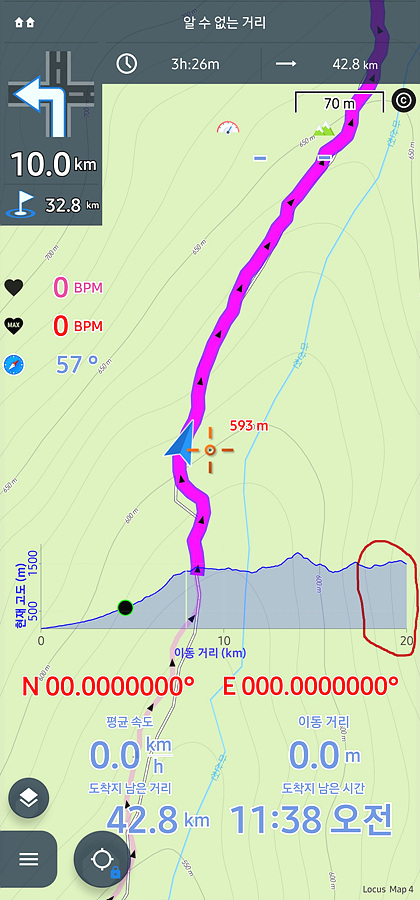
When I'm on a long hike, I get the help of an altitude graph in the Locus Map dashboard.
In general, distances less than 20km can be displayed on the Locus Map dashboard, which is convenient, but if you hike more than 20km or take a bike tour, the graphics are cut off.
Could this be improved?
If the altitude graph on the Locus Map dashboard shows 30 to 50 km well, it would be convenient to proceed while previewing the height of the route to be taken when using the navigation system for long-distance tracking, hiking, and cycling tours.
 The same question
Hello Dong,
technically this is doable, it is just one parameter. Previously, the distance was even shorter than this. The main reason for the shorter distance visible on the chart is performance and battery usage. Rendering of the chart is not for free and with the longer distance, it may be a significant. The chart in the dashboard should really serve only as an overview for upcoming hills. For overview across the whole route, please use the chart in the track detail.
Hope my explanation is clear.
Jiří M. aka Menion
How about let the Route line colercode the altitude or the slope? This helps me to visualize the upcomming route.
How about let the Route line colercode the altitude or the slope? This helps me to visualize the upcomming route.
Replies have been locked on this page!