This object is in archive!
Incorrect elevation data in planner
Answered
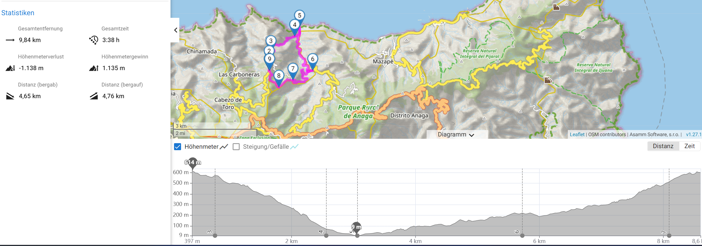
I tried to plan a route but for some reason the elevation data doesn't make sense at all
Please check
https://link.locusmap.app/r/qmghyt


 The same question
Hi Zdenek, first we walked this tour already and know that this is never an ascend of 1000m! If you compare the lowest and highest point, there is at max elevation of 600m maybe add another 100m if you go up and down sometimes. This is clearly shown in the graph. But on the left side you'll find the ascend and descend which is shown with 1138m ascend and 1135m ascend. This is incorrect.
Hi Zdenek, first we walked this tour already and know that this is never an ascend of 1000m! If you compare the lowest and highest point, there is at max elevation of 600m maybe add another 100m if you go up and down sometimes. This is clearly shown in the graph. But on the left side you'll find the ascend and descend which is shown with 1138m ascend and 1135m ascend. This is incorrect.
Hi Markus,
this is a typical example of GPS inaccuracy, which is in particular painful when it comes to elevation.
You may play a bit with the altitude filter in Locus settings to reduce the fuzziness of the altitude.
Cheers
Michael
Hi Markus,
this is a typical example of GPS inaccuracy, which is in particular painful when it comes to elevation.
You may play a bit with the altitude filter in Locus settings to reduce the fuzziness of the altitude.
Cheers
Michael
Replies have been locked on this page!