
This object is in archive!
Altitudes incorrect
Answered
Around this area (N 52° 54.336', E 014° 10.890') the offline altitudes are incorrect. Please check the parameters.
Around this area (N 52° 54.336', E 014° 10.890') the offline altitudes are incorrect. Please check the parameters.
 The same question
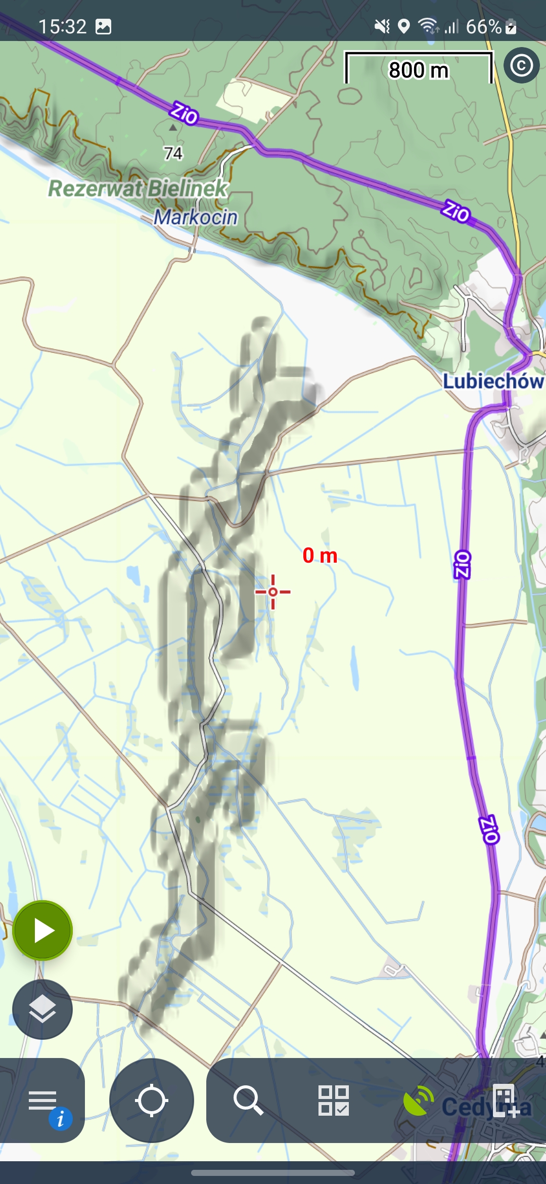
This is an anomaly coming from weird hgt (elevation) files. Even the 1" do contain that fake 500 ridge.
I have not checked Sonny's latest Germany LIDAR files, though (this area is covered as the border between Poland and Germany runs through this tile).
This is an anomaly coming from weird hgt (elevation) files. Even the 1" do contain that fake 500 ridge.
I have not checked Sonny's latest Germany LIDAR files, though (this area is covered as the border between Poland and Germany runs through this tile).
Thanks for the answer,
there is no way to correct the hgt-files?
Has anyone an idea for the reason, why the files are wrong in this area?
Thanks for the answer,
there is no way to correct the hgt-files?
Has anyone an idea for the reason, why the files are wrong in this area?
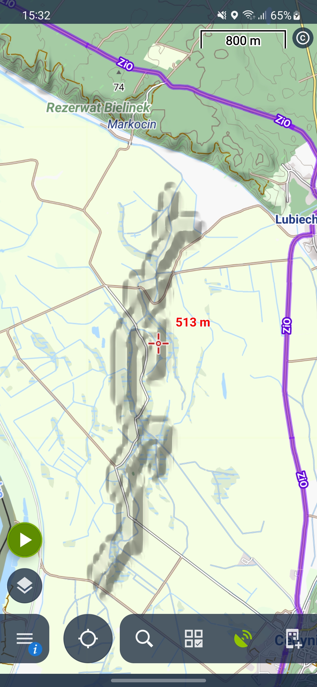
I just downloaded Sonny's latest LIDAR hgts for Germany and copied them to my Locus SRTM folder (on ext SD).
Now Locus' dynamic elevation and map shading show flat terrain, as it should be.
While the OAM vector map includes the anomaly (as contour lines). I have not yet checked LoMaps for this area.
The official LoMaps from Jan 2023 have the same issue.
The official LoMaps from Jan 2023 have the same issue.
https://sonny.4lima.de/
But you have to unzip manually twice. And as Poland does not open source LIDAR, you are restricted to the Western border with Germany.
https://sonny.4lima.de/
But you have to unzip manually twice. And as Poland does not open source LIDAR, you are restricted to the Western border with Germany.
@Michael Bechtold - thank you for investigation of this issue. We'll prepare the fixed elevation data during the next week
@Michael Bechtold - thank you for investigation of this issue. We'll prepare the fixed elevation data during the next week
Hi,
the elevation data are fixed. Please remove the file <locus_working_directory>/data/srtm/N52E014.hgt and download the elevation data again.
Issue will be also fixed in the next version of LoMaps maps
Thank you for the report
Petr
Hi,
the elevation data are fixed. Please remove the file <locus_working_directory>/data/srtm/N52E014.hgt and download the elevation data again.
Issue will be also fixed in the next version of LoMaps maps
Thank you for the report
Petr
Replies have been locked on this page!