
This object is in archive!
Country border visual characteristics settings
Completed
When hiking in border regions and using the dark theme + certain shadings, it's hard to see the border line between countries.
It would be very useful to be able to change color, thickness and pattern of the country border lines.
 I like this idea
Hi,
could I kindly ask you to send me screenshot with such situation? Mentioned dark theme - is it some custom Mapsforge map theme or map in night mode with inverted colors?
Thanks, Petr
Hi,
could I kindly ask you to send me screenshot with such situation? Mentioned dark theme - is it some custom Mapsforge map theme or map in night mode with inverted colors?
Thanks, Petr
Hi Petr,
It's with the inverted color scheme; my standard color scheme of choice.
With hill shading on it's ok-ish to see the border indicator, except when there are a lot of other green lines visible in the view. (I will send a screenshot of that). When you enable the lowland shading, the border line indicator becomes very hard to see. Add some bright sun, shades in front of your eyes and it becomes near impossible. I will also submit a screenshot with the lowlands shading enabled!
Uuuuhm...how can I submit Screenshots? (maybe my mobile browser is not showing me the upload option. If so, I will upload the screenshots when I'm back from my current hike!
Uuuuhm...how can I submit Screenshots? (maybe my mobile browser is not showing me the upload option. If so, I will upload the screenshots when I'm back from my current hike!
Hi,
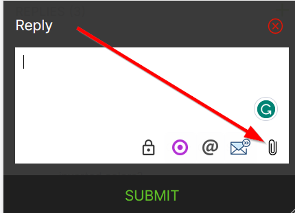
it should be possible to add an attachment using "paper clip" icon
Hi,

it should be possible to add an attachment using "paper clip" icon
Hi, I uploaded three examples. All cases have inverted colors enabled. In two cases, the inverted colors + hill shading is enabled. In one case, the inverted colors + lowland shading is enabled.
Hi, I uploaded three examples. All cases have inverted colors enabled. In two cases, the inverted colors + hill shading is enabled. In one case, the inverted colors + lowland shading is enabled.
Replies have been locked on this page!