
Web Planer: inaccurate contour lines
Gathering feedback
I think the contour lines in the map used in Locus' Web planer are based on SRTM-elevation data. Depending on the location this leads to quite unaccurate contour lines. An extreme example is a tour from "Hohes Kreuz" (2837 m) to "Niederes Kreuz" (2651 m) (both in "Bezirk Gmunden, Upper Austria")
In reality this is a route with a constant decent. The Web planers' elevation diagram is displaying it quite ok (besides the strange buckle in Waypoint 2).
But the contour lines are totaly off up to 400! (an artificial hole of 2300m instead of 2700m)
So it would be a big improvement if you could ask the map-developer (Thunderforest) to use the same good elevation sources as Locus is using for the calculation of the diagram.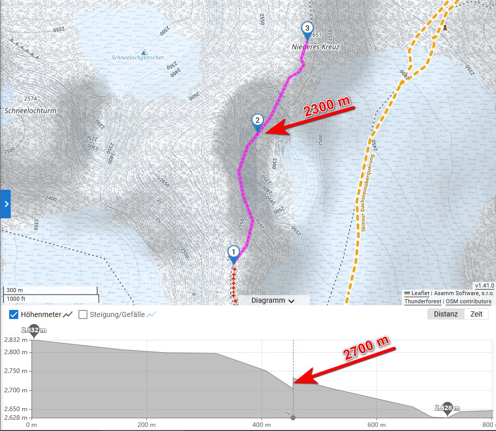
 I like this idea
Any comment on this? :-)
Any comment on this? :-)
Did Thunderforest gave you any answer? I contacted them myself sevceral times to use Sonny-elevation data, but I didn't even get an answer. Another "famous" area with extremely bad contour lines is lake "Obersee" at N 47.516°, E 12.989°. Around the flat lakeshore the contour lines are in a range between 600 - 2000 m and a big shading-ramp wihtin the lake
Did Thunderforest gave you any answer? I contacted them myself sevceral times to use Sonny-elevation data, but I didn't even get an answer. Another "famous" area with extremely bad contour lines is lake "Obersee" at N 47.516°, E 12.989°. Around the flat lakeshore the contour lines are in a range between 600 - 2000 m and a big shading-ramp wihtin the lake
Replies have been locked on this page!