
This object is in archive!
Map owner doesnt allow downloading
Not a Problem
Hi,
I have payed version. Trying to download satelite immages, trying to download offline data and map updates.
It doesnt work.
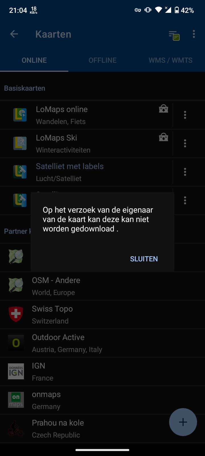
'On request of the owner this map is for you not download able.
Plrase advice.
Files:
Screenshot_2024...
 The same problem
Hi,
the satellite map can't be downloaded but it can be cached (stored in temporary memory) for 360 days. How to cache the map: browse the related area thoroughly across all the zooms that you want to use offline. Each map tile that is displayed is stored. More at https://docs.locusmap.app/doku.php?id=manual:user_guide:maps_download#map_caching
Hi Michal,
I think i tried that. But i get(when online on wifi with vpn) a gray background with one-repeating line: referance to settings and cach.
Tried the cach offline selction, but nothing to select on th gray map.
With kind regards,
Hi Michal,
I think i tried that. But i get(when online on wifi with vpn) a gray background with one-repeating line: referance to settings and cach.
Tried the cach offline selction, but nothing to select on th gray map.
With kind regards,
So the satellite map doesn't appear at all on your phone when you are online with VPN?
So the satellite map doesn't appear at all on your phone when you are online with VPN?
Solved:
In settings: maps -> online maps : only cached maps "disabled".
Think i did that myself, interface description of thecsettings does not include usability information regarding difference in online/offline maps as a feature/service.
Took me some time to realize maps could be online only with tile cache on device.
Are there any darkweb sources to get all satelite images cached trough download?
Are there in this app settings, to enlarge the circle of tile-buffering(to speed up caching)?
Are there in this app settings to buffer 'zommed' tiles, when watching from farther up? Like seeing town and street-close tiles are also downloaded for cache?
OK, so you had the "cached maps only" parameter active - this feature disables display of online-streamed map tiles.
"maps could be online only with tile cache on device"
- you can also display online maps without caching them but it's slower and demanding on the performance and data consumption
"Are there any darkweb sources to get all satelite images cached trough download?"
- I don't know about any
"Are there in this app settings, to enlarge the circle of tile-buffering(to speed up caching)?"
- no, just the phone screen
"Are there in this app settings to buffer 'zommed' tiles, when watching from farther up?"
- no, all zooms must be cached separately
Aerial and satellite maps are not the most important for outdoor activities as the paths and roads are not visible under the vegetation.
Thank you fo replying.
True.
Oke, i use it as a seccond layer. Main offline map and on top cached immages. With a fading tollarance the two map types merge perfect.
True, but immage-satelite can show interesting details, in top of the fully-featured-offline map.
Including walking paths.
Things here in holland sometimes a walking path-offroad is 25%forrest, 25%farmersfield(with gate), etc. So satelite shows details that offline map can not. All areas with icon-illustration get a fade with satelite fo is real content.
So in city i can see i its a grasfield park or has trees to sleep under.
Replies have been locked on this page!