
LoMaps POIs vs OSM POIs
In Progress
Hello,
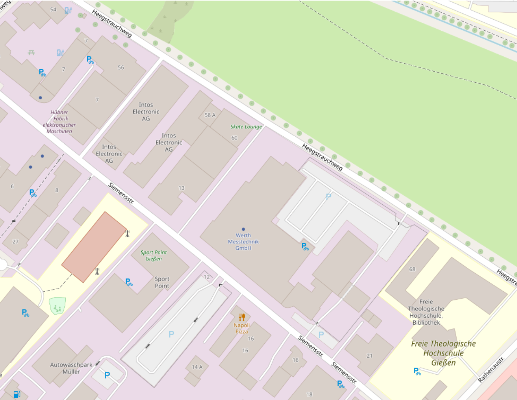
Lomaps is based on openstreetmaps?! But also noticed that OSM buildings (POIS) are displayed and not in Lomaps. I thought I remembered that it wasn't that way before.
Screenshot Example from WebPlanner vs OSM
--Translate---
hallo,
LoMaps basiert doch auf OpenStreetMaps?! Aber mit ist aufgefallen dass in OSM Gebäude (POIs) angezeigt werden und in LoMaps nicht. Ich meinte mich zu erinnern das es früher nicht so war.
 The same question
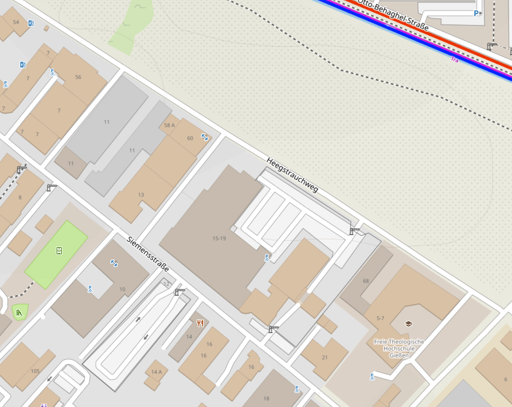
OSM is a MONSTER database and LoMaps takes a specific SUBSET of this data to show on its website and in its LoMaps.
That applies to the maps (streets, vegetation, rivers, lakes and sea) as well as the POI database.
And in particular if you use OAM maps and the Elevate themes, you can switch the visibility of POIs on map level - this a pure display topic.
With POIs in the databas (LoMpas as well as OAM), you have the filter (like on the map), but additionally a search feature, storing POIs etc. But again the SUBSET of POIs of both offerings differ.
Dear Richard,
As Michael wrote, LoMaps only show a subset of the OSM data.
Anyway, could you please point out what building is missing in LoMaps? I must be blind and can't see it in your example :)
Thanks, Petr
Dear Richard,
As Michael wrote, LoMaps only show a subset of the OSM data.
Anyway, could you please point out what building is missing in LoMaps? I must be blind and can't see it in your example :)
Thanks, Petr
Replies have been locked on this page!