
Get surface type for imported routes
Gathering feedback
When I draw a route in LocusMap, it shows the surface type and also what kind of road that is. That information is missing, when a route is imported from a GPX, FIT, ... file.
It woul be great, if there were a way to make LocusMap get that information afterwards (other than by trying to draw the exact same route again).
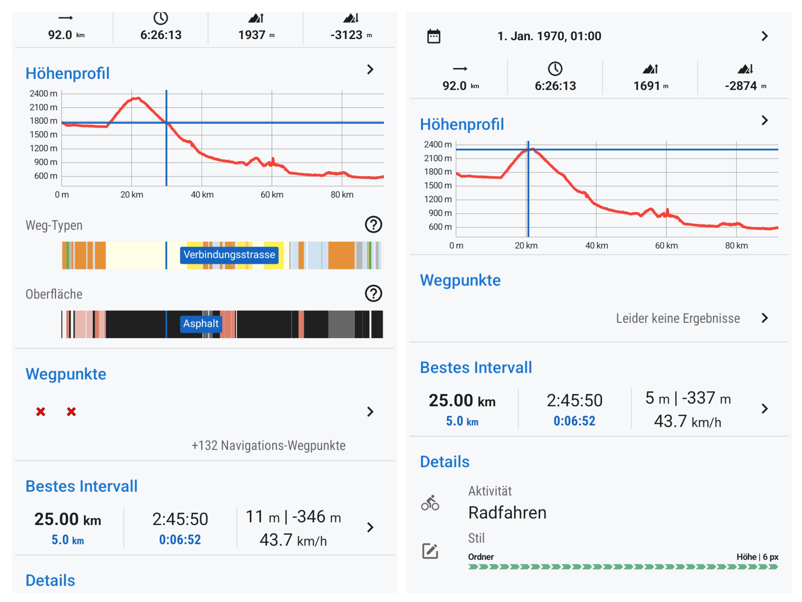
See the attached picture.
- On the left hand side, there's the original route, as drawn in LocusMap.
- On the right hand side, I exported the GPX (also attached) and imported it right away again. The surfce type ("Asphalt") and type of road ("Verbindungsstrasse") is missing.
 I like this idea
Hello Alexander. What you ask for is of course somehow possible, just quite tricky. The imported route can be anything - there is no guaranty it follows existing roads and paths. So lot of geometry based "guess work" has to be done to "match" imported route to map. The idea is not new for us, just we do not promise working solution any time soon, unfortunately.
Hello Alexander. What you ask for is of course somehow possible, just quite tricky. The imported route can be anything - there is no guaranty it follows existing roads and paths. So lot of geometry based "guess work" has to be done to "match" imported route to map. The idea is not new for us, just we do not promise working solution any time soon, unfortunately.
I'm certainly missing insights, but for me, as a user, there doesn't seem to be much difference whether I create a route from point A -> B without making LocusMap follow roads/paths, compared to having a GPX track which goes from the exact dame point A -> B.
But, yeah, you'll probably have your reasons. It's also quite interesting to see, that this feature is missing at other sites like OutdoorActive. (No, I do not expect you to comment on why they might by missing that as well.)
Replies have been locked on this page!