When a track is opend, the share menu contains "image & stats" since some months. I like to use that for title image in photo gallery and to share in social media to let others see what I did – and came again and again over the same improvement ideas, based on what I saw other people share with their apps. To better understand them, an example image:
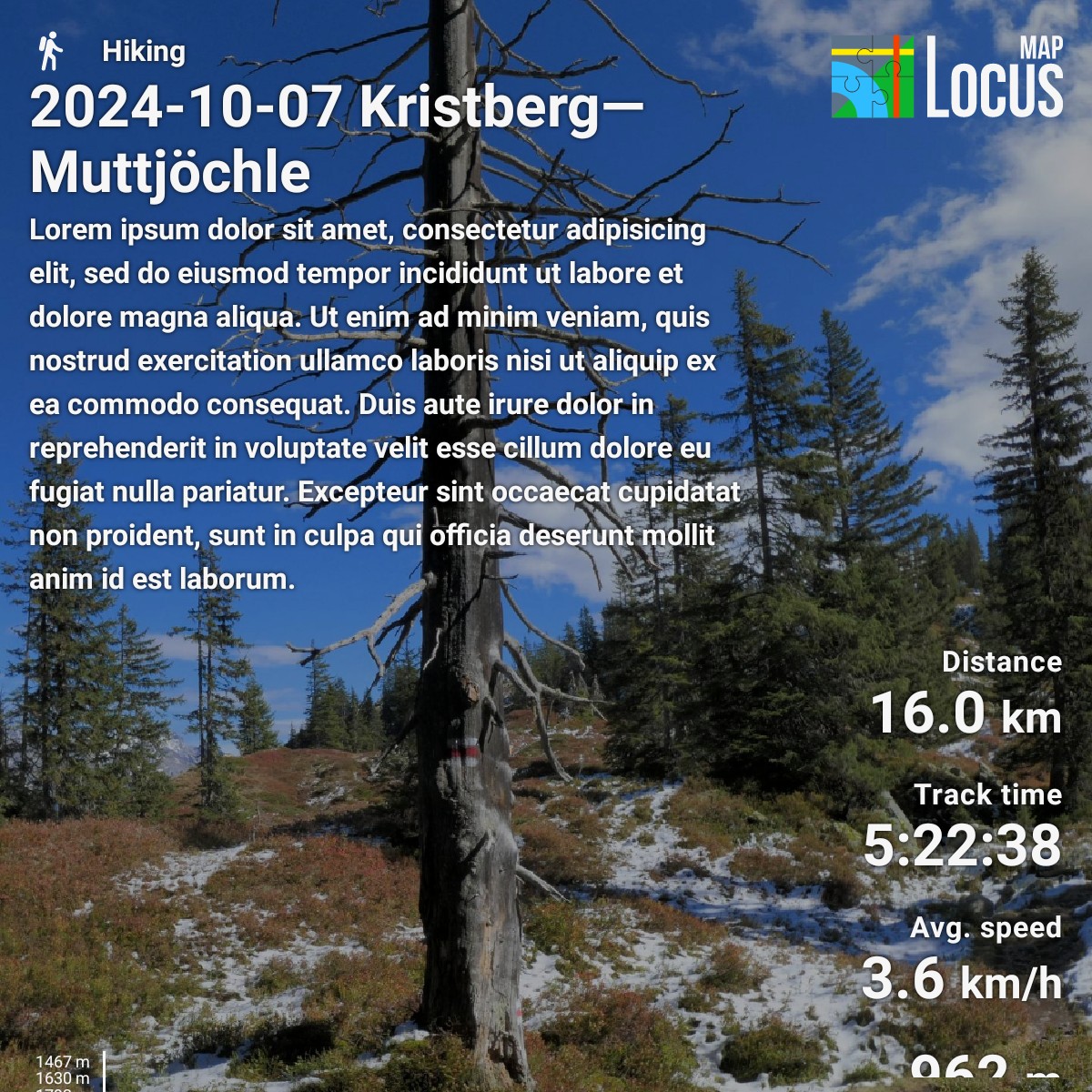
- Make track title much more often fit in 1 line. Place the title as first line, i.e. swap activity type & title, so activity type and app's logo are one line, and the title has full image with available. If title is still too long, scale text size down so it fits into one line – only if it becomes less than e.g. 133% the track description's size, wrap it over more lines.
- In menu, allow to toggle track description on/off – independant of statistics.
- Move track description into table's left column, so it does not shift statistics down until they are cut (as in example image) and/or out of screen – this happens even for lore ipsum with 446 chars which is that much, e.g. even many Mastodon instances allow more.
- Place chart with fixed margin from bottom so it is not shifted down by track description until it's cut (as in example image) and/or out of screen. If text reaches into table cell of chart, cut text until it fits and add suffix "[...]" so one becomes aware text was cut.
- Allow to enter a text that appears instead of track description, and inititally fill that text with track description and statistics. Background: For a track, I do usually note who was involved, whether, approach, path conditions, events, what I disliked & liked (views etc.) in description – but only parts of that is relevant for others. As it is much quicker to delete than enter text, I'd love to have track description and statistics as a base – which may be cleaned by one tap on an X or trash icon.
- If it's easy to implement, allow to toggle track's waypoints on/off in the map and chart. Often, they have a significant meaning, so a possibility to reference them in the textual description also when "custom background" instead "map background" (there, waypoints are rendered) is used would be nice. Sometimes, I use track waypoints for OSM mapping, thus a track is scattered with waypoints that are of no relevance to others, hence, I'd like to hide them.
- Make the picture bigger. 1200x1200 pixels is exceeded by many computer monitors, TVs and smartphones, so depending on display software, image is either scaled up (visibly lower quality than scaling down) or not full screen but with black borders around image.
- Save in JPEG instead PNG. That reduces file size by 75% and mobile network speed is especially limited where Locus is mostly used: outdoors in mountains, canyons, rural areas,...
- If it is easy to implement, e.g. because an underlaying library ships such a function, allow to do a rectangular selection on "cutsom background" of what shall become visible. In example image, the dead tree's top is cut – I'd like to have it in the picture. I would slightly prefer that the sharing image dimension's ratio simply follows the selection's ratio (e.g. 9:16 instead of 1:1) than to have always 1:1 with a black background left & right xor above & below the selection.

 I like this idea
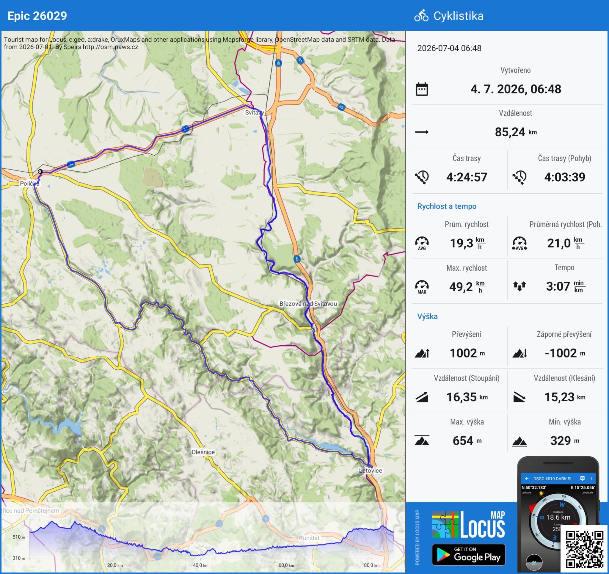
i did try to change the map style in the main app view but it didn't affect the generated image.
i did try to change the map style in the main app view but it didn't affect the generated image.
I can't edit my original post, wanted to add the feature is available since v4.24 and a further aspect:
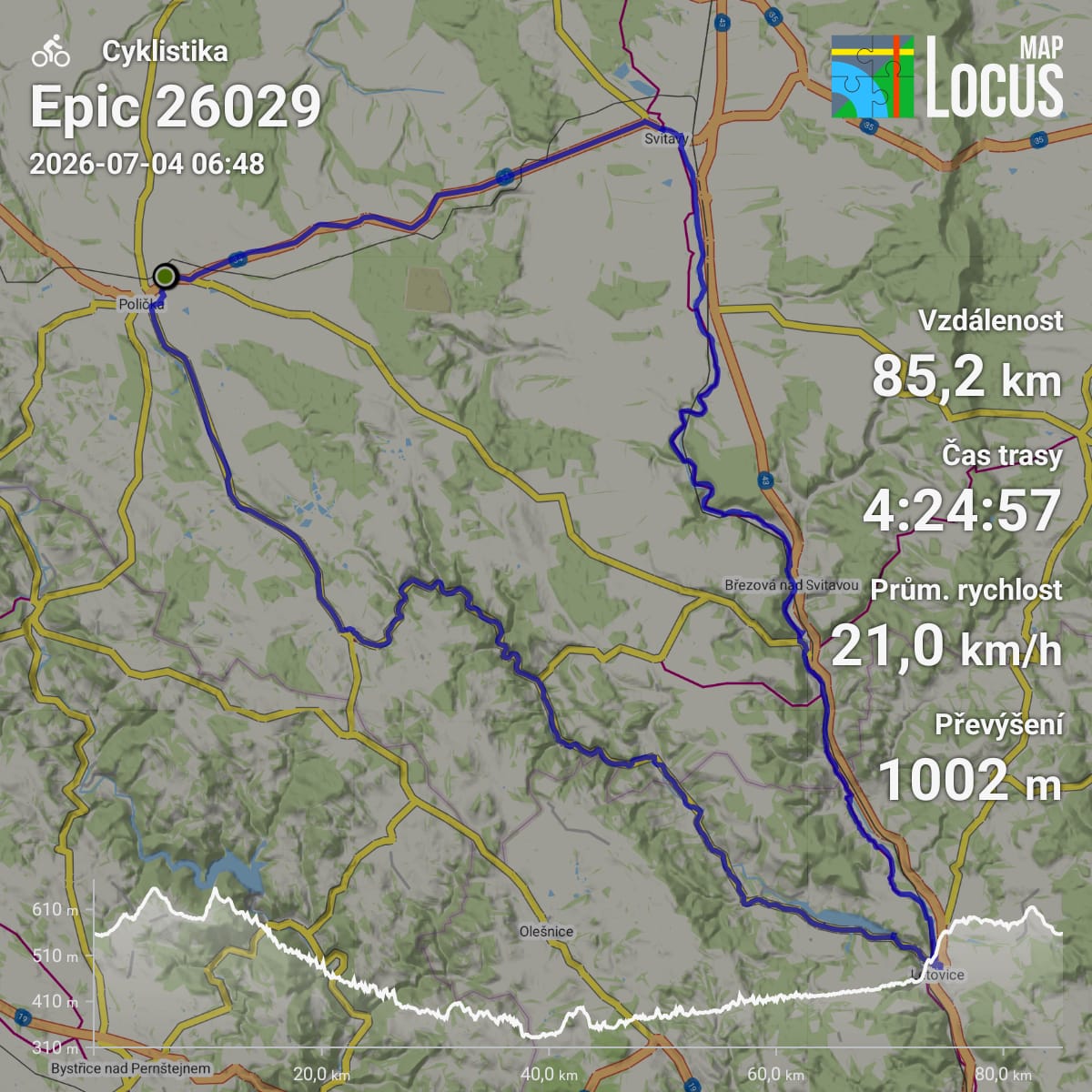
10. When using map background, avoid text is above track, so track is not well perceivable. example:
Solution ideas
10a) Automatically place texts more intelligent around track's shape – it's probably difficult to achive a reliable way, e.g. for an X shaped track.
10b) Render track above text – not good as it makes text not well readable
10c) Zoom + pan map view such that track is only rendered where no text is – simple and reliable but track is becoming small
10d) Allow user to place all objects (activity icon + name, title, description, logo, stats as a whole or each statistic on its own, elevation profile) to his liking, i.e. offer drag & drop and tap & resize and tap & delete – shall suit most scenarios, is satisfying also other desires (e.g. that stats are not above map text that is important for user's situation, like in my example "km/h" is making "Kybfelsen" hard ro read), probably not too difficult to implement
further ideas welcome 🙂
I can't edit my original post, wanted to add the feature is available since v4.24 and a further aspect:
10. When using map background, avoid text is above track, so track is not well perceivable. example:
Solution ideas
10a) Automatically place texts more intelligent around track's shape – it's probably difficult to achive a reliable way, e.g. for an X shaped track.
10b) Render track above text – not good as it makes text not well readable
10c) Zoom + pan map view such that track is only rendered where no text is – simple and reliable but track is becoming small
10d) Allow user to place all objects (activity icon + name, title, description, logo, stats as a whole or each statistic on its own, elevation profile) to his liking, i.e. offer drag & drop and tap & resize and tap & delete – shall suit most scenarios, is satisfying also other desires (e.g. that stats are not above map text that is important for user's situation, like in my example "km/h" is making "Kybfelsen" hard ro read), probably not too difficult to implement
further ideas welcome 🙂
11) I would like to choose another color for the track, a simple line with choosable color is sufficient. The MyLibrary folder is configured to line with coloring mode "Speed". This is good in Locus' map display because I have high contrast and I can tap the track causing "glowing widened bordered" display, but it's often badly recognizable in share image where background is "halfway blended out" (dynamic range / histogram is reduced to left half) and viewers can neither tap nor zoom, so green on green is hard to recognize. Example:
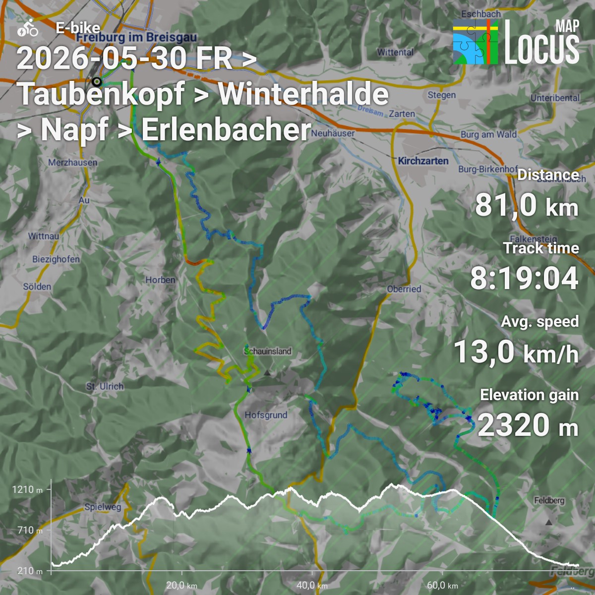
11) I would like to choose another color for the track, a simple line with choosable color is sufficient. The MyLibrary folder is configured to line with coloring mode "Speed". This is good in Locus' map display because I have high contrast and I can tap the track causing "glowing widened bordered" display, but it's often badly recognizable in share image where background is "halfway blended out" (dynamic range / histogram is reduced to left half) and viewers can neither tap nor zoom, so green on green is hard to recognize. Example:

Replies have been locked on this page!