
Hopefully, we can add 3D map functionality to our excellent LocusMap
Gathering feedback
Hi,
Locusmap is already very professional, but there is still a small regret. Some groups often engage in outdoor activities in areas with complex terrain. Although contour maps can help to judge the terrain, it's difficult for all of our users to be experienced enough to interpret contour lines and determine a safer route. If a 3D satellite view could be provided for more intuitive terrain visualization, it would greatly enhance safety and ease of use when choosing outdoor routes (as shown in the picture below). I believe the development team is capable of implementing this, and I sincerely hope that Locusmap can add a 3D display feature. Please consider this seriously, and thank you.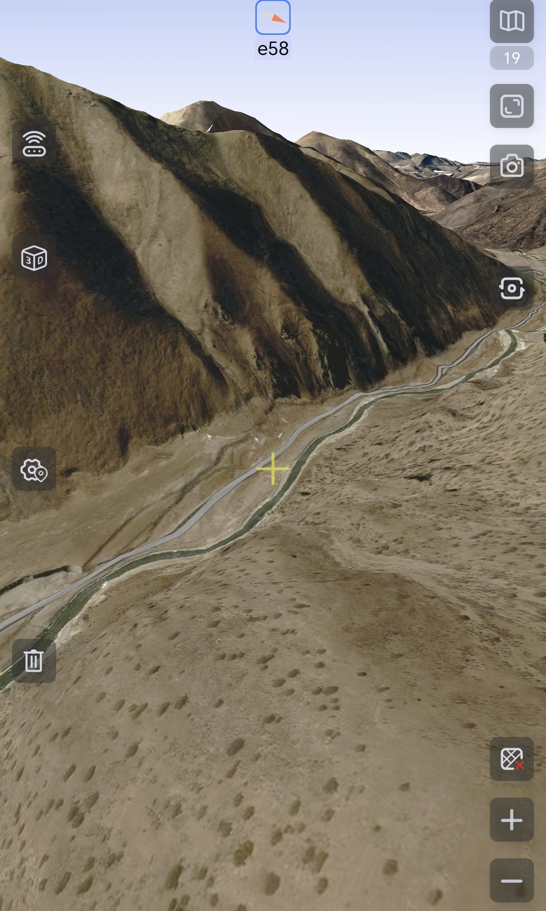
 I like this idea
Something like https://www.onxmaps.com/backcountry/app/features/3d-ski-hiking-maps would be great!
Something like https://www.onxmaps.com/backcountry/app/features/3d-ski-hiking-maps would be great!
The search facility of this help forum is pretty hopeless - I tried searching for topics already asking for 3D (including mine) - but gave up - there have been many requests for 3D over the years ;-( The best I can suggest is to export from Locus as KML then import into Google Earth. Works really well.
The search facility of this help forum is pretty hopeless - I tried searching for topics already asking for 3D (including mine) - but gave up - there have been many requests for 3D over the years ;-( The best I can suggest is to export from Locus as KML then import into Google Earth. Works really well.
The Google Earth workaround is not really a solution while hiking...
The Google Earth workaround is not really a solution while hiking...
Replies have been locked on this page!