How to edit a track on LOCUS Maps Web Version

Stephen Ricketts shared this question 41 days ago
Answered

Hello, I have been using Locus Maps for years and love it. I notice that on the Web Version there is no means to tweak track points after the track is saved. For example, you wish to move a few track points around as the route needs to be tweaked but when you go to planner mode, a track that is approx 5 km long, is split in as few as 4 track points that you can slide around. As soon as you move one, all lines are straight between each point. Surely this is possible. What am I missing.

Replies (1)

photo
1

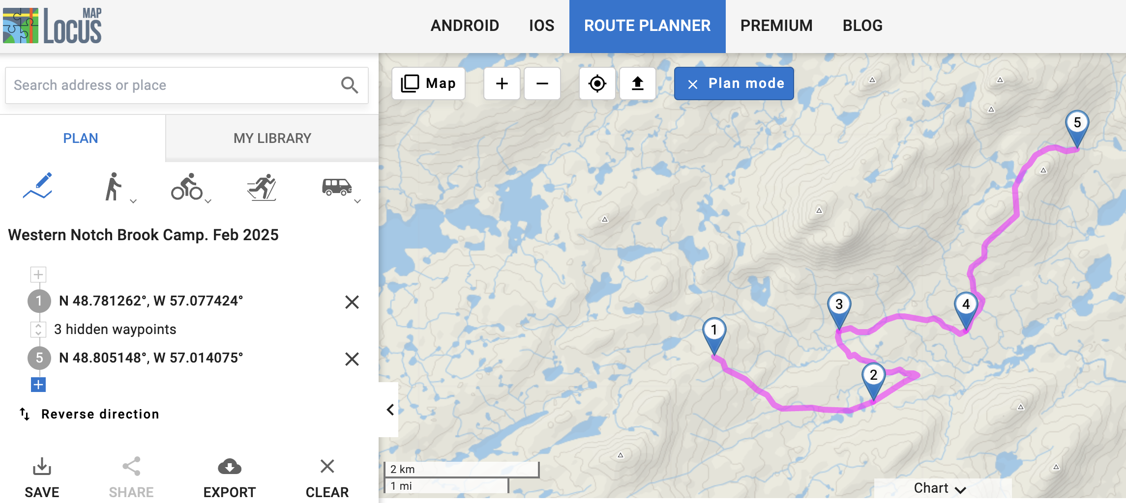
You have activated manual drawing mode in your screenshot (left icon with the pen). This will always create a straight line between two points. Use a different mode (walking, hiking, cycling...), then it will work. 😉

photo
1

Thanks for the reply. I understand that if I were creating a track on the web based version that that would be the case. What about a track that is already recorded on your device that you now wish to edit slightly? Surely a track that is more than 10 km long should have more than 3 points? Even in another mode, hiking as an example, as soon as I click on point 2, the actual track disappears and I get 2 straight lines. If I send this track to Garmin Basecamp I get the same track with 470 track points that I can edit by clickind and dragging or adding and deleting points as needed.

photo
1

Same track in Basecamp

photo
1

In the web planner, you can only change a recorded or planned route with the route planner. The straight line from waypoint 1 eastwards is mapped in OpenStreetMap as a cutline and power=line (high-voltage overhead line), not as a routable route. Therefore, no routing profile can create a route along here. Apparently you can still walk along it in reality, just as you can walk across fields or meadows. And of course you can always record the route you have run, even if you walk across an ocean. ;-)

This is because when recording, your position is only saved as a coordinate every few metres and/or seconds and a straight line is drawn to your last position. Regardless of whether there is a path or not.

But a routing service can only calculate a route for which the map data allows it. And they don't do that here.

What you do with basecamp, or would like to do here, is move track points. But that has nothing to do with routing. You can also edit track points with Locus (move, delete, add...) but only in the app and not in the web planner. Both are possible in the app.

In the route planner, some shaping points (green triangles in the app, round markers with numbers in the web planner) are created for a recorded track, which can be moved. The segment is then re-routed. In the web planner, you can move your mouse over the line anywhere on the track (without clicking) and a new red marker will appear, which you can also move.

You can also edit the track points in the app. Click on the track and select "Edit track" from the three-dot menu. The track editor will then open.

photo
1

Thanks for that. I was hoping someone knew of a way to amend a track but I guess my understanding was correct. Only in the app is this possible. Thanks for your response.

photo
1

Yes, you can only change this in the app. But the name says it all. It is a planner.
But you can make a suggestion to integrate this function.
https://help.locusmap.eu/topic/add
idea

photo
Leave a Comment
 
Attach a file