
This object is in archive!
Problematic curve notice on navigation
Not a Problem
I don't know if something changed in Locus recently or if it was always like this, but I've been noticing that curves are being wrongly presented while route navigating.
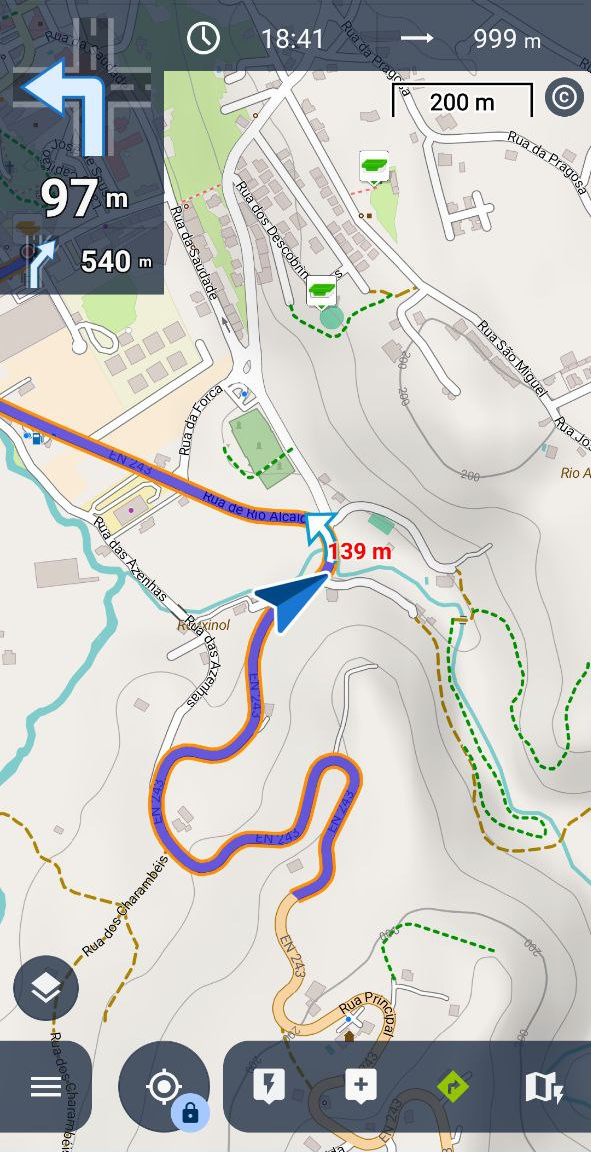
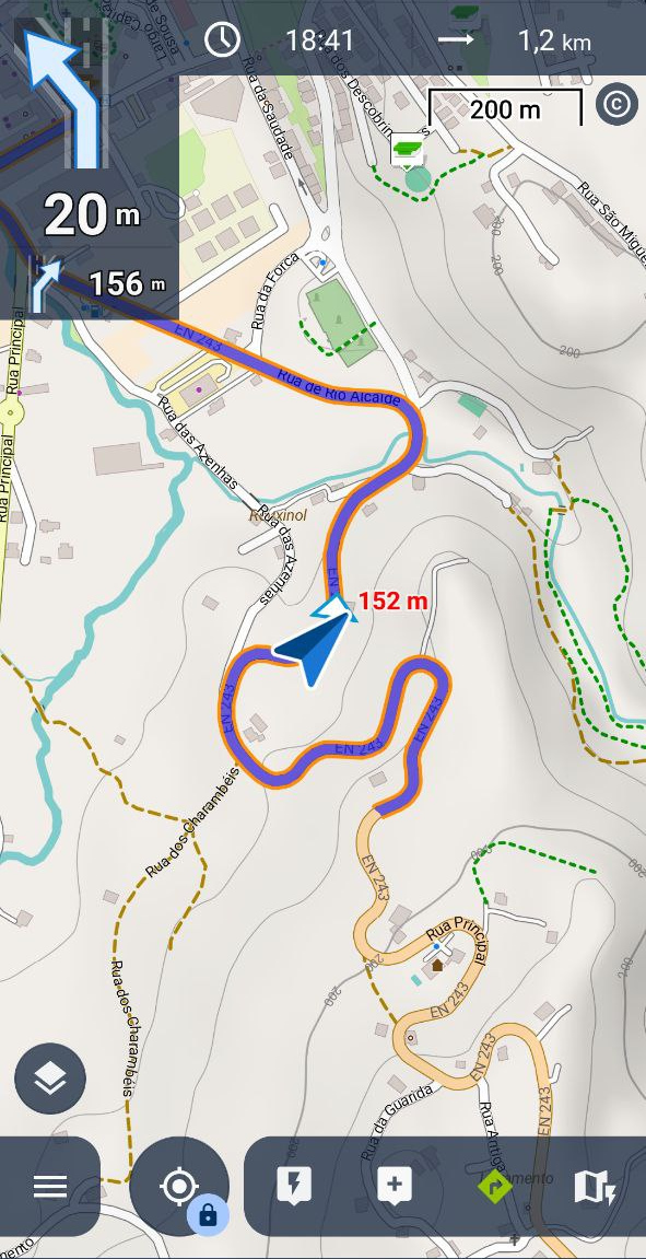
It's very awkward to see a crossing or fork on the top left image when the only thing that exists is a curve on the road.
It's very distracting and it makes the navigation very problematic. Here's two screenshots of this issue. Notice the road I follow is the main road, with no stop signs or crossings.
Is it something I can change on my side or is this a problem with Locus' internals?
Why not just show crossings when there are STOP signs or crossings where you have to change to another road?
Regards.
 The same problem
There is another aspect to this.
If you disable "Include Navigation Commands" in route planner then the created route has no navpoints. Obviously correct.
In route planner if you do "Recalculate all" with same setting then again the route has no navpoints. Correct.
If you do "Navigate to a Point" then the created route uses the last setting in route planner for "Include Navigation Commands". Correct.
When you navigate the route and do "Recalculate" - then the part of the route which gets changed now DOES get navpoints (not just shape based).
IMO this is incorrect. If you do not add navpoints to a route, whether deliberately or accidentally, then you would not expect Recalculate to override this.
Or is there some setting which controls this ?
Are you writing route navigation, i.e. navigating along a previously planned and saved route?
Have you perhaps created this WITHOUT navigation commands (deactivated the option in the route planner menu)?
If so, Locus will generate instructions during navigation based on the direction changes of the route, regardless of the routing data on the map. This includes, for example, curves or bends where are no turn-offs, junction etc.
In many cases, I personally prefer this option, as it is often more precise for my needs.
Hi,
what router do you use? Where exactly does this happen? Is it only on the place you show on the screenshot or anywhere else?
Hi,
what router do you use? Where exactly does this happen? Is it only on the place you show on the screenshot or anywhere else?
Could you please send the coordinates of any place where this happens? I'm not able to simulate the issue in my neighborhood.
Could you please send the coordinates of any place where this happens? I'm not able to simulate the issue in my neighborhood.
What routing profile do you use? I'm testing it with a car or bike profile and the minor turns to the houses near the road are not announced:
What routing profile do you use? I'm testing it with a car or bike profile and the minor turns to the houses near the road are not announced:
Antonio, do you have the option to generate navigation commands turned on in the routing profile setup?
Antonio, do you have the option to generate navigation commands turned on in the routing profile setup?
There is another aspect to this.
If you disable "Include Navigation Commands" in route planner then the created route has no navpoints. Obviously correct.
In route planner if you do "Recalculate all" with same setting then again the route has no navpoints. Correct.
If you do "Navigate to a Point" then the created route uses the last setting in route planner for "Include Navigation Commands". Correct.
When you navigate the route and do "Recalculate" - then the part of the route which gets changed now DOES get navpoints (not just shape based).
IMO this is incorrect. If you do not add navpoints to a route, whether deliberately or accidentally, then you would not expect Recalculate to override this.
Or is there some setting which controls this ?
Replies have been locked on this page!