
This object is in archive!
Track point information
Answered
I recall in Locus maps classic I could select a point on a track and get information about that point. Specifically of interest to me is how much distance into the track the point is and the time from the start.
Also, elevation profile graph is shown, instead an option for a graph of speed vs time or distance would be desired. I mainly do water activities where elevation is meaningless. I do know I can click into the elevation profile then see the desired graph but if liked it see it without having to dig into the menu and allow me to select the point on the map and see where that is on the graph as currently can only be done for elevation profile.
Files:
Screenshot_2025...
 The same question
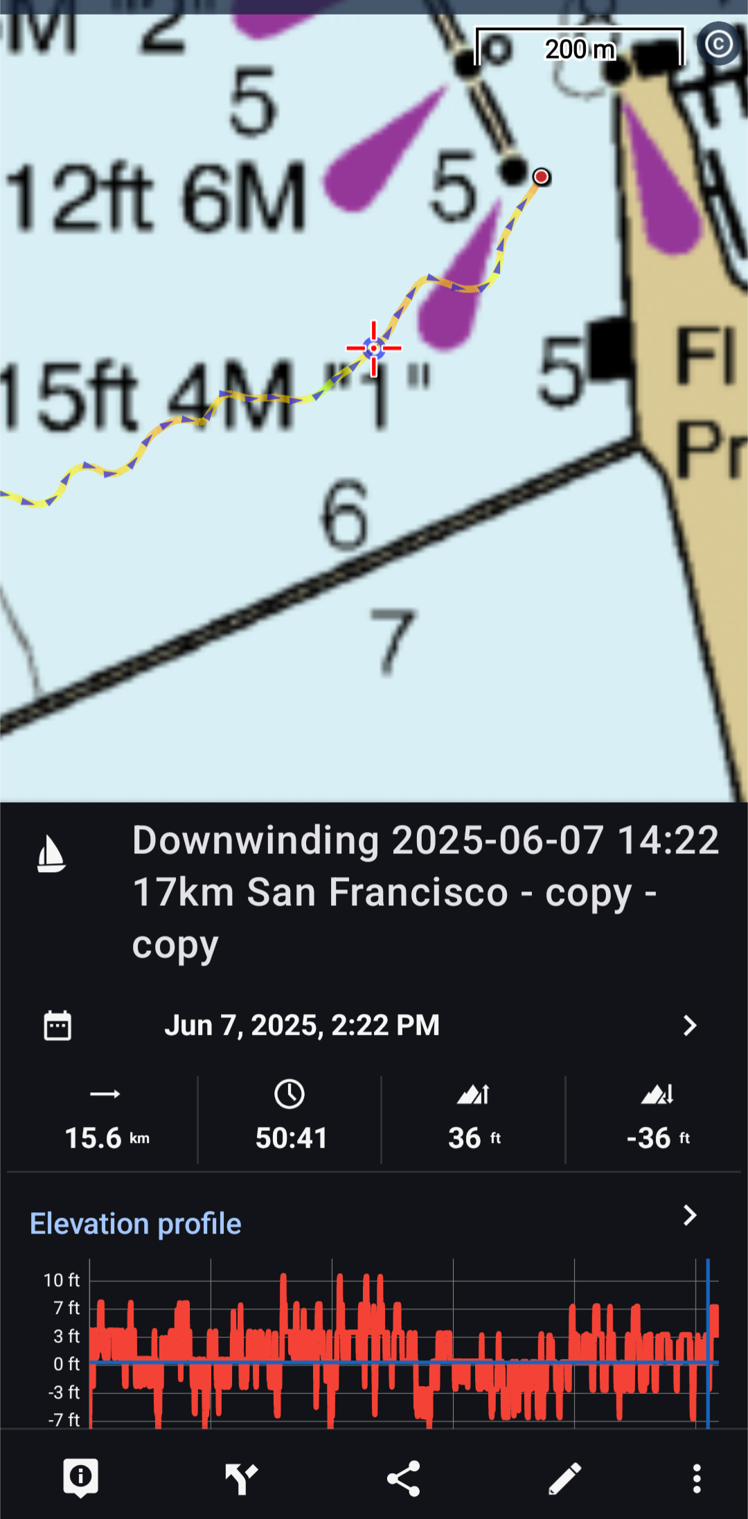
Hi Joshua,
tap the place on the track > tap the trackpoint button in the bottom left corner and you'll see details of the selected trackpoint, including distance to start or end and time. If you swipe it up, you'll see other details on the particular spot, like the current speed, heart rate, temperature and other parameters, depending on connected sensors:
"elevation profile graph is shown, instead an option for a graph of speed vs time"
- yes, the elevation graph is displayed by default and you can open its detail with an option to view other charts. Locus Map is primarily an app for hikers, bikers or geocachers, that's why the elevation graph is pre-selected. If you want other charts to display in the track detail, create an idea on the helpdesk and let others vote for this change. If you gather enough support from others, the devs will think about implementing it.
Replies have been locked on this page!