
Cant recalculate imported GPX with hiking profile properly
Hello,
I often import GPX tracks from hiking websites. These are always treated as “manually drawn” after import, which I assume is expected. However, it results in missing data, especially for time estimation. That's why I always edit the imported GPX into the planner to update the track with the LoRouter "Hiking" profile to have accurate data, but I encounter some trouble when perforing this operation :
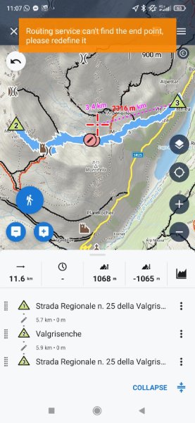
- With the first GPX attached (source) : After import, there's no estimated duration. When I open it in the route planner and switch to “hiking profile” with LoRouter Offline, I get this error:
“Routing service can’t find start point, please redefine it.”
Same issue with LoRouter Online. With GraphHopper, there's no error, but the route is significantly altered and follows completely different trails. The only workaround I've found so far is to redraw the track manually.
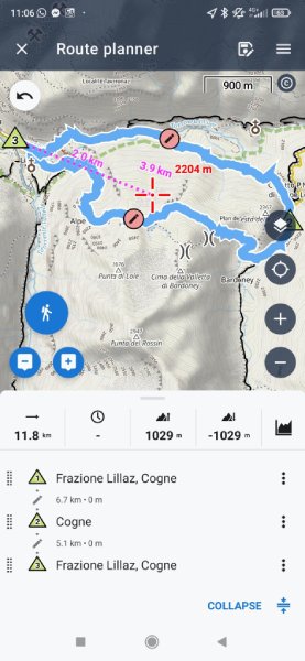
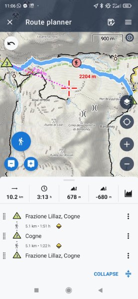
- Same issue with With the second GPX attached (source) : no estimated duration after import, and the route is significantly altered when switching to “hiking profile” in the planner even though the original GPX follows marked trails on the map.
Before :
After :
So my questions are:
- Why do I get the error "Routing service can’t find start point, please redefine it" with some GPXs ? Are these GPXs malformed in some way ?
- Is there a way to apply the "hiking" profile to imported GPXs without major path changes, I mean make the router follow the existing paths closest to the imported GPX track when possible ?
I'm using Locus Map 4.30.1 (Gold plan) on Android 11.
Thanks for your great work and for any advice you can share !
 The same problem
Hi Vincent,
1) the shaping point on the peak Mont de l'Arp Vieille is placed on a path that doesn't exist in the map or routing data. The app, though, reports it as missing starting/ending point which is obviously a bug. @Menion FYI. Move the shaping point on an existing pth under the peak and the rute will recalculate OK. Then edit it by adding the missing part in manual mode.
2) when editing imported routes, I always recommend adding a few extra shaping points on the route so that the router better knows where the route runs. More about rerouting: https://docs.locusmap.app/doku.php?id=manual:user_guide:tracks:editing#changing_progress
Hi @Michal,
I’ve followed your advice on both points and it worked very well.
- I moved the shaping point on Mont de l'Arp Vieille to the existing path as you suggested. The route recalculated properly right away.
- I also tried adding extra shaping points to the other imported GPX before applying the "hiking" profile. That really helped keep the intended path during rerouting. Thanks also for the link to the rerouting guide, very useful !
Much appreciated, thanks !
Replies have been locked on this page!