Introduction: Locus Map has established itself as a leading navigation and mapping software provider, offering a comprehensive range of features to its users. In order to enhance the user experience and keep up with the evolving landscape of mapping technology, we propose the integration of a 3D functionality similar to Google Earth into the Locus Map application. This document outlines the technical details and considerations for implementing this exciting feature.
Objective: The objective of this project is to develop and incorporate a 3D functionality into Locus Map, enabling users to explore and interact with geographical data in a three-dimensional environment. By bringing the power of 3D visualization to Locus Map, we aim to provide users with a richer and more immersive mapping experience.
Technical Approach:
- Data Acquisition:
- Utilize elevation data from reliable sources, such as digital elevation models (DEMs) or satellite imagery, to create a realistic terrain model.
- Acquire 3D building models from various sources, including publicly available datasets or partnerships with third-party providers.
- Rendering Engine:
- Implement a rendering engine capable of handling complex 3D scenes efficiently and rendering them in real-time.
- Utilize modern rendering techniques, such as level-of-detail (LOD) rendering and occlusion culling, to optimize performance while maintaining visual fidelity.
- User Interface:
- Design an intuitive and user-friendly interface for interacting with the 3D functionality.
- Implement intuitive camera controls, allowing users to navigate and explore the 3D environment effortlessly.
- Enable interactive features such as zooming, panning, and rotating the map in 3D space.
- Integration with Existing Features:
- Ensure seamless integration with existing Locus Map features, such as route planning, point-of-interest search, and track recording.
- Enable users to switch between 2D and 3D views seamlessly, providing flexibility in their map exploration.
- Performance Optimization:
- Implement efficient data streaming techniques to handle large 3D datasets without sacrificing performance.
- Employ GPU acceleration and parallel processing to achieve smooth rendering and responsive user interactions.
- Cross-Platform Compatibility:
- Develop the 3D functionality to be compatible with various platforms, including mobile devices (Android and iOS) and desktop environments.
- Optimize the performance and user experience for each platform, taking advantage of platform-specific capabilities.
Conclusion: The addition of a 3D functionality similar to Google Earth will elevate the capabilities of Locus Map, providing users with a compelling and immersive mapping experience. By following the proposed technical approach, Locus Map can unlock new possibilities for visualization and exploration of geographical data. This feature will further solidify Locus Map's position as a leading provider of mapping and navigation solutions in the industry.

 I like this idea
...or at least get some nice 2,5D shading.
...or at least get some nice 2,5D shading.
There are some similar ideas in getsetisfaction for hillshading or contour lines. I support this idea.
There are some similar ideas in getsetisfaction for hillshading or contour lines. I support this idea.
Any news regarding this topic?
AFAIK, there`s already a beta version supporting it.
Any news regarding this topic?
AFAIK, there`s already a beta version supporting it.
news? I was playing few days with OpenGL, but because it`s completely new topic for me, and because huge number of requests and issues forced me back to raw locus, it`s again frozen for a while. OpenGL support is planned, probably also something with 3D (even if this is not so much needed), but I cannot promise now nothing specific, because there is many much more interesting and wanted ideas to do ...
news? I was playing few days with OpenGL, but because it`s completely new topic for me, and because huge number of requests and issues forced me back to raw locus, it`s again frozen for a while. OpenGL support is planned, probably also something with 3D (even if this is not so much needed), but I cannot promise now nothing specific, because there is many much more interesting and wanted ideas to do ...
I think it`s needed for example for hikers who like to see and know the hills or mountain names surrounding them with help of the 3D map. This is implemented in Google maps and is helpful, especially when map is centered to my position and looking around rotates map. I would use AR plugin for that, but it`s very imprecise so I can`t rely on it. It would be great if 3D maps or AR plugin were implemented or fixed.
I think it`s needed for example for hikers who like to see and know the hills or mountain names surrounding them with help of the 3D map. This is implemented in Google maps and is helpful, especially when map is centered to my position and looking around rotates map. I would use AR plugin for that, but it`s very imprecise so I can`t rely on it. It would be great if 3D maps or AR plugin were implemented or fixed.
Apemap now supports 3D and it is really really great. So good that I`m thinking about buying one of the extensive licenses.
Apemap now supports 3D and it is really really great. So good that I`m thinking about buying one of the extensive licenses.
Sometimes this could be very handy!
Sometimes this could be very handy!
I like hiking, the mountains contours of desperately i need in 3d, hopefully this can happen ..
thx
This reply was created from a merged topic originally titled
<a class="notranslate" href="http://getsatisfaction.com/locus/topics/i_craved_locus_could_3d/changes" rel="nofollow" target="_blank">I craved locus could 3D...</a>.
Hello,
Until the challenges with OpenGL API are solved, we should look into different manner to visualise altitude changes on a map.
There`s a big difference between what looks nice and what we actually need. I love 3D views but what I am missing is a way for my brain to know what are peaks and what are valleys in maps and specially orthophotos . There are different ways to achieve that result, static methods and dynamic methods.
1. Would it be a solution to generate some hillshade on top of the view? This is a static method. The depth information is communicated with a single picture.
Hillshade maps already exist but what could be even more useful is a user defined hillshade where it is possible to define the coming direction of the light.
One needs to define one 3D vector v1 from the chosen position of the sun to say the center of the map.
A field of ground normal vectors of ad-hoc density must also be calculated. Each ground vector v2ij is the surface normal vector pointing upward at point ij
The angle Aij is the angle between v1 and v2ij. If |Aij| is between 90° and 0° then the shading is on at point ij . The shading intensity is then inversely proportional to |Aij|.
2. Generating altitude contour lines could also help to produce a sensation of depth. The distance between curves (delta altitude), color should be user defined.
3. Finally, the most interesting concept.
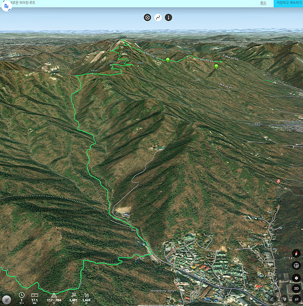
It is possible to give a real 3D depth to a top view. This is a dynamic method. The depth information is communicated by displaying a succession of pictures by panning the view. Try panning a top view in Google earth at reasonable altitude. It will give you a good idea of what I am talking about.
When panning the view, pixels at higher altitude translate more than at lower altitude. The translation is inversely proportional to the distance between the eye and the terrain. This is of course function of the altitude of the terrain.
This technique can be applied together to any data in Locus: maps, overlays and wms to indifferently map data to the the topography. Used separately on different data sources could create some interesting 3D layering effects.
The question is if the transformation made on the screen pixel grid can be calculated in real time or does it slow down the screen refresh rate?
What do you think of these suggestions?
Cheers
This reply was created from a merged topic originally titled
<a class="notranslate" href="http://getsatisfaction.com/locus/topics/ideas_to_implement_a_pseudo_3d_visualisation_while_waiting_for_a_full_3d_locus/changes" rel="nofollow" target="_blank">Ideas to implement a pseudo 3D visualisation while waiting for a full 3D-Locus</a>.
Hello,
Until the challenges with OpenGL API are solved, we should look into different manner to visualise altitude changes on a map.
There`s a big difference between what looks nice and what we actually need. I love 3D views but what I am missing is a way for my brain to know what are peaks and what are valleys in maps and specially orthophotos . There are different ways to achieve that result, static methods and dynamic methods.
1. Would it be a solution to generate some hillshade on top of the view? This is a static method. The depth information is communicated with a single picture.
Hillshade maps already exist but what could be even more useful is a user defined hillshade where it is possible to define the coming direction of the light.
One needs to define one 3D vector v1 from the chosen position of the sun to say the center of the map.
A field of ground normal vectors of ad-hoc density must also be calculated. Each ground vector v2ij is the surface normal vector pointing upward at point ij
The angle Aij is the angle between v1 and v2ij. If |Aij| is between 90° and 0° then the shading is on at point ij . The shading intensity is then inversely proportional to |Aij|.
2. Generating altitude contour lines could also help to produce a sensation of depth. The distance between curves (delta altitude), color should be user defined.
3. Finally, the most interesting concept.
It is possible to give a real 3D depth to a top view. This is a dynamic method. The depth information is communicated by displaying a succession of pictures by panning the view. Try panning a top view in Google earth at reasonable altitude. It will give you a good idea of what I am talking about.
When panning the view, pixels at higher altitude translate more than at lower altitude. The translation is inversely proportional to the distance between the eye and the terrain. This is of course function of the altitude of the terrain.
This technique can be applied together to any data in Locus: maps, overlays and wms to indifferently map data to the the topography. Used separately on different data sources could create some interesting 3D layering effects.
The question is if the transformation made on the screen pixel grid can be calculated in real time or does it slow down the screen refresh rate?
What do you think of these suggestions?
Cheers
This reply was created from a merged topic originally titled
<a class="notranslate" href="http://getsatisfaction.com/locus/topics/ideas_to_implement_a_pseudo_3d_visualisation_while_waiting_for_a_full_3d_locus/changes" rel="nofollow" target="_blank">Ideas to implement a pseudo 3D visualisation while waiting for a full 3D-Locus</a>.
I would definitely like to see this in Locus.
One of few functions I found present or better implemented in OruxMaps missing in Locus.
I would definitely like to see this in Locus.
One of few functions I found present or better implemented in OruxMaps missing in Locus.
Hello, I find the interesting points raised noutters, especially point 2.
I think it would be very helpful to have contour lines (elevation) generated from DEM files, so you can take them over any map.
Greetings.
Hello, I find the interesting points raised noutters, especially point 2.
I think it would be very helpful to have contour lines (elevation) generated from DEM files, so you can take them over any map.
Greetings.
"Status changed to Under consideration"
This is indeed a good sign :D
"Status changed to Under consideration"
This is indeed a good sign :D
Yes, from 'planned' :). There was set too much ideas to 'Planned' so I change them all back to "Under consideration". Now will be chance to reconsider what is possible and what isn't and mark only these really "planned" to "planned" :)
Yes, from 'planned' :). There was set too much ideas to 'Planned' so I change them all back to "Under consideration". Now will be chance to reconsider what is possible and what isn't and mark only these really "planned" to "planned" :)
nothing easier then vote down onelook ;). Anyway hope you know, that shading is already implemented in Locus (menu > settings > maps - advanced)
nothing easier then vote down onelook ;). Anyway hope you know, that shading is already implemented in Locus (menu > settings > maps - advanced)
Thanks for reply. Yes, I know it. I try it, but it's too relative bland for flat areas. Can I set intensity of this overlay (set whitepoint and blackpoint height)? On first screenshot is overlay on classic map. Second image is manualy edited if image editor (contrast, ...) - it's perfect for me. It's look as 3D, but it's 2D.
Thanks for reply. Yes, I know it. I try it, but it's too relative bland for flat areas. Can I set intensity of this overlay (set whitepoint and blackpoint height)? On first screenshot is overlay on classic map. Second image is manualy edited if image editor (contrast, ...) - it's perfect for me. It's look as 3D, but it's 2D.
No, unfortunately shading has no public settings. I tried to find some compromise between intensity and usage. And this is result
No, unfortunately shading has no public settings. I tried to find some compromise between intensity and usage. And this is result
I believe that this is an exhaustive feature to implement. CPU intensive, takes lot of time to implement properly and error prone while not being that useful. Hands down it looks cool, but not that useful.
I believe that this is an exhaustive feature to implement. CPU intensive, takes lot of time to implement properly and error prone while not being that useful. Hands down it looks cool, but not that useful.
Examples of map generated from SRTM data:
Examples of map generated from SRTM data:
Shadding from SRTM data generated by Locus:
Color semitransparent overlay custom map (darken mode):
On first map you can see where is hill and where is lowland. When you plan trip, this information helps.
Shadding from SRTM data generated by Locus:
Color semitransparent overlay custom map (darken mode):
On first map you can see where is hill and where is lowland. When you plan trip, this information helps.
I want to support smsa001 and onelook and Bálint Szebenyi - well working 3d will consume a lot of development resources whereas improvements of 2d (hill shading with adjustable intensity or the like) and of augmented reality (simply "really working") will consume considerably less resources and would satisfy most "3d use cases". And if I really need 3d, well, I simply use Google Earth for 5 minutes.
I want to support smsa001 and onelook and Bálint Szebenyi - well working 3d will consume a lot of development resources whereas improvements of 2d (hill shading with adjustable intensity or the like) and of augmented reality (simply "really working") will consume considerably less resources and would satisfy most "3d use cases". And if I really need 3d, well, I simply use Google Earth for 5 minutes.
have a look at these two pages
http://www.railpage.com.au/f-t12007.htm
http://forums.atomic-systems.com/viewtopic.php?t=24507&sid=79e52e0afa17f7b373625e37524bebbf
have a look at these two pages
http://www.railpage.com.au/f-t12007.htm
http://forums.atomic-systems.com/viewtopic.php?t=24507&sid=79e52e0afa17f7b373625e37524bebbf
Hello mark,
thanks for links. Anyway problem here are not an elevation data. Locus already have access to completely all data needed for 3D (as you may notice on offline hillshading). Problem here is simple - my technological skills. I'm total nubie in work with 3D, so it should take a long time to learn and do it. That's why it's still not yet "completed" ...
Hmmm ... would it have something interesting to do with the Nutiteq SDK ?
http://www.nutiteq.com/nutiteq-sdk/overview/
http://www.nutiteq.com/nutiteq-sdk/comparison/
http://www.nutiteq.com/nutiteq-sdk/licensing/
https://github.com/nutiteq/hellomap3d/wiki
Best regards
Hmmm ... would it have something interesting to do with the Nutiteq SDK ?
http://www.nutiteq.com/nutiteq-sdk/overview/
http://www.nutiteq.com/nutiteq-sdk/comparison/
http://www.nutiteq.com/nutiteq-sdk/licensing/
https://github.com/nutiteq/hellomap3d/wiki
Best regards
Can't understand the hype about "3D"-maps.
I have tested this now in Orucks - nice - but not really usable in most situations.
So i vote -1
:P
Color semitransparent overlay custom map (darken mode)
like screenshot from user onelook are just fine...
Can't understand the hype about "3D"-maps.
I have tested this now in Orucks - nice - but not really usable in most situations.
So i vote -1
:P
Color semitransparent overlay custom map (darken mode)
like screenshot from user onelook are just fine...
gynta:
3D maps are easier to read (if done right) when you plan to pass a difficult terrain. Especially un-experienced users who have not that well trained imagination of translating contours into terrain will benefit from it.
Hillshading helps, but 3D goes further. Most people will have much better understanding from 3D than flat map (imagine it even without hill-shading):
Sometimes it is hard (slow) to learn from the map if contours go up or down. You must watch for peaks or lakes to find what is up or down. One look into 3D explains all.
1) So the non-experienced users would typically overview the 2D map with hillshading and when he wants to understand the slopes, he will switch to 3D for a particular view.
2) Or (even experienced users) want to see difficult parts of the track from 3D view before they go there to pre-imagine how it will go, remember and find the path better and avoid dangerous areas.
Introduction: Locus Map has established itself as a leading navigation and mapping software provider, offering a comprehensive range of features to its users. In order to enhance the user experience and keep up with the evolving landscape of mapping technology, we propose the integration of a 3D functionality similar to Google Earth into the Locus Map application. This document outlines the technical details and considerations for implementing this exciting feature.
Objective: The objective of this project is to develop and incorporate a 3D functionality into Locus Map, enabling users to explore and interact with geographical data in a three-dimensional environment. By bringing the power of 3D visualization to Locus Map, we aim to provide users with a richer and more immersive mapping experience.
Technical Approach:
Conclusion: The addition of a 3D functionality similar to Google Earth will elevate the capabilities of Locus Map, providing users with a compelling and immersive mapping experience. By following the proposed technical approach, Locus Map can unlock new possibilities for visualization and exploration of geographical data. This feature will further solidify Locus Map's position as a leading provider of mapping and navigation solutions in the industry.
Something like https://www.onxmaps.com/backcountry/app/features/3d-ski-hiking-maps would be great!
Something like https://www.onxmaps.com/backcountry/app/features/3d-ski-hiking-maps would be great!
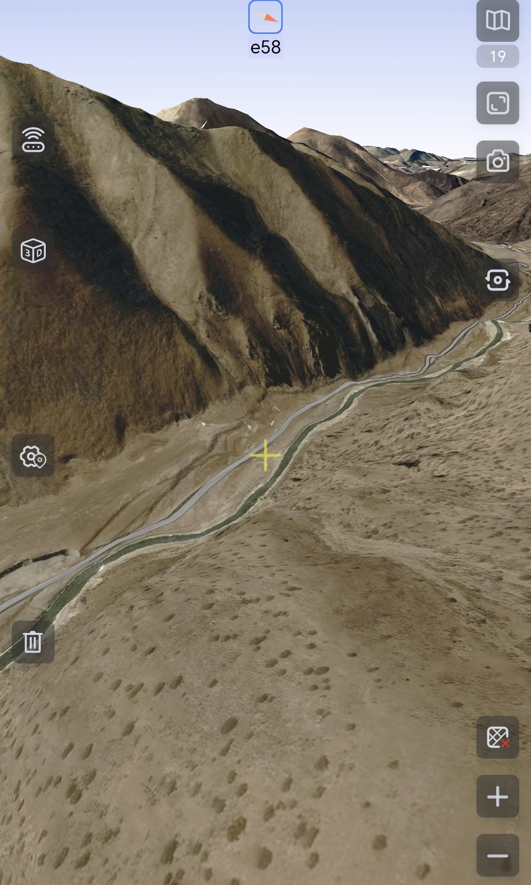
The search facility of this help forum is pretty hopeless - I tried searching for topics already asking for 3D (including mine) - but gave up - there have been many requests for 3D over the years ;-( The best I can suggest is to export from Locus as KML then import into Google Earth. Works really well.
The search facility of this help forum is pretty hopeless - I tried searching for topics already asking for 3D (including mine) - but gave up - there have been many requests for 3D over the years ;-( The best I can suggest is to export from Locus as KML then import into Google Earth. Works really well.
The Google Earth workaround is not really a solution while hiking...
The Google Earth workaround is not really a solution while hiking...
Replies have been locked on this page!