


Why when creating route is the surface displayed but not if same route is imported
Not a Problem
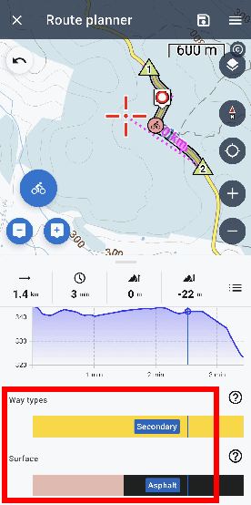
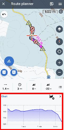
As far as I know the ONLY place where route surface & way types are displayed is in the Route Planner. Once I export the saved route, import again, and edit with Route Planner, the route surface & way types are lost. If I use Route Planner with the original-saved route the route surface & way types are displayed. Can this be improved? It also implies that saving a route to GPX as a backup isn't a full backup. Information has been lost.
original route
identical route after import from GPX - but observe only the chart is displayed
 The same problem
Hello Andrew,
not sure if I ever recommended a GPX or any other export format as full backup. Maybe in far history. There is many info lost when export and re-import over GPX and this is expected behavior. Sorry, this does not have an easy solution. Simply > do not use GPX for a full data backup.
Hello Andrew,
not sure if I ever recommended a GPX or any other export format as full backup. Maybe in far history. There is many info lost when export and re-import over GPX and this is expected behavior. Sorry, this does not have an easy solution. Simply > do not use GPX for a full data backup.
Replies have been locked on this page!