


Issues with Using Mock Location Apps
Within South Korean hiking clubs, many members now use external GNSS devices—such as the M10S or F10N—to obtain more precise tracking data; these devices are produced and sold to members specifically for use during their hikes.
I also use an external GNSS device.
To set it up, I configure the "GPS Connector" app as the "mock location app" and use it within Locus 4.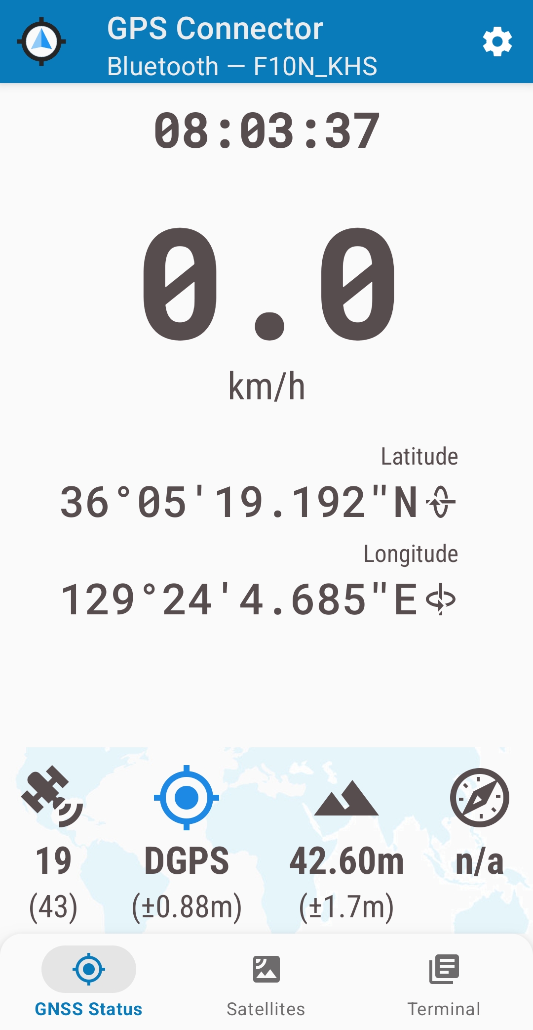
When GPS is connected, Locus 4 displays the following:
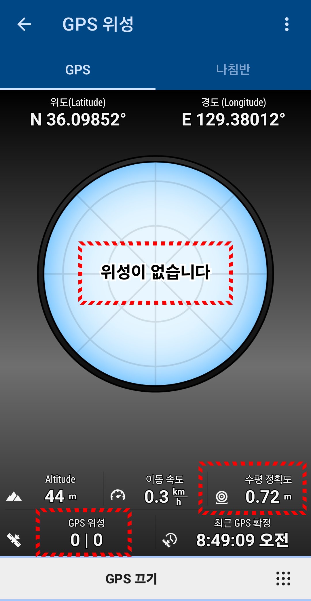
This appears to be a normal connection screen; however, after some time, a number of satellites—which were not initially detected—begin to appear. This suggests an internal issue within Locus 4. Since an external GNSS device was connected via a "mock location" app, and there was no change in horizontal accuracy, it is certain that the data is not coming from the phone’s built-in GPS.
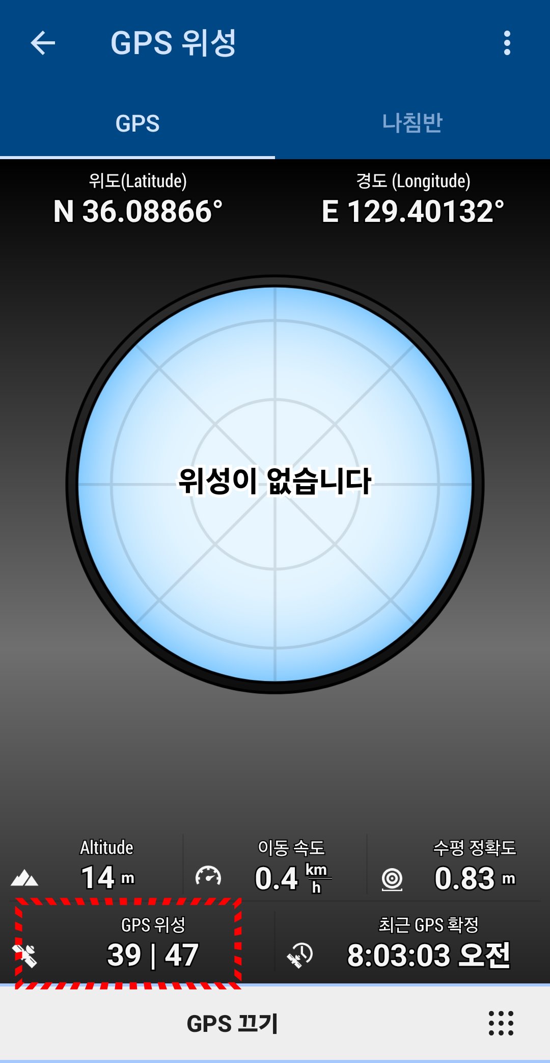
Why do these satellites, which were not detected at first, appear after a certain amount of time?
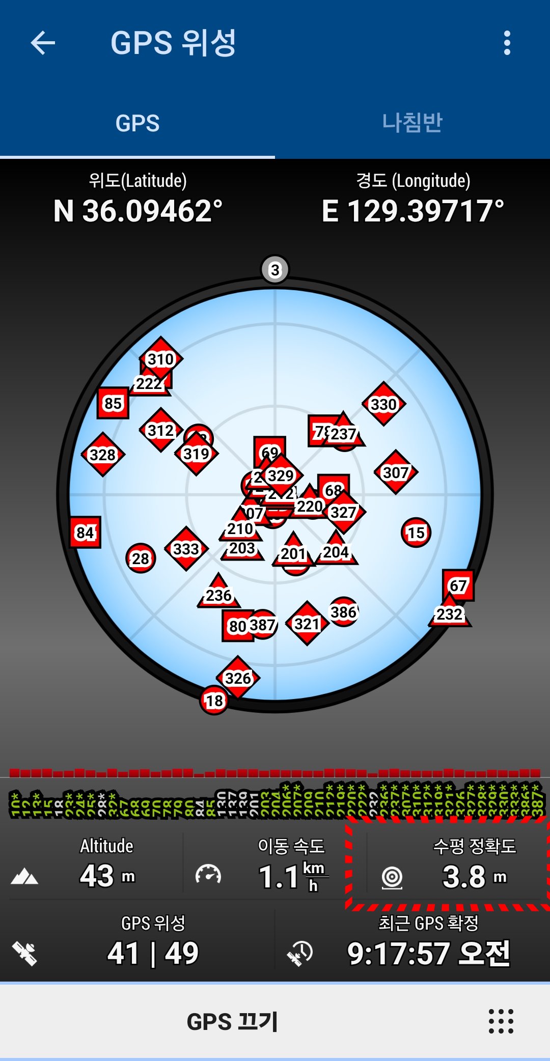
When a phone's GPS is connected, it appears as shown here. If you look specifically at the horizontal accuracy, you will find that mobile phones manufactured in South Korea are subject to legal restrictions, making it impossible to achieve a horizontal accuracy of less than 3.8 meters. Attaining an accuracy of under 3.8 meters is only possible when using external GNSS equipment.
Personally, I connect an external GNSS device directly for use; the connection screen is shown below.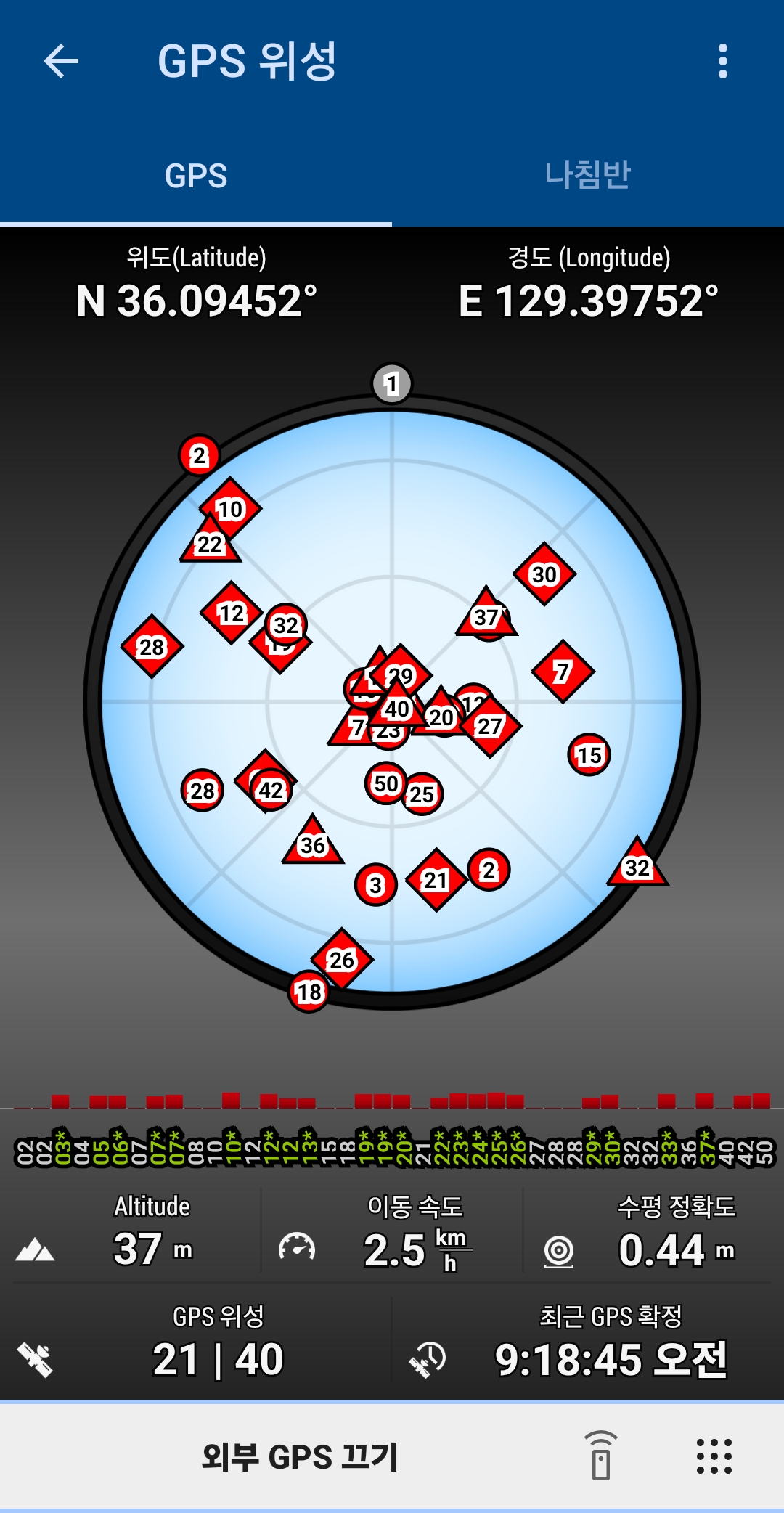
conclusion
1. Why does the number of visible satellites increase when using a mock location app, even though they weren't visible before?
2. Is it possible to display the satellite configuration diagram and the number of satellites—just as they appear with a direct connection—even when using a mock location app?
 The same question
Hi,
Locus Map is optimized for use with external GNSS units via the built-in sensor manager. Other ways of connecting external units may not work reliably.
Hi,
Locus Map is optimized for use with external GNSS units via the built-in sensor manager. Other ways of connecting external units may not work reliably.
Replies have been locked on this page!