Creating a geologic map in mapsOnline/custom
Hi.
I want to integrate a French geological map in Locus Pro.
I can not do it. I do not know how to do it and turn to the forum. Could someone help me?
However, with Mobile Atlas Creator (MOBAC) (http://mobac.sourceforge.net/), this content of "mapsources / geologie.xml" gives good results. Here it is :
<?xml version="1.0" encoding="UTF-8" standalone="yes"?>
<customWmsMapSource>
<name>aFrance-BRGM-Geologie</name>
<minZoom>7</minZoom>
<maxZoom>15</maxZoom>
<layers>SCAN_GEOL50</layers>
<coordinatesystem>EPSG:4326</coordinatesystem>
<tileType>JPG</tileType>
</customWmsMapSource>
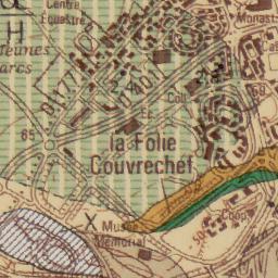
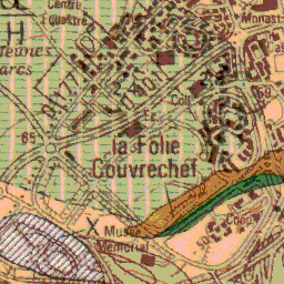
Here is the link (obtained with MOBAC) to a tile (mapserv.jpg):

We can also get a png tile with FORMAT=image/png:

Based on this information, I did a dozen tests, all without success.
Here is an example of mapsOnline/custom/BRGM.xml content:
<?xml version="1.0" encoding="UTF-8"?>
<BRGM>
<provider id="30846" type="0" visible="true" background="-1">
<name>BRGM</name>
<mode>Geologie1</mode>
<zoomPart>{z}-8</zoomPart>
<zoomMin>21</zoomMin>
<zoomMax>23</zoomMax>
<tileSize>256</tileSize>
<countries>France</countries>
<usage>overlay</usage>
</provider>
</BRGM>
In response, Locus gives a blank screen. Yet, there should be a solution.
If possible, thank you for your help.
Kim


 The same problem
... and I do not know if I have to use {c} or {c}.png or something like {z}/{x}/{y} or {z}/{x}/{y}.png ...
... and I do not know if I have to use {c} or {c}.png or something like {z}/{x}/{y} or {z}/{x}/{y}.png ...
Hi,
it seems that this is WMS service. The custom xml can not handle WMS but you can add WMS manually.
Please open Menu - Maps - WMS and create new definition. I guess that the based url is http://mapdmz.brgm.fr/cgi-bin/mapserv?map=/carto/infoterre/mapFiles/geolWMS.map
I searched for other info and it seems that this map can be available in form of KML file http://infoterre.brgm.fr/geoservices-ogc
Please download it into Locus/mapItems folder and display it via Menu > More > Map items
Best regards
Petr
Hi,
the problem is in structure of KML file - because Locus loads all tiles (whole map) and it causes the memory issues. Maybe would be possible to improve it but we'd like to postpone it because it's very special issue.
However as Nils mentioned the offline map downloaded via Mobac could be solution for you. How to use Mobac and Locus is described in http://docs.locusmap.eu/doku.php?id=manual:advanced:map_tools:mobac
Thank you
Best regards
Petr
Thank you. It's OK for me. I can use MOBAC. And I know that I have not to spend more time.
Thanks for all and best regards.
Kim
Thank you. It's OK for me. I can use MOBAC. And I know that I have not to spend more time.
Thanks for all and best regards.
Kim
Replies have been locked on this page!