This object is in archive!
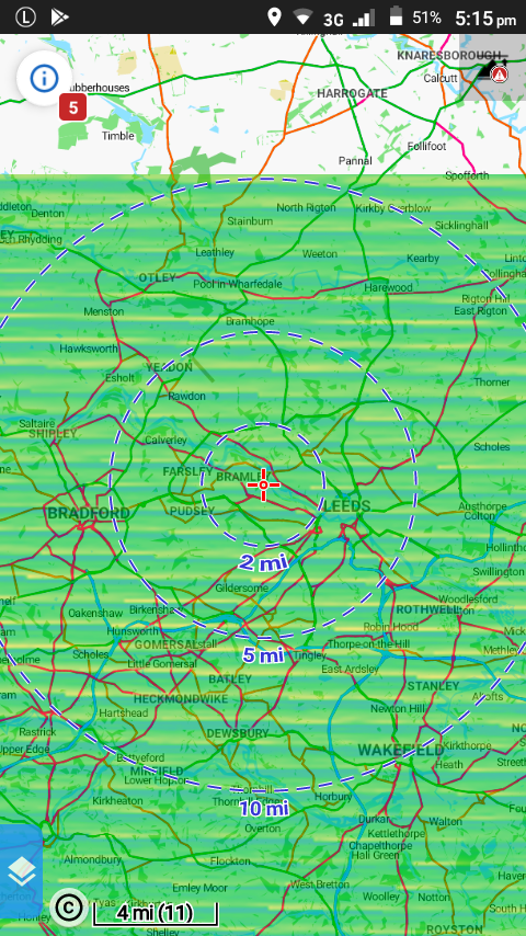
Elevation data showing as horizontal bands
Solved
I'm using Locus Map Pro ver 3.32.2 and an offline Vector map of GB.
Map shading enabled for Personal maps, LoMaps & other vector maps...Type = Coloured elevation (Universal) [similar issues with other Types].
I downloaded elevation data for the area around Leeds, England and the map displays that area overlaid with coloured horizontal bands (see screenshot).
The icon (top right) appears when the elevation data is not downloaded, but not for the area I downloaded, so Locus thinks it has downloaded that area OK and points in that area do have elevation data.
I downloaded another area and that's OK.
How do I remove the elevation data for one area so I can re-do the download???
Phone is running Android 7.0 -


 The same problem
Hi,
that's interesting issue. Please use arbitrary file manager and navigate into folder /Locus/data/srtm and delete *.hgt files. After that open Locus and download data again. Please let me know about progress
Thanks, Petr
Hi,
that's interesting issue. Please use arbitrary file manager and navigate into folder /Locus/data/srtm and delete *.hgt files. After that open Locus and download data again. Please let me know about progress
Thanks, Petr
Hi Petr,
Deleting and re-downloading worked.
Thanks
Jon
Hi Petr,
Deleting and re-downloading worked.
Thanks
Jon
Replies have been locked on this page!