This object is in archive!
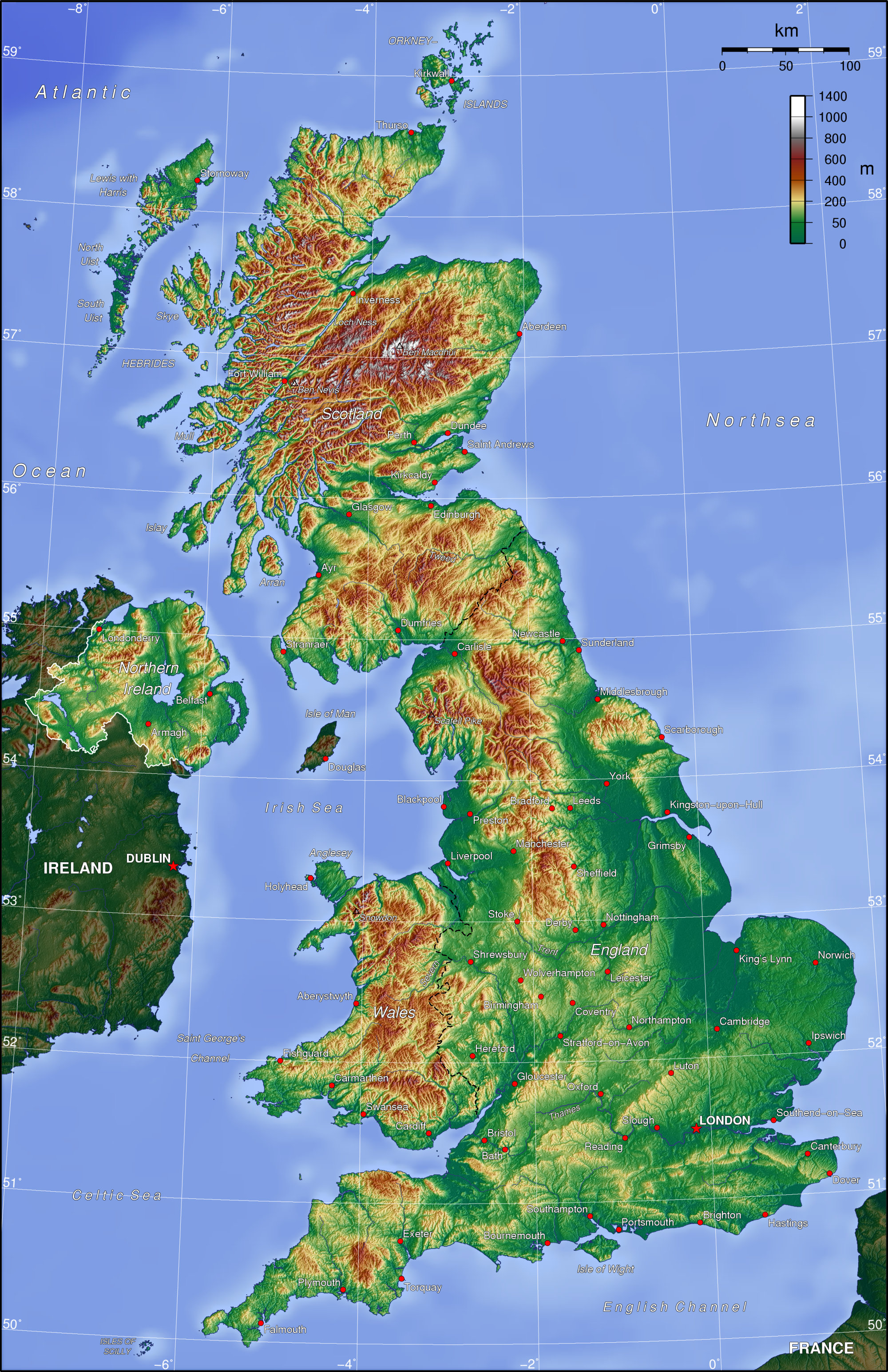
Map colored by elevation like UK topo map
Answered
I would just love a theme like topo maps on my LoMaps... maybe there is one already?
I do not like mapshading altitude, cause mapshading overlay (lowland blurry greenish) seems to cover everything.
Like the UK picture below, is it possible to come even close with todays settings and possibilities?

Hallgeir


 The same question
a theme can't do it for you.
a theme can't do it for you.
Good Hallgeir,
as gynta mentioned, it is not a question of map themes, as they cannot help here. Theme has influence on items in map, roads, points, areas, but cannot affect coloring by elevation as you need this here.
Solution is to try "elevation coloring" as Libor mentioned. Check http://docs.locusmap.eu/doku.php?id=manual:user_guide:maps_settings:misc > Map shading settings > colored elevation. This should partially helps here.
I have to admit, I kind of knew this answer. Some time in the future I want to have this type of map on lower zoom levels, because I was really surprised by how much terrain info ...bla bla
Thanks everyone :-)
I have to admit, I kind of knew this answer. Some time in the future I want to have this type of map on lower zoom levels, because I was really surprised by how much terrain info ...bla bla
Thanks everyone :-)
I am resurrecting this old thread with a related question:
With "Map shading" --> "Colored Elevation" as recommended above, we have to select a theme such as "Lowland", "Highland", "Alps", "Mountains".
Is there a way to set Locus so that it automatically adapts the shading color range to the minimum and maximum elevation which is currently on the screen?
Like on https://de-de.topographic-map.com/
Everytime you scroll the map on that website, the highest elevations on the screen will be colored red, the lowest elevations on the screen will be colored blue.
This is easier to use than manually changing the colored elevation shading preset based on which map area we are currently looking at.
If there is currently no way to use Locus this way, would you consider implementing it?
Kind regards
Andreas
Replies have been locked on this page!