
This object is in archive!
Issue with Quick Map Switch text encoding in 3.38
Closed
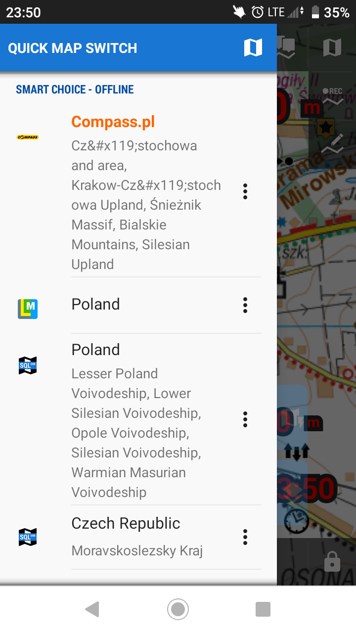
Like in title. See attached screenshot.
Files:
Screenshot_2019...
 The same problem
Good day Marcin,
interesting problem. I've downloaded the same Krakow map and no problem.
May you please attach here file Jura_Krakowsko_Czestochowska.info from the directory Locus\maps\compass.pl\ ? Thank you.
Menion
Good day Marcin,
interesting problem. I've downloaded the same Krakow map and no problem.
May you please attach here file Jura_Krakowsko_Czestochowska.info from the directory Locus\maps\compass.pl\ ? Thank you.
Menion
Thanks Marcin,
indeed in your *.info file is incorrectly defined name. I have no idea why this happens to be true.
Anyway, fixed file in the attachment. You may modify "name > def" parameter on your own if the same problem exists in another map. Only important you have to keep untouched is "storeItem" parameter.
Btw. I received an error about little problematic calibration of TAR maps, but not about its complete malfunction. May you share with me one problematic TAR map for the test? Thank you!
Menion
Hi Menion,
Please find attached .tar map you asked for.
Let me know once you will figure it out.
Thanks!
Marcin
On Sat, 25 May 2019, 19:54 Locus Map, <locus.map@asamm.com> wrote:
Hi Menion,
Please find attached .tar map you asked for.
Let me know once you will figure it out.
Thanks!
Marcin
On Sat, 25 May 2019, 19:54 Locus Map, <locus.map@asamm.com> wrote:
Hello Marcin,
this map worked for you before?? I'm trying it with previous 3.37.2 version and map does not work as well.
Seems that Locus Map has a problem how to handle configuration for this map. In its definition is wrote that projection is "Map Projection,Latitude/Longitude", but in next calibration points is missing lat/lon and instead is there some kind of UTM coordinates. Little confusing for me.
In the case of lat/lon projection, app expect spherical coordinates like this
Any tip on how to handle it?Menion
Replies have been locked on this page!