
This object is in archive!
Map shading incomplete
Solved
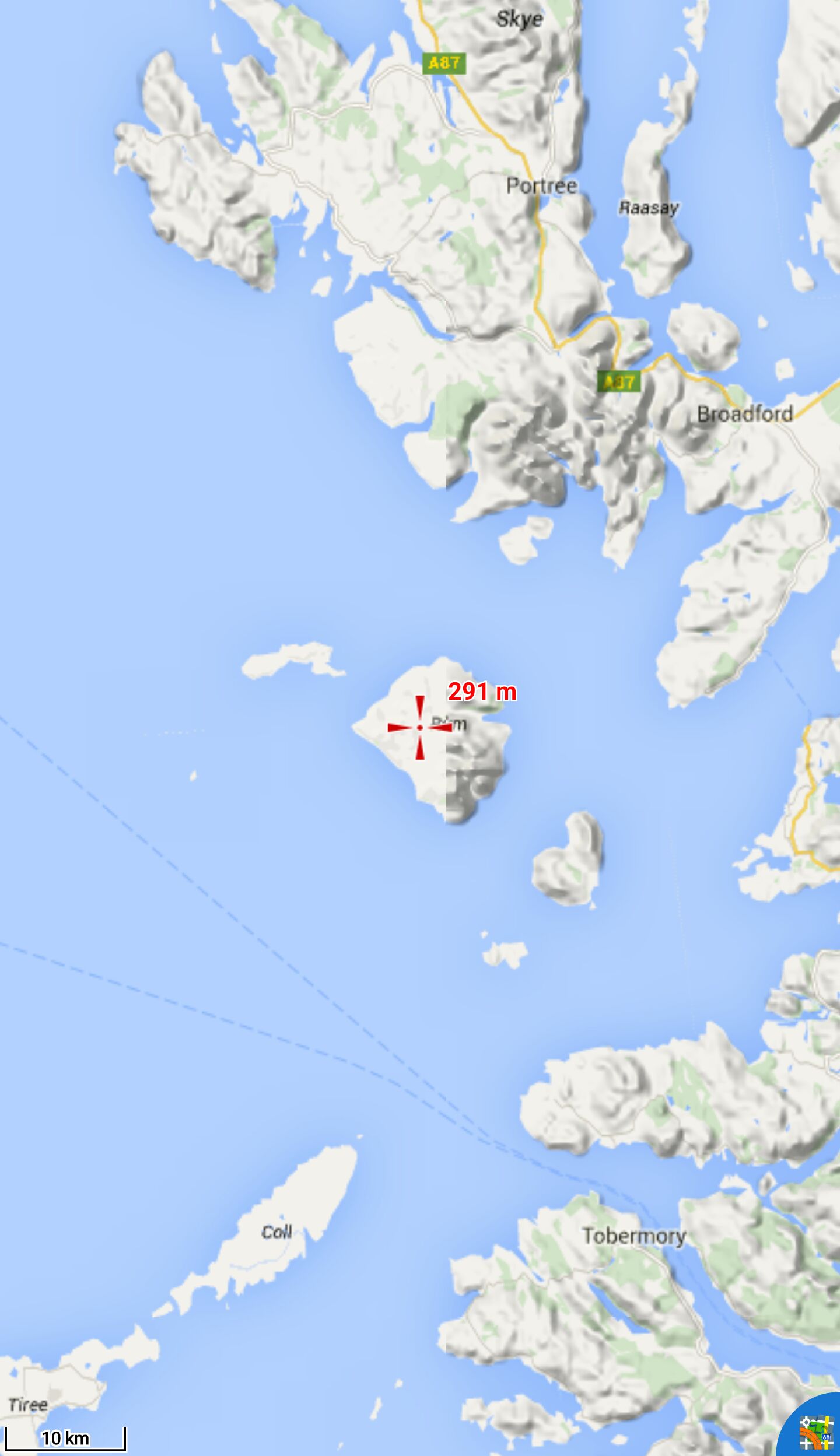
I downloaded all SRTM/HGT files to have a complete map shading of Scotland - but in the outerlying regions (mainly islands) it is cut off at some point. As the attached picture shows, the data is there (altitude displayed at the cross), so it's something with the shading. I tried clearing map cache, I tried online, offline and vector maps - all the same.
It also depends on zoom level - in the attached example, zooming in one level will fully shade that island. But some other regions will still not be shaded until I zoom in more.
Device: Galaxy Note 4
Locus 3.24.3
Files:
screenshot.jpg
 The same problem
Hi Ingo.
I dont use internal shader, but downloads osmand files and use as overlay..quick and reliable.
http://download.osmand.net/hillshade/
Maybe a temp solution for you?
Hi Ingo.
I dont use internal shader, but downloads osmand files and use as overlay..quick and reliable.
http://download.osmand.net/hillshade/
Maybe a temp solution for you?
Hello Ingo,
Hallgeir, this sounds to me like really crazy solution! Shading in app is I believe quite good, more then 10 times (maybe more, just guess) smaller and because only single map is drawn (not too) I believe that in worst case equally fast.
I'll download necessary data and check this area, thanks ...
So, firstly ... fact that you see dynamic elevation value is not important. Important is, how quickly you see this value. If immediately during moving, then it's ok and offline data are there. If only few seconds after you stop moving, that it's bad and it means that data are downloaded from internet. Also fact that you have data in area is only condition. Locus Map also needs to have data for whole map tile.
I'm testing it and it seems to work. So firstly, please open Locus Store > Europe > UK > Scotland, open LoMap and in detail tap on "Download elevation" button. Locus Map should offer you to download missing HGT files if some are missing.
Thx for that shortcut to download elevation data - didn't know that and makes things much easier than what I did (getting elevation for various points until the area seemed complete).
And it worked - no unrendered areas as far as I can see.
Still, just for the record: The value always appeared immediately, and, as I said, when zooming in, the same region suddenly was rendered fully - so probably the offline data wasn't complete for the bigger tile when zoomed out. As there was water to the west, I didn't try to get more data there, that must've been the problem.
Anyway: Solved!
Perfect, glad it works.
Perfect, glad it works.
Replies have been locked on this page!