
This object is in archive!
NPS Visitor maps & USFS Visitor maps
Answered
These are great maps and dispay in caltopo pc and mobile, avenza (I think), backcountry navigator free and Gaia.
If they are free in BCN free I woudl think access to the data layer must not cost much???
can you please add this to the onlin map list or even sell on your store for offline?
As a test type in "lake stampede, ca" on any current locus map then look on caltopo usfs visitor map and see the difference.
Files:
Screenshot_2019...
 The same question
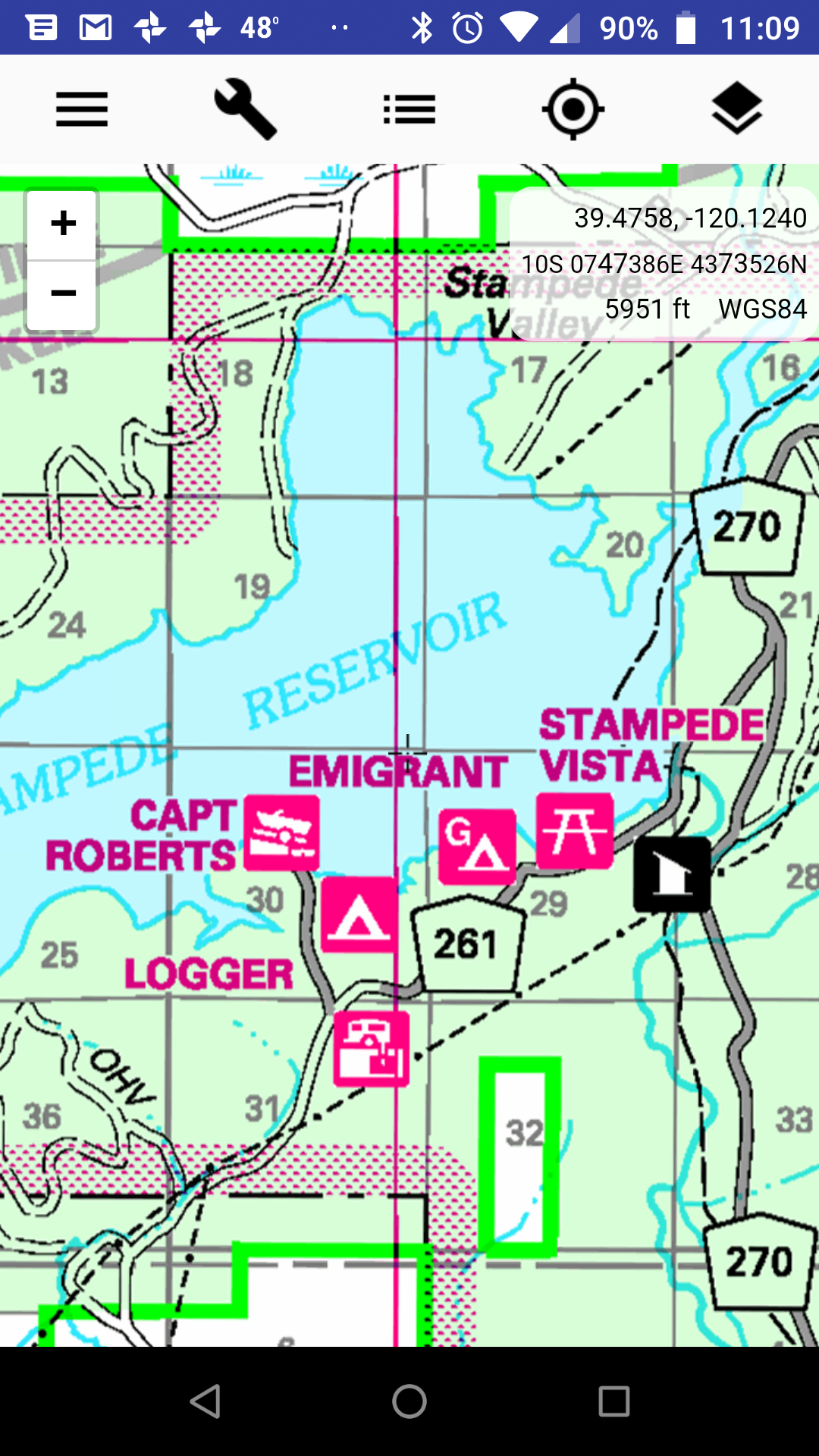
Hi,
thank you for the post. We already try to negotiate cooperation with caltopo service but there were some complications. However you can find USGS JohnThorn maps in the Locus Store for every US state. These maps are generated from USGS and USFS vector data. The appereance is little bit different then original USFS PDF map but it should contain the same data. Please try it
Regarding NPS Visitor maps - thank you I didn't know these maps. We'll check the terms of use and if possible to prepare these maps for Locus Store.
BTW: do you use the NPS maps? Are they useful for navigation in NP?
Thank you
Petr
Starting here we all became interested in getting USFS in to locus as a WTMS service https://advrider.com/f/threads/locus.989332/page-159#post-37146163 and it worked. Then another user asked for those 2 maps.
Later in the thread Advnener believes these maps data layer might be available with a caltopo subscription then you get a key to the api an get a WMTS link but was not sure.
The USFS visitor map is available in the free version of Back Country Navigator?…based on my previous experience with them, they tend to charge for everything so the fact that thy give away that data in free version might mean it can be accessed for low cost?
Personally I did not know these maps even existed since I am far away from an area covered but I can see how very useful they are especially for finding camp spots and facilities.
It would be great if you can make these work.
Also…do you have a contact email for JohnThorn Maps?
Thanks
Morgan
Hi,
again some old unfinished topic - sorry for that. I checked the USFS map services and added a FSTopo map into list of WMTS services. Please try it:
Menu > Map manager > WMS/WMTS > PLUS > search for "FSTopo" > select it and zoom in any National forest.
Is this map usable for you, please?
When it comes to NPS visitor map - I can't find any WMS or WMTS service that can be used in Locus. Do you know if NPS data are available for free?
Thanks, Petr
Replies have been locked on this page!